
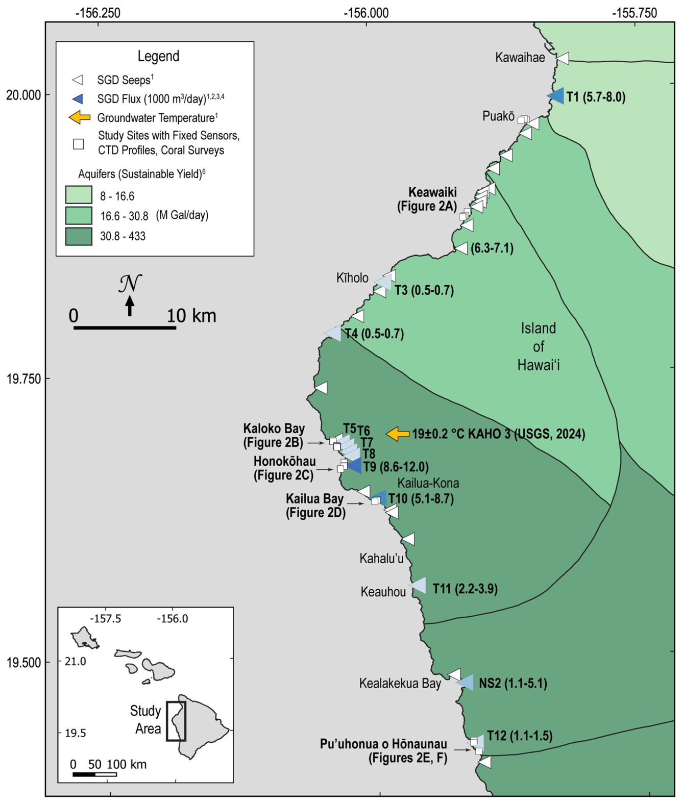
Map showing locations of mapped groundwater seeps in western Big Island, Hawaii
Detailed Description
Map showing locations of mapped groundwater seeps (white triangles), estimated fluxes of submarine groundwater discharge (blue triangles), groundwater temperature (orange arrow), and study sites (white squares) from the study Submarine groundwater discharge creates cold‐water refugia that can mitigate exposure of heat stress in nearshore corals.
Sources/Usage
Public Domain.