
The Myanmar Earthquake, March 28, 2025 and Groundwater well response viz
Detailed Description
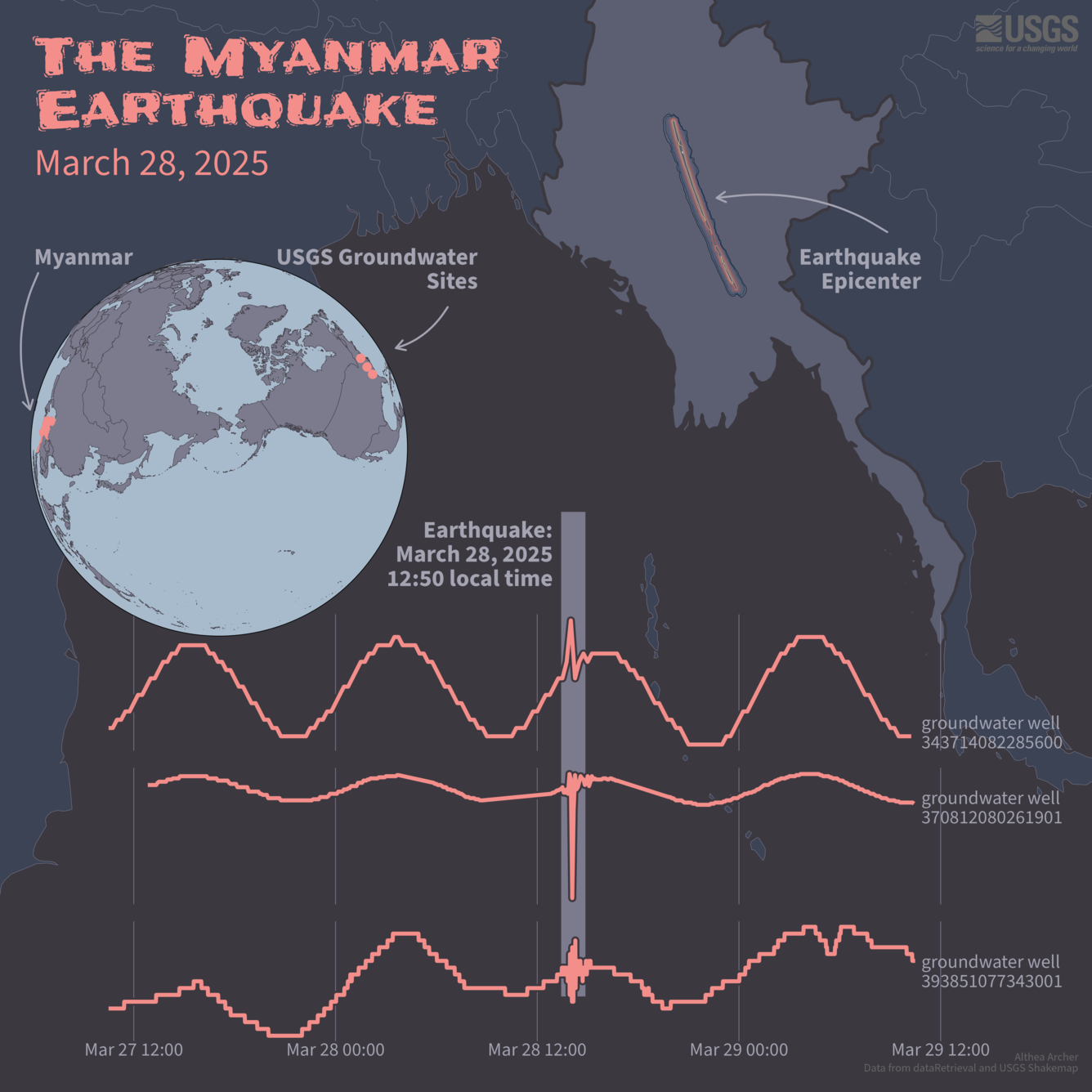
The Myanmar Earthquake, March 28, 2025.
More USGS groundwater wells showing the impact from the Myanmar 7.7 magnitude earthquake on March 28, 2025.
Globe map shows Myanmar in Asia, and three USGS groundwater sites across the globe on the east coast of the U.S. Line graphs show distinct blips in the groundwater level data from those three sites, which were associated with the Myanmar Earthquake.
Stay informed with USGS Science. Learn more about the Myanmar earthquake from the USGS Earthquake Hazards Program and more about groundwater from us at USGS Water!
Sources/Usage
Public Domain.