
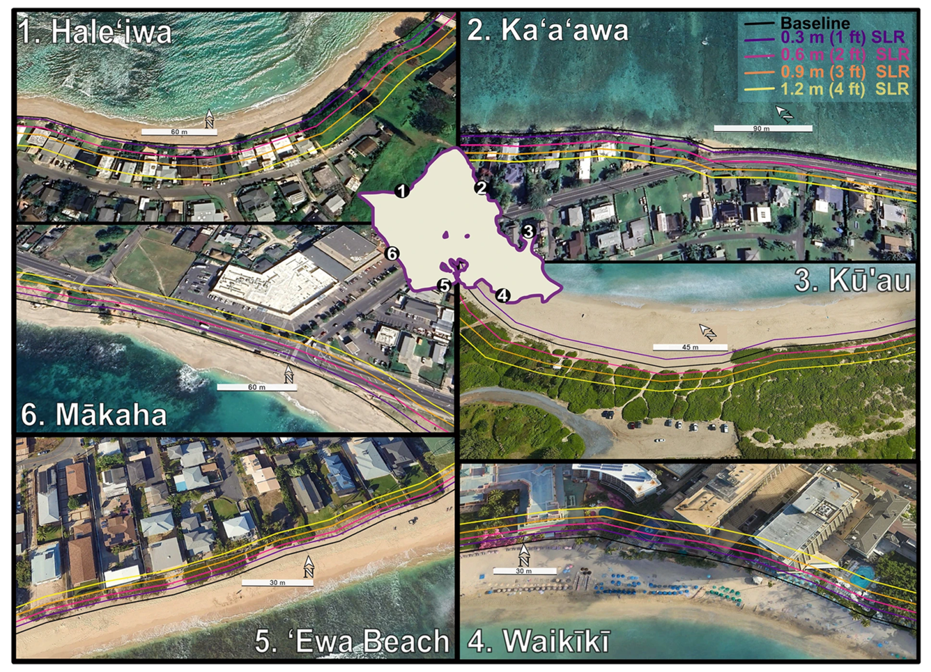
Six example sites around Oahu under different SLR scenarios
Detailed Description
Six example sites around Oʻahu with forecasted vegetation line positions for the month of July, under 0.3–1.2 m (1 ft (black)—4 ft (yellow)) of SLR. Locations are labeled by number and common beach name, and oriented with North pointing upwards in every photo except for Kūʻau. Inset of Oʻahu has labels of approximate locations of the example sites. From the study Wave driven cross shore and alongshore transport reveal more extreme projections of shoreline change in island environments.
Sources/Usage
Public Domain.