
Three ways to measure groundwater

Detailed Description
USGS serves data from almost 1 million groundwater monitoring wells!
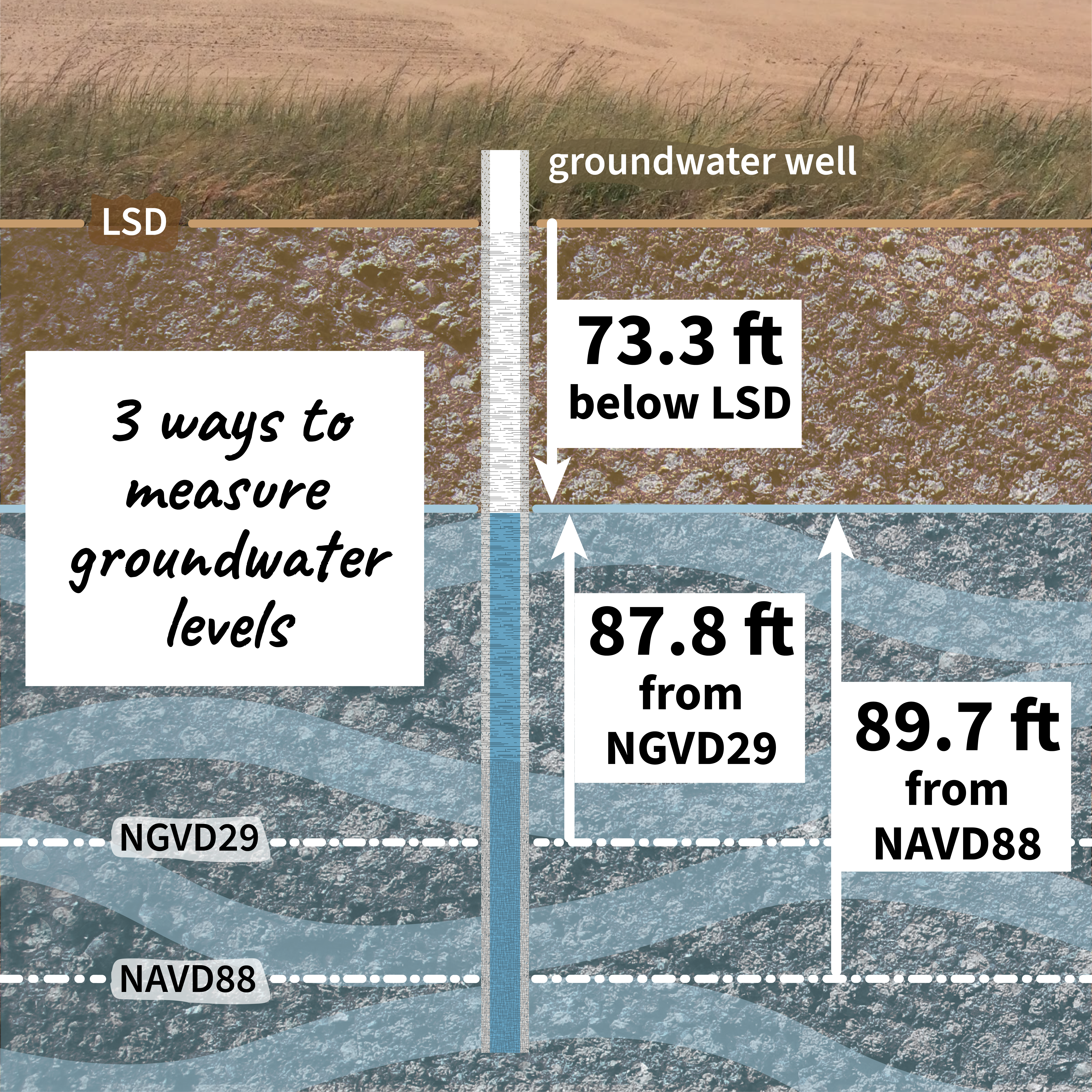
Three ways to measure groundwater are from the land surface datum to the groundwater well water level (73.3 feet), from the National Geodetic Vertical Datum of 1929 (87.8 feet), or from the North American Vertical Datum of 1988 (89.7 feet).
USGS Monitoring location pages show groundwater levels from LSD and provide information (and sometimes data) for other datums.
Checkout current or historic groundwater levels near you with the National Ground-Water Monitoring Network.
Relationships - Complicated #30DayChartChallenge
Sources/Usage
Public Domain.