
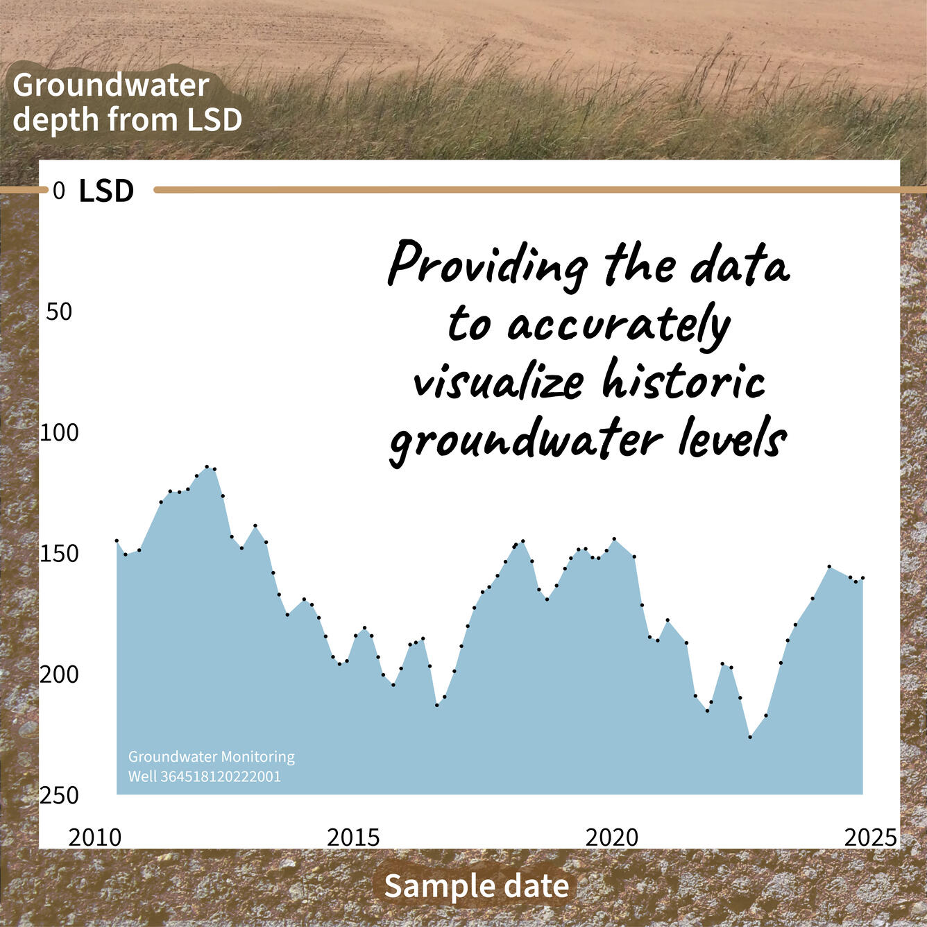
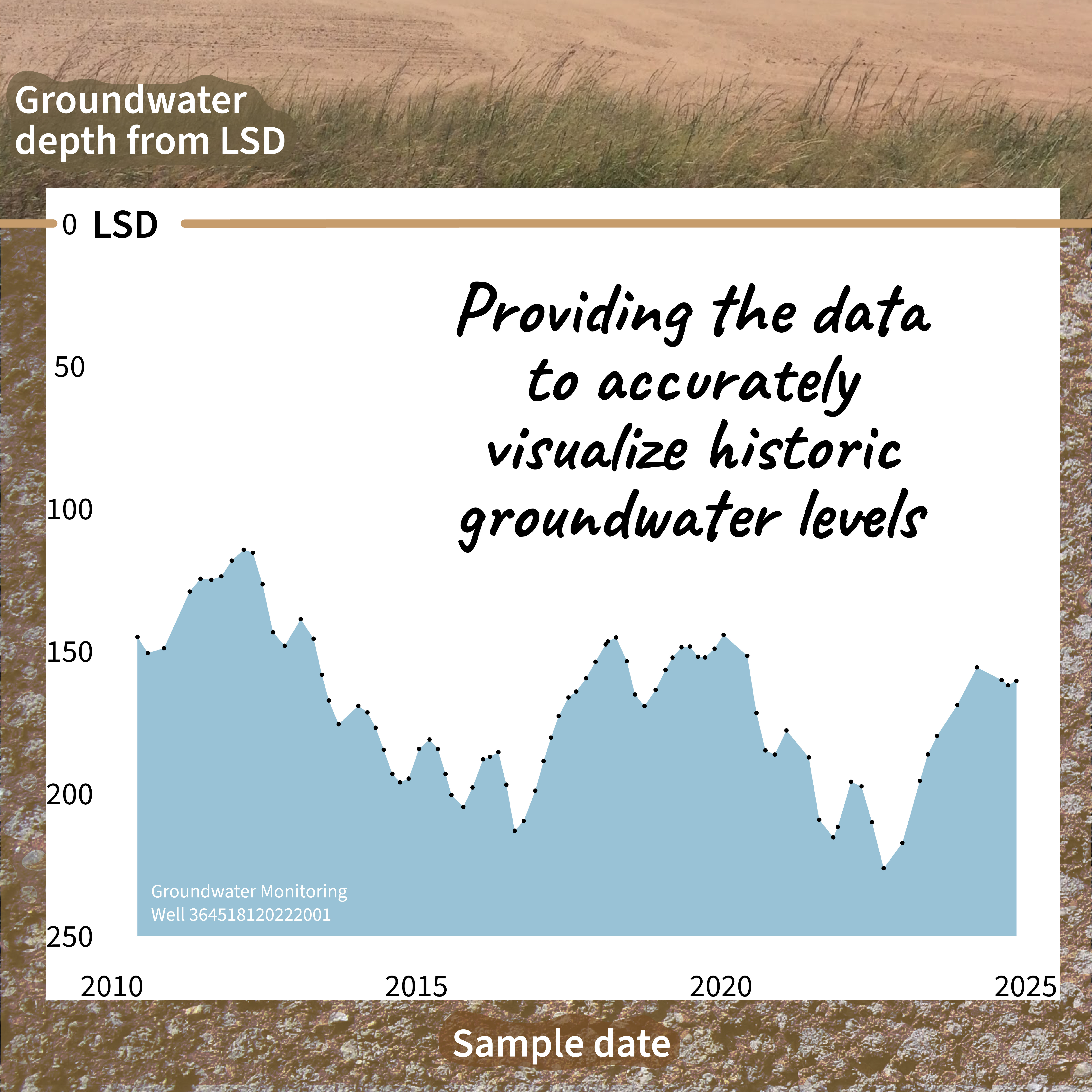
USGS provides the data to accurately visualize historic groundwater levels.
Detailed Description
USGS serves data from almost 1 million groundwater monitoring wells!
Groundwater levels can be measured from ground level (land surface datum, or LSD) or from standardized datums, such as the North American Vertical Datum of 1988 (NAVD88).
USGS Monitoring location pages show groundwater levels from LSD and provide information (and sometimes data) for other datums.
USGS provides the data to accurately visualize historic groundwater levels. Groundwater levels for an example site near Mendota, California shown as a timeseries from 2010 to 2025. Overtime, the groundwater levels fluctuate from about 100 to about 225 feet below land surface.
Checkout current or historic groundwater levels near you with the National Ground-Water Monitoring Network.
Relationships - Complicated #30DayChartChallenge
Sources/Usage
Public Domain.