
100K OnDemand Topo Cartographic Specifications - Hydrography
100K OnDemand Topo cartographic specifications for Hydrography including NHDArea, NHDFlowline, NHDLine, NHDPoint, NHDWaterbody, and National Wetland Inventory (NWI).
Feature Type
NHDArea
Area of Complex Channels (no attributes)
FType: 537
FCode: 53700
Feature Description: An area where a stream or river flows in an intricate network of sediment-driven interlacing channels. Not named features.
Cartographic Representation
| Point Graphic Depiction | Linear Graphic Depiction | Polygon Graphic Depiction |
|---|---|---|
| Not Applicable | Not Applicable |
Media
Sources/Usage: Public Domain. View Media Details
|
Polygon Symbology Specifications
| SpecName | Size (Pt) | Color R/G/B | Transparency (%) |
|---|---|---|---|
| Layer 1 (Solid Stroke) | 0.45 | 116/154/209 | 0 |
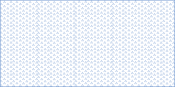
| Layer 2 (Shape Marker, Rotation Angle: 45) (Marker Placement: Fill Polygon, Clip at Boundary) (X Step: 12 Points, Y Step: 6 Points) | 7.00 | 171/203/248 | 0 |
BayInlet (No Attributes)
FType: 312
FCode: 31200
Feature Description: A water area that is an opening of the sea/ocean into the land, or of an estuary, lake, or river into its shore. BayInlets are used in the NHD to provide named areas for other hydrographic features, and must overlap Estuary, LakePond, SeaOcean, or StreamRiver. May be named feature.
Cartographic Representation
| Point Graphic Depiction | Linear Graphic Depiction | Polygon Graphic Depiction |
|---|---|---|
| Not Applicable | Not Applicable |
Media

Sources/Usage: Public Domain. View Media Details
|
Labeling
| Font Style | Font Size (Pt) | Font Color R/G/B | Halo Size (Pt) | Halo Color R/G/B | Placement Properties | Label Graphic Depiction |
|---|---|---|---|---|---|---|
| Charis SIL | 7.50 | 48/ 102/ 166 | 0.80 | 240/ 240/ 240 | Best position around point; Preferred offset 1 point; Maximum 100%; Simplified symbol zones: 0, 2, 1, 3, 5, 7, 8, 6, 4 |
Media

Sources/Usage: Public Domain. View Media Details
|
CanalDitch (CanalDitch Type = Aqueduct)
FType: 336
FCode: 33601
Feature Description: An artificial, open waterway designed to transport domestic or industrial water from a supply source to a distribution point, often by gravity.
CanalDitch (CanalDitch Type = null)
FType: 336
FCode: 33600
Feature Description: An artificial open waterway constructed to transport water, to irrigate or drain land, to connect two or more bodies of water, or to serve as a waterway for watercraft. May be a named feature.
Cartographic Representation
| Point Graphic Depiction | Linear Graphic Depiction | Polygon Graphic Depiction |
|---|---|---|
| Not Applicable |
Media

Sources/Usage: Public Domain. View Media Details
|
Media
Sources/Usage: Public Domain. View Media Details
|
Line Symbology Specifications
| SpecName | Size (Pt) | Color R/G/B | Transparency (%) |
|---|---|---|---|
| Layer 1 (Stroke - Dash: 17 2 1 2 1 2 1 2) | 0.80 | 116/154/209 | 0 |
Polygon Symbology Specifications
| SpecName | Size (Pt) | Color R/G/B | Transparency (%) |
|---|---|---|---|
| Layer 1 (Solid Stroke) | 0.45 | 116/154/209 | 0 |
| Layer 2 (Solid Fill) | Not Applicable | 217/233/255 | 0 |
Labeling
| Font Style | Font Size (Pt) | Font Color R/G/B | Halo Size (Pt) | Halo Color R/G/B | Placement Properties | Label Graphic Depiction |
|---|---|---|---|---|---|---|
| Charis SIL, Italic | 7.00 | 48/ 102/ 166 | 0.80 | 240/ 240/ 240 | Regular placement; Offset curved; Primary offset 1.0 point |
Media

Sources/Usage: Public Domain. View Media Details
|
DamWeir (Construction Material = Earthen)
FType: 343
FCode: 34305
Feature Description: A barrier constructed to control the flow or raise the level of water where the predominant material used in construction is earth, or a combination of earth and rock.
DamWeir (Construction Material = null)
FType: 343
FCode: 34300
Feature Description: A barrier constructed to control the flow or raise the level of water. No information on the predominant construction material.
Cartographic Representation
| Point Graphic Depiction | Linear Graphic Depiction | Polygon Graphic Depiction | ||
|---|---|---|---|---|
| Not Applicable |
Media

Sources/Usage: Public Domain. View Media Details
|
Media

Sources/Usage: Public Domain. View Media Details
| ||
Line Symbology Specifications
| SpecName | Size (Pt) | Color R/G/B | Transparency (%) |
|---|---|---|---|
| Layer 1 (Stroke - Dash: 5 2) (Miter Limit: 10) | 0.86 | 159/85/31 | 0 |
Polygon Symbology Specifications
| SpecName | Size (Pt) | Color R/G/B | Transparency (%) |
|---|---|---|---|
| Layer 1 (Solid Stroke) | 0.45 | 104/104/104 | 0 |
| Layer 2 (Solid Fill) | Not Applicable | 156/156/156 | 0 |
DamWeir (Construction Material = Nonearthen)
FType: 343
FCode: 34306
Feature Description: A barrier constructed to control the flow or raise the level of water where the predominant material used in construction is concrete, brick, or stone. Coincident with a Nonearthen Shore Feature.
Cartographic Representation
| Point Graphic Depiction | Linear Graphic Depiction | Polygon Graphic Depiction |
|---|---|---|
Not Applicable
|
Media

Sources/Usage: Public Domain. View Media Details
|
Media
Sources/Usage: Public Domain. View Media Details
|
Line Symbology Specifications
| SpecName | Size (Pt) | Color R/G/B | Transparency (%) |
|---|---|---|---|
| Layer 1 (Solid Stroke) | 0.72 | 52/52/52 | 0 |
Polygon Symbology Specifications
| SpecName | Size (Pt) | Color R/G/B | Transparency (%) |
|---|---|---|---|
| Layer 1 (Solid Stroke) | 0.45 | 104/104/104 | 0 |
| Layer 2 (Solid Fill) | Not Applicable | 156/156/156 | 0 |
Flume (no attributes)
FType: 362
FCode: 36200
Feature Description: A water area that is an opening of the sea/ocean into the land, or of an estuary, lake, or river into its shore and/or sn open, inclined, artificial channel constructed of wood, metal, or concrete; generally elevated. BayInlets are used in the NHD to provide named areas for other hydrographic features, and must overlap Estuary, LakePond, SeaOcean, or StreamRiver. Flume features may exist as an NHDArea and/or NHDLine. May be named feature.
Cartographic Representation
| Point Graphic Depiction | Linear Graphic Depiction | Polygon Graphic Depiction |
|---|---|---|
| Not Applicable |
Media

Sources/Usage: Public Domain. View Media Details
|
Media
Sources/Usage: Public Domain. View Media Details
|
Line Symbology Specifications
| SpecName | Size (Pt) | Color R/G/B | Transparency (%) |
|---|---|---|---|
| Layer 1 (Stroke - Dash: 4 2) | 1.00 | 81/129/184 | 0 |
Polygon Symbology Specifications
| SpecName | Size (Pt) | Color R/G/B | Transparency (%) |
|---|---|---|---|
| Layer 1 (Solid Stroke) | 0.45 | 116/154/209 | 0 |
| Layer 2 (Solid Fill) | Not Applicable | 217/233/255 | 0 |
Labeling
| Font Style | Font Size (Pt) | Font Color R/G/B | Halo Size (Pt) | Halo Color R/G/B | Placement Properties | Label Graphic Depiction |
|---|---|---|---|---|---|---|
| Charis SIL | 7.50 | 48/ 102/ 166 | 0.80 | 240/ 240/ 240 | Best position around point; Preferred offset 1 point; Maximum 100%; Simplified symbol zones: 0, 2, 1, 3, 5, 7, 8, 6, 4 |
Media
Sources/Usage: Public Domain. View Media Details
|
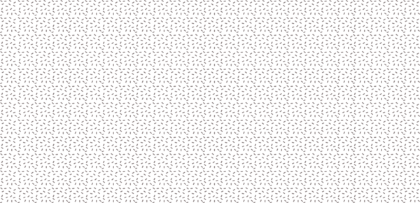
Foreshore (no attributes)
FType: 364
FCode: 36400
Feature Description: The area of shore that lies between the limits of the mean high water (MHW) and mean lower low water (MLLW) tidal marks and is exposed during low tides. The NHD acquires Foreshore data from the National Ocean and Atmospheric Agency (NOAA) and it is not a product of the USGS. May be a named feature.
Cartographic Representation
| Point Graphic Depiction | Linear Graphic Depiction | Polygon Graphic Depiction |
|---|---|---|
| Not Applicable | Not Applicable |
Media
Sources/Usage: Public Domain. View Media Details
Pattern fill made up of small gray markers. |
Polygon Symbology Specifications
| SpecName | Size (Pt) | Color R/G/B | Transparency (%) |
|---|---|---|---|
| Layer 1 (Shape Marker) (Rotation: 90) (Marker Placement: Fill Polygon, Clip at Boundary) (X Step: 8 Points, Y Step: 8 Points) | 11.00 | 143/133/133 | 0 |
Inundation Area (Inundation Control Status = Controlled, Stage = Flood Elevation)
FType: 403
FCode: 40309
Feature Description: An area of land subject to flooding. Functional structures, such as a levees or DamWeirs, exist to control the water and inundate specific areas. Height of the surface water is flood elevation (the stage that prevails when a natural water body is at or near capacity).
Inundation Area (Inundation Control Status = Controlled, Stage = null)
FType: 403
FCode: 40308
Feature Description: An area of land subject to flooding. Functional structures such as a levee or DamWeir, exist to control the water and inundate specific areas. No information on the height of the water surface.
Inundation Area (Inundation Control Status = Not Controlled, Stage = null)
FType: 403
FCode: 40307
Feature Description: An area of land subject to flooding. No controlling structures exist; flooding is natural and periodic. No information on the height of the water surface.
Inundation Area (Inundation Control Status = null, Stage = null)
FType: 403
FCode: 40300
Feature Description: An area of land subject to flooding.
Cartographic Representation
| Point Graphic Depiction | Linear Graphic Depiction | Polygon Graphic Depiction |
|---|---|---|
| Not Applicable | Not Applicable |
Media
Sources/Usage: Public Domain. View Media Details
|
Polygon Symbology Specifications
| SpecName | Size (Pt) | Color R/G/B | Transparency (%) |
|---|---|---|---|
| Layer 1 (Stroke - Dash: 5.68 1.42) | 0.45 | 116/154/209 | 0 |
| (Layer 2: (Shape Marker - Dash) (Marker Placement, Fill Polygon, Clip at Boundary) (X Step: 6 Points, Y Step: 8 Points (Offset X: 8, Offset Y: 4) | 3.00 | 116/154/209 | 0 |
| Layer 3: Shape Marker - Dash) (Marker Placement, Fill Polygon, Clip at Boundary) (X Step: 6 Points, Y Step: 8 Points, No Offset) | 3.00 | 116/154/209 | 0 |
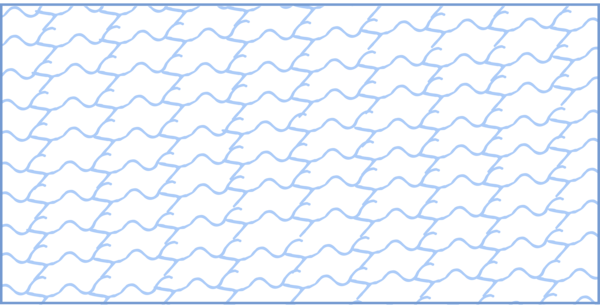
Rapids (no attributes)
FType: 431
FCode: 43100
Feature Description: An area of swift current in a stream or river, characterized by standing waves or by boulders and rocks. Rapids also exist as NHDPoint or as NHDLine. May be a named feature.
Cartographic Representation
| Point Graphic Depiction | Linear Graphic Depiction | Polygon Graphic Depiction |
|---|---|---|
| Not Applicable |
Media

Sources/Usage: Public Domain. View Media Details
|
Media
Sources/Usage: Public Domain. View Media Details
|
Line Symbology Specifications
| SpecName | Size (Pt) | Color R/G/B | Transparency (%) |
|---|---|---|---|
| Layer 1 (Solid Stroke) | 1.00 | 81/129/184 | 0 |
Polygon Symbology Specifications
| SpecName | Size (Pt) | Color R/G/B | Transparency (%) |
|---|---|---|---|
| Layer 1 (Hatched Fill - Wavy Line) (Pattern Separation: 7 Points) | 9.00 | 21/112/188 | 0 |
Labeling
| Font Style | Font Size (Pt) | Font Color R/G/B | Halo Size (Pt) | Halo Color R/G/B | Placement Properties | Label Graphic Depiction |
|---|---|---|---|---|---|---|
| Charis SIL | 7.00 | 48/ 102/ 166 | 0.80 | 240/ 240/ 240 | Best position around point; Preferred offset 5 point; Maximum 100%; Simplified symbol zones: 0, 2, 1, 3, 5, 7, 8, 6, 4 |
Media

Sources/Usage: Public Domain. View Media Details
|
SeaOcean (no attributes)
FType: 445
FCode: 44500
Feature Description: The great body of salt water that covers much of the earth. May be a named feature.
Cartographic Representation
| Point Graphic Depiction | Linear Graphic Depiction | Polygon Graphic Depiction |
|---|---|---|
| Not Applicable | Not Applicable |
Media
Sources/Usage: Public Domain. View Media Details
|
Polygon Symbology Specifications
| SpecName | Size (Pt) | Color R/G/B | Transparency (%) |
|---|---|---|---|
| Layer 1 (Solid Stroke) | 0.45 | 116/154/209 | 0 |
| Layer 2 (Solid Fill) | Not Applicable | 217/233/255 | 0 |
Labeling
| Font Style | Font Size (Pt) | Font Color R/G/B | Halo Size (Pt) | Halo Color R/G/B | Placement Properties | Label Graphic Depiction |
|---|---|---|---|---|---|---|
| Sitka, Italic, Uppercase | 10.00 | 81/ 129/ 184 | 0.60 | 240/ 240/ 240 | Regular placement; Avoid Holes in polygon; Horizontal in polygon |
Media

Sources/Usage: Public Domain. View Media Details
|
StreamRiver (Hydrographic Category = Intermittent)
FType: 460
FCode: 46003
Feature Description: A body of flowing water that contains water for only part of the year, but more than just after rainstorms and at snowmelt.
Cartographic Representation
| Point Graphic Depiction | Linear Graphic Depiction | Polygon Graphic Depiction |
|---|---|---|
| Not Applicable |
Media

Sources/Usage: Public Domain. View Media Details
|
Media
Sources/Usage: Public Domain. View Media Details
|
Line Symbology Specifications
| SpecName | Size (Pt) | Color R/G/B | Transparency (%) |
|---|---|---|---|
| Layer 1 (Stroke - Dash: 17 2 1 2 1 2 1) | 0.56 | 116/154/209 | 0 |
Polygon Symbology Specifications
| SpecName | Size (Pt) | Color R/G/B | Transparency (%) |
|---|---|---|---|
| Layer 1 (Solid Stroke) | 0.45 | 116/154/209 | 0 |
| Layer 2 (Shape Marker) (Marker Placement: Fill Polygon) (X Step: 9 Points, Y Step: 9 Points) | 16.00 | 116/154/209 | 0 |
Labeling
| Font Style | Font Size (Pt) | Font Color R/G/B | Halo Size (Pt) | Halo Color R/G/B | Placement Properties | Label Graphic Depiction |
|---|---|---|---|---|---|---|
| Charis SIL, Italic | 7.50 | 48/ 108/ 166 | 0.80 | 240/ 240/ 240 | Regular placement; Offset curved; Primary offset 1.0 point |
Media

Sources/Usage: Public Domain. View Media Details
|
StreamRiver (Hydrographic Category = Perennial)
FType: 460
FCode: 46006
Feature Description: A body of flowing water that contains water throughout the year, except for infrequent periods of severe drought.
StreamRiver (no attributes)
FType: StreamRiver
FCode: 46000
Feature Description: A body of flowing water. Portion of the year the feature contains water unknown.
Cartographic Representation
| Point Graphic Depiction | Linear Graphic Depiction | Polygon Graphic Depiction |
|---|---|---|
| Not Applicable |
Media

Sources/Usage: Public Domain. View Media Details
|
Media
Sources/Usage: Public Domain. View Media Details
|
Line Symbology Specifications
| SpecName | Size (Pt) | Color R/G/B | Transparency (%) |
|---|---|---|---|
| Layer 1 (Solid Stroke) | 0.56 | 116/154/209 | 0 |
Polygon Symbology Specifications
| SpecName | Size (Pt) | Color R/G/B | Transparency (%) |
|---|---|---|---|
| Layer 1 (Solid Stroke) | 0.45 | 116/154/209 | 0 |
| Layer 2 (Solid Fill) | Not Applicable | 217/233/255 | 0 |
Labeling
| Font Style | Font Size (Pt) | Font Color R/G/B | Halo Size (Pt) | Halo Color R/G/B | Placement Properties | Label Graphic Depiction |
|---|---|---|---|---|---|---|
| Charis SIL Italic | 8.00 | 48/ 102/ 166 | 0.8 | 240/ 240/ 240 | Regular placement; Offset curved; Primary offset 1.0 points |
Media
Sources/Usage: Public Domain. View Media Details
|
Submerged Stream (no attributes)
FType: 461
FCode: 46100
Feature Description: The original river course inundated by an impounded water body. These are mostly used in drowned river systems like the Tennessee Valley Authority (TVA) lakes. May be a named feature.
Cartographic Representation
| Point Graphic Depiction | Linear Graphic Depiction | Polygon Graphic Depiction |
|---|---|---|
| Not Applicable | Not Applicable |
Media

Sources/Usage: Public Domain. View Media Details
|
Polygon Symbology Specifications
| SpecName | Size (Pt) | Color R/G/B | Transparency (%) |
|---|---|---|---|
| Layer 1 (Stroke - Dash: 5.68 1.42) | 0.45 | 116/154/209 | 0 |
Wash (no attributes)
FType: 484
FCode: 48400
Feature Description: The usually dry portion of a stream bed that contains water only during or after a local rainstorm or heavy snowmelt. May be a named feature.
Cartographic Representation
| Point Graphic Depiction | Linear Graphic Depiction | Polygon Graphic Depiction |
|---|---|---|
| Not Applicable | Not Applicable |
Media
Sources/Usage: Public Domain. View Media Details
|
Polygon Symbology Specifications
| SpecName | Size (Pt) | Color R/G/B | Transparency (%) |
|---|---|---|---|
| Layer 1 (Solid Stroke) | 0.45 | 141/126/109 | 0 |
| (Layer 2 (Shape Marker) (Marker Placement: 0.45, Fill Polygon, Clip at Boundary) (X Step: 11 Points, Y Step: 11 Points) | 18.00 | 141/126/109 | 0 |
NHDFlowline
Artificial Path (no attributes)
FType: 558
FCode: 55800
Feature Description: A surrogate for general flow direction in NHDWaterbodies and NHDAreas. Artificial Paths carry the name of the flowline feature. NHDArea, StreamRivers will have an Artificial Path that will carry the name of the river.
Cartographic Representation
Feature Not Symbolized
Labeling
| Font Style | Font Size (Pt) | Font Color R/G/B | Halo Size (Pt) | Halo Color R/G/B | Placement Properties | Label Graphic Depiction |
|---|---|---|---|---|---|---|
| Charis SIL, Italic | 8.00 | 48/ 102/ 166 | 0.8 | 240/ 240/ 240 | Regular placement; Offset curved; Primary offset 1.0 points |
Media

Sources/Usage: Public Domain. View Media Details
|
CanalDitch (CanalDitch Type = Aqueduct)
FType: 336
FCode: 33601
Feature Description: An artificial, open waterway designed to transport domestic or industrial water from a supply source to a distribution point, often by gravity.
CanalDitch (CanalDitch Type = null)
FType: 336
FCode: 33600
Feature Description: An artificial open waterway constructed to transport water, to irrigate or drain land, to connect two or more bodies of water, or to serve as a waterway for watercraft. May be a named feature.
Cartographic Representation
| Point Graphic Depiction | Linear Graphic Depiction | Polygon Graphic Depiction |
|---|---|---|
| Not Applicable |
Media
Sources/Usage: Public Domain. View Media Details
|
Media
Sources/Usage: Public Domain. View Media Details
|
Line Symbology Specifications
| SpecName | Size (Pt) | Color R/G/B | Transparency (%) |
|---|---|---|---|
| Layer 1 (Stroke - Dash: 17 2 1 2 1 2 1 2) | 0.80 | 116/154/209 | 0 |
Polygon Symbology Specifications
| SpecName | Size (Pt) | Color R/G/B | Transparency (%) |
|---|---|---|---|
| Layer 1 (Solid Stroke) | 0.45 | 116/154/209 | 0 |
| Layer 2 (Solid Fill) | Not Applicable | 217/233/255 | 0 |
Labeling
| Font Style | Font Size (Pt) | Font Color R/G/B | Halo Size (Pt) | Halo Color R/G/B | Placement Properties | Label Graphic Depiction |
|---|---|---|---|---|---|---|
| Charis SIL, Italic | 7.00 | 48/ 102/ 166 | 0.80 | 240/ 240/ 240 | Regular placement; Offset curved; Primary offset 1.0 point |
Media
Sources/Usage: Public Domain. View Media Details
|
Pipeline (Product = null, Pipeline Type = null, Relationship to Surface = null)
FType: Pipeline
FCode: 42800
Feature Description: A closed conduit, with pumps, valves and control devices, for conveying fluids, gases, or finely divided solids. Type of product conveyed by pipeline unknown. Type of function or purpose of pipeline unknown. Vertical location of pipeline relative to the surface unknown.
Cartographic Representation
| Point Graphic Depiction | Linear Graphic Depiction | Polygon Graphic Depiction |
|---|---|---|
| Not Applicable |
Media

Sources/Usage: Public Domain. View Media Details
| Not Applicable |
Line Symbology Specifications
| SpecName | Size (Pt) | Color R/G/B | Transparency (%) |
|---|---|---|---|
| Layer 1 (Solid Stroke) | 0.80 | 116/154/209 | 0 |
Pipeline (Product = water, Pipeline Type = Aqueduct, Relationship to Surface = At or near)
FType: Pipeline
FCode: 42801
Feature Description: A closed conduit, with pumps, valves and control devices, for conveying fluids, gases, or finely divided solids. Aqueduct pipeline, designed to transport domestic or industrial water from a supply source to a distribution point, often by gravity. Vertical location of pipeline is at or near the surface.
Cartographic Representation
| Point Graphic Depiction | Linear Graphic Depiction | Polygon Graphic Depiction |
|---|---|---|
| Not Applicable |
Media
Sources/Usage: Public Domain. View Media Details
| Not Applicable |
Line Symbology Specifications
| SpecName | Size (Pt) | Color R/G/B | Transparency (%) |
|---|---|---|---|
| Layer 1 (Solid Stroke) | 0.80 | 116/154/209 | 0 |
Labeling
| Font Style | Font Size (Pt) | Font Color R/G/B | Halo Size (Pt) | Halo Color R/G/B | Placement Properties | Label Graphic Depiction |
|---|---|---|---|---|---|---|
| Charis SIL, Italic | 7.00 | 48/ 102/ 166 | 0.80 | 240/ 240/ 240 | Regular placement; Offset curved; Primary offset 1.0 point |
Media
Sources/Usage: Public Domain. View Media Details
|
Pipeline (Product = water, Pipeline Type = Aqueduct, Relationship to Surface = Elevated)
FType: Pipeline
FCode: 42802
Feature Description: A closed conduit, with pumps, valves and control devices, for conveying fluids, gases, or finely divided solids. Aqueduct pipeline, designed to transport domestic or industrial water from a supply source to a distribution point, often by gravity. Vertical location of pipeline is elevated (supported above the earth).
Cartographic Representation
| Point Graphic Depiction | Linear Graphic Depiction | Polygon Graphic Depiction |
|---|---|---|
| Not Applicable |
Media
Sources/Usage: Public Domain. View Media Details
| Not Applicable |
Line Symbology Specifications
| SpecName | Size (Pt) | Color R/G/B | Transparency (%) |
|---|---|---|---|
| Layer 1 (Solid Stroke) | 0.80 | 116/154/209 | 0 |
Labeling
| Font Style | Font Size (Pt) | Font Color R/G/B | Halo Size (Pt) | Halo Color R/G/B | Placement Properties | Label Graphic Depiction |
|---|---|---|---|---|---|---|
| Charis SIL, Italic | 7.00 | 48/ 102/ 166 | 0.80 | 240/ 240/ 240 | Regular placement; Offset curved; Primary offset 1.0 points |
Media
Sources/Usage: Public Domain. View Media Details
|
Pipeline (Product = water, Pipeline Type = Aqueduct, Relationship to Surface = Underground)
FType: 428
FCode: 42803
Feature Description: A closed conduit, with pumps, valves and control devices, for conveying fluids, gases, or finely divided solids. Aqueduct pipeline, designed to transport domestic or industrial water from a supply source to a distribution point, often by gravity. Vertical location of pipeline is underground (buried below the surface).
Cartographic Representation
| Point Graphic Depiction | Linear Graphic Depiction | Polygon Graphic Depiction |
|---|---|---|
| Not Applicable |
Media

Sources/Usage: Public Domain. View Media Details
| Not Applicable |
Line Symbology Specifications
| SpecName | Size (Pt) | Color R/G/B | Transparency (%) |
|---|---|---|---|
| Layer 1 (Stroke - Dash: 4 2) | 0.80 | 116/154/209 | 0 |
Labeling
| Font Style | Font Size (Pt) | Font Color R/G/B | Halo Size (Pt) | Halo Color R/G/B | Placement Properties | Label Graphic Depiction |
|---|---|---|---|---|---|---|
| Charis SIL, Italic | 7.00 | 48/ 102/ 166 | 0.80 | 240/ 240/ 240 | Regular placement; Offset curved; Primary offset 1.0 point |
Media
Sources/Usage: Public Domain. View Media Details
|
Pipeline (Product = water, Pipeline Type = Aqueduct, Relationship to Surface = Underwater)
FType: 428
FCode: 42804
Feature Description: A closed conduit, with pumps, valves and control devices, for conveying fluids, gases, or finely divided solids. Aqueduct pipeline, designed to transport domestic or industrial water from a supply source to a distribution point, often by gravity. Vertical location of pipeline is underwater (always submerged).
Cartographic Representation
| Point Graphic Depiction | Linear Graphic Depiction | Polygon Graphic Depiction |
|---|---|---|
| Not Applicable |
Media
Sources/Usage: Public Domain. View Media Details
| Not Applicable |
Line Symbology Specifications
| SpecName | Size (Pt) | Color R/G/B | Transparency (%) |
|---|---|---|---|
| Layer 1 (Solid Stroke) | 0.80 | 116/154/209 | 0 |
Labeling
| Font Style | Font Size (Pt) | Font Color R/G/B | Halo Size (Pt) | Halo Color R/G/B | Placement Properties | Label Graphic Depiction |
|---|---|---|---|---|---|---|
| Charis SIL, Italic | 7.00 | 48/ 102/ 166 | 0.80 | 240/ 240/ 240 | Regular placement; Offset curved; Primary offset 1.0 point |
Media
Sources/Usage: Public Domain. View Media Details
|
Pipeline (Product = water, Pipeline Type = Aqueduct, Relationship to Surface = null)
FType: 428
FCode: 42816
Feature Description: A closed conduit, with pumps, valves and control devices, for conveying fluids, gases, or finely divided solids. Aqueduct pipeline, designed to transport domestic or industrial water from a supply source to a distribution point, often by gravity. Vertical location of pipeline is unknown.
Cartographic Representation
| Point Graphic Depiction | Linear Graphic Depiction | Polygon Graphic Depiction |
|---|---|---|
| Not Applicable |
Media
Sources/Usage: Public Domain. View Media Details
| Not Applicable |
Line Symbology Specifications
| SpecName | Size (Pt) | Color R/G/B | Transparency (%) |
|---|---|---|---|
| Layer 1 (Solid Stroke) | 0.80 | 116/154/209 | 0 |
Labeling
| Font Style | Font Size (Pt) | Font Color R/G/B | Halo Size (Pt) | Halo Color R/G/B | Placement Properties | Label Graphic Depiction |
|---|---|---|---|---|---|---|
| Charis SIL, Italic | 7.00 | 48/ 102/ 166 | 0.80 | 240/ 240/ 240 | Regular placement; Offset curved; Primary offset 1.0 point |
Media
Sources/Usage: Public Domain. View Media Details
|
Pipeline (Product = water, Pipeline Type = General Case, Relationship to Surface = At or near)
FType: 428
FCode: 42805
Feature Description: A closed conduit, with pumps, valves and control devices, for conveying fluids, gases, or finely divided solids. General case (common use) pipeline, used to channel flowing water to another site. Vertical location of pipeline is at or near the surface.
Cartographic Representation
| Point Graphic Depiction | Linear Graphic Depiction | Polygon Graphic Depiction |
|---|---|---|
| Not Applicable |
Media
Sources/Usage: Public Domain. View Media Details
| Not Applicable |
Line Symbology Specifications
| SpecName | Size (Pt) | Color R/G/B | Transparency (%) |
|---|---|---|---|
| Layer 1 (Solid Stroke) | 0.80 | 116/154/209 | 0 |
Pipeline (Product = water, Pipeline Type = General Case, Relationship to Surface = Elevated)
FType: 428
FCode: 42806
Feature Description: A closed conduit, with pumps, valves and control devices, for conveying fluids, gases, or finely divided solids. General case (common use) pipeline, used to channel flowing water to another site. Vertical location of pipeline is elevated (supported above the earth).
Cartographic Representation
| Point Graphic Depiction | Linear Graphic Depiction | Polygon Graphic Depiction |
|---|---|---|
| Not Applicable |
Media
Sources/Usage: Public Domain. View Media Details
| Not Applicable |
Line Symbology Specifications
| SpecName | Size (Pt) | Color R/G/B | Transparency (%) |
|---|---|---|---|
| Layer 1 (Solid Stroke) | 0.80 | 116/154/209 | 0 |
Pipeline (Product = water, Pipeline Type = General Case, Relationship to Surface = Underground)
FType: 428
FCode: 42807
Feature Description: A closed conduit, with pumps, valves and control devices, for conveying fluids, gases, or finely divided solids. General case (common use) pipeline, used to channel flowing water to another site. Vertical location of pipeline is underground (buried below the surface).
Cartographic Representation
| Point Graphic Depiction | Linear Graphic Depiction | Polygon Graphic Depiction |
|---|---|---|
| Not Applicable |
Media
Sources/Usage: Public Domain. View Media Details
| Not Applicable |
Line Symbology Specifications
| SpecName | Size (Pt) | Color R/G/B | Transparency (%) |
|---|---|---|---|
| Layer 1 (Stroke - Dash: 4 2) | 0.80 | 116/154/209 | 0 |
Labeling
| Font Style | Font Size (Pt) | Font Color R/G/B | Halo Size (Pt) | Halo Color R/G/B | Placement Properties | Label Graphic Depiction |
|---|---|---|---|---|---|---|
| Charis SIL, Italic | 7.00 | 48/ 102/ 166 | 0.80 | 240/ 240/ 240 | Regular placement; Offset curved; Primary offset 1.0 point |
Media
Sources/Usage: Public Domain. View Media Details
|
Pipeline (Product = water, Pipeline Type = General Case, Relationship to Surface = Underwater)
FType: 428
FCode: 42808
Feature Description: A closed conduit, with pumps, valves and control devices, for conveying fluids, gases, or finely divided solids. General case (common use) pipeline, used to channel flowing water to another site. Vertical location of pipeline is underwater (always submerged).
Cartographic Representation
| Point Graphic Depiction | Linear Graphic Depiction | Polygon Graphic Depiction |
|---|---|---|
| Not Applicable |
Media
Sources/Usage: Public Domain. View Media Details
| Not Applicable |
Line Symbology Specifications
| SpecName | Size (Pt) | Color R/G/B | Transparency (%) |
|---|---|---|---|
| Layer 1 (Solid Stroke) | 0.80 | 116/154/209 | 0 |
Pipeline (Product = water, Pipeline Type = General Case, Relationship to Surface = null)
FType: 428
FCode: 42814
Feature Description: A closed conduit, with pumps, valves and control devices, for conveying fluids, gases, or finely divided solids. General case (common use) pipeline, used to channel flowing water to another site. Vertical location of pipeline is unknown.
Cartographic Representation
| Point Graphic Depiction | Linear Graphic Depiction | Polygon Graphic Depiction |
|---|---|---|
| Not Applicable |
Media
Sources/Usage: Public Domain. View Media Details
| Not Applicable |
Line Symbology Specifications
| SpecName | Size (Pt) | Color R/G/B | Transparency (%) |
|---|---|---|---|
| Layer 1 (Solid Stroke) | 0.80 | 116/154/209 | 0 |
Pipeline (Product = water, Pipeline Type = Penstock, Relationship to Surface = At or near)
FType: 428
FCode: 42809
Feature Description: A closed conduit, with pumps, valves and control devices, for conveying fluids, gases, or finely divided solids. Penstock pipeline, designed to convey water into the turbine of a hydroelectric generating plant. Vertical location of pipeline is at or near the surface.
Cartographic Representation
| Point Graphic Depiction | Linear Graphic Depiction | Polygon Graphic Depiction |
|---|---|---|
| Not Applicable |
Media
Sources/Usage: Public Domain. View Media Details
| Not Applicable |
Line Symbology Specifications
| SpecName | Size (Pt) | Color R/G/B | Transparency (%) |
|---|---|---|---|
| Layer 1 (Solid Stroke) | 0.80 | 116/154/209 | 0 |
Pipeline (Product = water, Pipeline Type = Penstock, Relationship to Surface = Elevated)
FType: 428
FCode: 42810
Feature Description: A closed conduit, with pumps, valves and control devices, for conveying fluids, gases, or finely divided solids. Penstock pipeline, designed to convey water into the turbine of a hydroelectric generating plant. Vertical location of pipeline is elevated (supported above the earth).
Cartographic Representation
| Point Graphic Depiction | Linear Graphic Depiction | Polygon Graphic Depiction |
|---|---|---|
| Not Applicable |
Media
Sources/Usage: Public Domain. View Media Details
| Not Applicable |
Line Symbology Specifications
| SpecName | Size (Pt) | Color R/G/B | Transparency (%) |
|---|---|---|---|
| Layer 1 (Solid Stroke) | 0.80 | 116/154/209 | 0 |
Pipeline (Product = water, Pipeline Type = Penstock, Relationship to Surface = Underground)
FType: 428
FCode: 42811
Feature Description: A closed conduit, with pumps, valves and control devices, for conveying fluids, gases, or finely divided solids. Penstock pipeline, designed to convey water into the turbine of a hydroelectric generating plant. Vertical location of pipeline is underground (buried below the surface).
Cartographic Representation
| Point Graphic Depiction | Linear Graphic Depiction | Polygon Graphic Depiction |
|---|---|---|
| Not Applicable |
Media
Sources/Usage: Public Domain. View Media Details
| Not Applicable |
Line Symbology Specifications
| SpecName | Size (Pt) | Color R/G/B | Transparency (%) |
|---|---|---|---|
| Layer 1 (Stroke - Dash: 4 2) | 0.80 | 116/154/209 | 0 |
Labeling
| Font Style | Font Size (Pt) | Font Color R/G/B | Halo Size (Pt) | Halo Color R/G/B | Placement Properties | Label Graphic Depiction |
|---|---|---|---|---|---|---|
| Charis SIL, Italic | 7.00 | 48/ 102/ 166 | 0.80 | 240/ 240/ 240 | Regular placement; Offset curved; Primary offset 1.0 point |
Media
Sources/Usage: Public Domain. View Media Details
|
Pipeline (Product = water, Pipeline Type = Penstock, Relationship to Surface = Underwater)
FType: 428
FCode: 42812
Feature Description: A closed conduit, with pumps, valves and control devices, for conveying fluids, gases, or finely divided solids. Penstock pipeline, designed to convey water into the turbine of a hydroelectric generating plant. Vertical location of pipeline is underwater (always submerged).
Cartographic Representation
| Point Graphic Depiction | Linear Graphic Depiction | Polygon Graphic Depiction |
|---|---|---|
| Not Applicable |
Media
Sources/Usage: Public Domain. View Media Details
| Not Applicable |
Line Symbology Specifications
| SpecName | Size (Pt) | Color R/G/B | Transparency (%) |
|---|---|---|---|
| Layer 1 (Solid Stroke) | 0.80 | 116/154/209 | 0 |
Pipeline (Product = water, Pipeline Type = Siphon, Relationship to Surface = Unspecified)
FType: 428
FCode: 42813
Feature Description: A closed conduit, with pumps, valves and control devices, for conveying fluids, gases, or finely divided solids. Siphon pipeline, designed to convey water by gravitational force over, or under, an obstruction. Vertical location of pipeline is The value is not known and is not required.
Cartographic Representation
| Point Graphic Depiction | Linear Graphic Depiction | Polygon Graphic Depiction |
|---|---|---|
| Not Applicable |
Media
Sources/Usage: Public Domain. View Media Details
| Not Applicable |
Line Symbology Specifications
| SpecName | Size (Pt) | Color R/G/B | Transparency (%) |
|---|---|---|---|
| Layer 1 (Solid Stroke) | 0.80 | 116/154/209 | 0 |
Pipeline (Product = water, Pipeline Type = Penstock, Relationship to Surface = null)
FType: 428
FCode: 42815
Feature Description: A closed conduit, with pumps, valves and control devices, for conveying fluids, gases, or finely divided solids. Penstock pipeline, designed to convey water into the turbine of a hydroelectric generating plant. Vertical location of pipeline is unknown.
Cartographic Representation
| Point Graphic Depiction | Linear Graphic Depiction | Polygon Graphic Depiction |
|---|---|---|
| Not Applicable |
Media
Sources/Usage: Public Domain. View Media Details
| Not Applicable |
Line Symbology Specifications
| SpecName | Size (Pt) | Color R/G/B | Transparency (%) |
|---|---|---|---|
| Layer 1 (Solid Stroke) | 0.80 | 116/154/209 | 0 |
StreamRiver (Hydrographic Category = Intermittent)
FType: 460
FCode: 46003
Feature Description: A body of flowing water that contains water for only part of the year, but more than just after rainstorms and at snowmelt.
Cartographic Representation
| Point Graphic Depiction | Linear Graphic Depiction | Polygon Graphic Depiction |
|---|---|---|
| Not Applicable |
Media
Sources/Usage: Public Domain. View Media Details
|
Media
Sources/Usage: Public Domain. View Media Details
|
Line Symbology Specifications
| SpecName | Size (Pt) | Color R/G/B | Transparency (%) |
|---|---|---|---|
| Layer 1 (Stroke - Dash: 17 2 1 2 1 2 1 | 0.56 | 116/154/209 | 0 |
Polygon Symbology Specifications
| SpecName | Size (Pt) | Color R/G/B | Transparency (%) |
|---|---|---|---|
| Layer 1 (Solid Stroke) | 0.45 | 116/154/209 | 0 |
| Layer 2 (Shape Marker) (Marker Placement: Fill Polygon) (X Step: 9 Points, Y Step: 9 Points) | 16.00 | 116/154/209 | 0 |
Labeling
| Font Style | Font Size (Pt) | Font Color R/G/B | Halo Size (Pt) | Halo Color R/G/B | Placement Properties | Label Graphic Depiction |
|---|---|---|---|---|---|---|
| Charis SIL, Italic | 7.50 | 48/ 108/ 166 | 0.80 | 240/ 240/ 240 | Regular placement; Offset curved; Primary offset 1.0 point |
Media
Sources/Usage: Public Domain. View Media Details
|
StreamRiver (Hydrographic Category = Perennial)
FType: 460
FCode: 46006
Feature Description: A body of flowing water that contains water throughout the year, except for infrequent periods of severe drought.
StreamRiver (no attributes)
FType: 460
FCode: 46000
Feature Description: A body of flowing water. Portion of the year the feature contains water unknown.
Cartographic Representation
| Point Graphic Depiction | Linear Graphic Depiction | Polygon Graphic Depiction |
|---|---|---|
| Not Applicable |
Media
Sources/Usage: Public Domain. View Media Details
|
Media
Sources/Usage: Public Domain. View Media Details
|
Line Symbology Specifications
| SpecName | Size (Pt) | Color R/G/B | Transparency (%) |
|---|---|---|---|
| Layer 1 (Solid Stroke) | 0.56 | 116/154/209 | 0 |
Polygon Symbology Specifications
| SpecName | Size (Pt) | Color R/G/B | Transparency (%) |
|---|---|---|---|
| Layer 1 (Solid Stroke) | 0.45 | 116/154/209 | 0 |
| Layer 2 (Solid Fill) | Not Applicable | 217/233/255 | 0 |
Labeling
| Font Style | Font Size (Pt) | Font Color R/G/B | Halo Size (Pt) | Halo Color R/G/B | Placement Properties | Label Graphic Depiction |
|---|---|---|---|---|---|---|
| Charis SIL, Italic | 8.00 | 48/ 102/ 166 | 0.80 | 240/ 240/ 240 | Regular placement; Offset curved; Primary offset 1.0 point |
Media
Sources/Usage: Public Domain. View Media Details
|
Underground Conduit (Positional Accuracy = null)
FType: 420
FCode: 42000
Feature Description: A set of naturally occurring subsurface drainage channels formed from the dissolution of soluble rocks in Karst terrain or in terrain similar to karst but formed in non-soluble rocks, as by melting of permafrost or ground ice, collapse after mining, and by outflow of liquid lava from beneath its solidified crust. The accuracy within which the feature may be confidently positioned is unknown.
Cartographic Representation
| Point Graphic Depiction | Linear Graphic Depiction | Polygon Graphic Depiction |
|---|---|---|
| Not Applicable |
Media

Sources/Usage: Public Domain. View Media Details
| Not Applicable |
Line Symbology Specifications
| SpecName | Size (Pt) | Color R/G/B | Transparency (%) |
|---|---|---|---|
| Layer 1 (Solid Stroke) | 0.72 | 52/52/52 | 0 |
NHDLine
DamWeir (Construction Material = Earthen)
FType: 343
FCode: 34305
Feature Description: A barrier constructed to control the flow or raise the level of water where the predominant material used in construction is earth, or a combination of earth and rock.
DamWeir (Construction Material = null)
FType: 343
FCode: 34300
Feature Description: A barrier constructed to control the flow or raise the level of water. No information on the predominant construction material.
Cartographic Representation
| Point Graphic Depiction | Linear Graphic Depiction | Polygon Graphic Depiction | ||
|---|---|---|---|---|
| Not Applicable |
Media
Sources/Usage: Public Domain. View Media Details
|
Media
Sources/Usage: Public Domain. View Media Details
| ||
Line Symbology Specifications
| SpecName | Size (Pt) | Color R/G/B | Transparency (%) |
|---|---|---|---|
| Layer 1 (Stroke - Dash: 5 2) (Miter Limit: 10) | 0.86 | 159/85/31 | 0 |
Polygon Symbology Specifications
| SpecName | Size (Pt) | Color R/G/B | Transparency (%) |
|---|---|---|---|
| Layer 1 (Solid Stroke) | 0.45 | 104/104/104 | 0 |
| Layer 2 (Solid Fill) | Not Applicable | 156/156/156 | 0 |
DamWeir (Construction Material = Nonearthen)
FType: 343
FCode: 34306
Feature Description: A barrier constructed to control the flow or raise the level of water where the predominant material used in construction is concrete, brick, or stone. Coincident with a Nonearthen Shore Feature.
Cartographic Representation
| Point Graphic Depiction | Linear Graphic Depiction | Polygon Graphic Depiction |
|---|---|---|
| Not Applicable |
Media
Sources/Usage: Public Domain. View Media Details
|
Media
Sources/Usage: Public Domain. View Media Details
|
Line Symbology Specifications
| SpecName | Size (Pt) | Color R/G/B | Transparency (%) |
|---|---|---|---|
| Layer 1 (Solid Stroke) | 0.72 | 52/52/52 | 0 |
Polygon Symbology Specifications
| SpecName | Size (Pt) | Color R/G/B | Transparency (%) |
|---|---|---|---|
| Layer 1 (Solid Stroke) | 0.45 | 104/104/104 | 0 |
| Layer 2 (Solid Fill) | Not Applicable | 156/156/156 | 0 |
Flume (no attributes)
FType: 362
FCode: 36200
Feature Description: An open, inclined, artificial channel constructed of wood, metal, or concrete; generally elevated. Flume may also exist as an NHDArea. May be a named feature.
Cartographic Representation
| Point Graphic Depiction | Linear Graphic Depiction | Polygon Graphic Depiction |
|---|---|---|
| Not Applicable |
Media
Sources/Usage: Public Domain. View Media Details
| Not Applicable |
Line Symbology Specifications
| SpecName | Size (Pt) | Color R/G/B | Transparency (%) |
|---|---|---|---|
| Layer 1 (Stroke - Dash: 4 2) | 1.00 | 81/129/184 | 0 |
Levee (no attributes)
FType: 568
FCode: 56800
Feature Description: An embankment built to prevent flooding or to control or confine the flow of liquids. Not a named feature.
Cartographic Representation
| Point Graphic Depiction | Linear Graphic Depiction | Polygon Graphic Depiction |
|---|---|---|
| Not Applicable |
Media

Sources/Usage: Public Domain. View Media Details
| Not Applicable |
Line Symbology Specifications
| SpecName | Size (Pt) | Color R/G/B | Transparency (%) |
|---|---|---|---|
| Layer 1 (Shape Marker - Dot, Rotation: 90) (Marker Placement: Along Line, Angle to Line) (Placement Template: 2, Offset: 1.5 Points) | 1.00 | 159/85/31 | 0 |
Nonearthen Shore (no attributes)
FType: 411
FCode: 41100
Feature Description: A structure built of stone, brick, concrete, or other building materials that borders a body of water. Not a named feature.
Cartographic Representation
| Point Graphic Depiction | Linear Graphic Depiction | Polygon Graphic Depiction |
|---|---|---|
| Not Applicable |
Media

Sources/Usage: Public Domain. View Media Details
| Not Applicable |
Line Symbology Specifications
| SpecName | Size (Pt) | Color R/G/B | Transparency (%) |
|---|---|---|---|
| Layer 1 (Solid Stroke) | 0.45 | 104/104/104 | 0 |
Rapids (no attributes)
FType: 431
FCode: 43100
Feature Description: An area of swift current in a stream or river, characterized by standing waves or by boulders and rocks. Rapids also exist as NHDPoint or as NHDLine. May be a named feature.
Cartographic Representation
| Point Graphic Depiction | Linear Graphic Depiction | Polygon Graphic Depiction |
|---|---|---|
| Not Applicable |
Media
Sources/Usage: Public Domain. View Media Details
|
Media
Sources/Usage: Public Domain. View Media Details
|
Line Symbology Specifications
| SpecName | Size (Pt) | Color R/G/B | Transparency (%) |
|---|---|---|---|
| Layer 1 (Solid Stroke) | 1.00 | 81/129/184 | 0 |
Polygon Symbology Specifications
| SpecName | Size (Pt) | Color R/G/B | Transparency (%) |
|---|---|---|---|
| Layer 1 (Hatched Fill - Wavy Line) (Pattern Separation: 7 Points) | 9.00 | 21/112/188 | 0 |
Labeling
| Font Style | Font Size (Pt) | Font Color R/G/B | Halo Size (Pt) | Halo Color R/G/B | Placement Properties | Label Graphic Depiction |
|---|---|---|---|---|---|---|
| Charis SIL | 7.00 | 48/ 102/ 166 | 0.80 | 240/ 240/ 240 | Best position around point; Preferred Offset 5 Points; Maximum 100%; Simplified symbol zones: 0, 2, 1, 3, 5, 7, 8, 6, 4 |
Media
Sources/Usage: Public Domain. View Media Details
|
Reef (no attributes)
FType: 434
FCode: 43400
Feature Description: A chain of rocks or coral at or near the surface of the water. May be a named feature.
Cartographic Representation
| Point Graphic Depiction | Linear Graphic Depiction | Polygon Graphic Depiction |
|---|---|---|
| Not Applicable |
Media

Sources/Usage: Public Domain. View Media Details
| Not Applicable |
Line Symbology Specifications
| SpecName | Size (Pt) | Color R/G/B | Transparency (%) |
|---|---|---|---|
| Layer 1 (Shape Marker: Dot) (Marker Placement: Along Line, Angle to Line) (Placement Template: 3 Points, Offset: 2 Points) | 5.04 | 52/52/52 | 0 |
Tunnel (no attributes)
FType: 478
FCode: 47800
Feature Description: An underground or underwater passage that carries water bearing features such as CanalDitch or Pipeline. May be a named feature.
Cartographic Representation
| Point Graphic Depiction | Linear Graphic Depiction | Polygon Graphic Depiction |
|---|---|---|
| Not Applicable |
Media

Sources/Usage: Public Domain. View Media Details
| Not Applicable |
Line Symbology Specifications
| SpecName | Size (Pt) | Color R/G/B | Transparency (%) |
|---|---|---|---|
| Layer 1 (Stroke - Dash: 4 2) (Offset: 0.72 Points) | 0.288 | 81/129/184 | 0 |
| Layer 2 (Stroke - Dash: 4 2) (Offset: -0.72 Points) | 0.288 | 81/129/184 | 0 |
Waterfall (no attributes)
FType: 487
FCode: 48700
Feature Description: A vertical or near vertical descent of water over a step or ledge in the bed of a river. Waterfall also exists as an NHDPoint. May be a named feature.
Cartographic Representation
| Point Graphic Depiction | Linear Graphic Depiction | Polygon Graphic Depiction |
|---|---|---|
Media

Sources/Usage: Public Domain. View Media Details
|
Media
Sources/Usage: Public Domain. View Media Details
| Not Applicable |
Point Symbology Specifications
| SpecName | Size (Pt) | Color R/G/B | Transparency (%) |
|---|---|---|---|
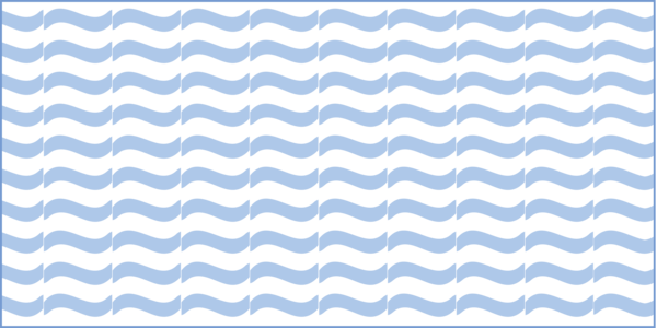
| Layer 1 (Shape Marker - Wavy Line) (Rotation: -285) | 8.00 | 45/137/217 | 0 |
| Layer 2 (Shape Marker - Wavy Line) (Position Absolute - X: 2, Y: -1) (Rotation: -285) | 8.00 | 81/129/184 | 0 |
| Layer 3 (Shape Marker - Wavy Line) (Position Absolute - X: -2, Y: 1) (Rotation: -285) | 8.00 | 81/129/184 | 0 |
Line Symbology Specifications
| SpecName | Size (Pt) | Color R/G/B | Transparency (%) |
|---|---|---|---|
| Layer 1 (Solid Stroke) | 1.00 | 81/129/184 | 0 |
Labeling
| Font Style | Font Size (Pt) | Font Color R/G/B | Halo Size (Pt) | Halo Color R/G/B | Placement Properties | Label Graphic Depiction |
|---|---|---|---|---|---|---|
| Charis SIL | 7.00 | 48/ 102/ 166 | 0.80 | 240/ 240/ 240 | Best position around point; Preferred offset 5 points; Maximum 100%; Simplified symbol zones: 0, 2, 1, 3, 5, 7, 8, 6, 4 |
Media
Sources/Usage: Public Domain. View Media Details
|
NHDPoint
Gaging Station (no attributes)
FType: 367
FCode: 36700
Feature Description: A structure used to measure the characteristics of a hydrographic feature. Stream Gages are usually captured on the flowline and not necessarily on the physical location of the monitoring station. Stream Gages are also available as a Point Event. Not a named feature.
Cartographic Representation
| Point Graphic Depiction | Linear Graphic Depiction | Polygon Graphic Depiction |
|---|---|---|
Media

Sources/Usage: Public Domain. View Media Details
| Not Applicable | Not Applicable |
Point Symbology Specifications
| SpecName | Size (Pt) | Color R/G/B | Transparency (%) |
|---|---|---|---|
| Layer 1 (Shape Marker) | 7.0 | 0/0/0 | 0 |
Rock (Relationship to Surface = Abovewater)
FType: 441
FCode: 44101
Feature Description: A concreted mass of stony material. The vertical location of the rock relative to the surface is above water (exposed at mean lower low water).
Rock (Relationship to Surface = Underwater)
FType: 441
FCode: 44102
Feature Description: A concreted mass of stony material. The vertical location of the rock relative to the surface is underwater (always submerged).
Rock (Relationship to Surface = null)
FType: 441
FCode: 44100
Feature Description: A concreted mass of stony material.
Cartographic Representation
| Point Graphic Depiction | Linear Graphic Depiction | Polygon Graphic Depiction |
|---|---|---|
Media

Sources/Usage: Public Domain. View Media Details
| Not Applicable | Not Applicable |
Point Symbology Specifications
| SpecName | Size (Pt) | Color R/G/B | Transparency (%) |
|---|---|---|---|
| Layer 1 (Shape Marker: X) | 5.00 | 114/100/100 | 0 |
| Layer 2 (Shape Marker: Dash) | 6.00 | 114/100/100 | 0 |
Spring (no attributes)
FType: 458
FCode: 45800
Feature Description: A place where water issues from the ground naturally. May be a named feature.
Cartographic Representation
| Point Graphic Depiction | Linear Graphic Depiction | Polygon Graphic Depiction |
|---|---|---|
Media

Sources/Usage: Public Domain. View Media Details
| Not Applicable | Not Applicable |
Point Symbology Specifications
| SpecName | Size (Pt) | Color R/G/B | Transparency (%) |
|---|---|---|---|
| Layer 1 (Shape Marker - Circle) (Position, Y: -2.286) | 8.10 | 255/255/255 | 0 |
| Layer 2 (Shape Marker - Circle and Line) (Rotation: -90) | 18.00 | 81/129/184 | 0 |
Labeling
| Font Style | Font Size (Pt) | Font Color R/G/B | Halo Size (Pt) | Halo Color R/G/B | Placement Properties | Label Graphic Depiction |
|---|---|---|---|---|---|---|
| Charis SIL | 7.00 | 48/ 102/ 166 | 0.80 | 240/ 240/ 240 | Best position around point; Preferred offset 5 points; Maximum 100%; Simplified symbol zones: 0, 2, 1, 3, 5, 7, 8, 6, 4 |
Media
Sources/Usage: Public Domain. View Media Details
|
Waterfall (no attributes)
FType: Waterfall
FCode: 48700
Feature Description: A vertical or near vertical descent of water over a step or ledge in the bed of a river. Waterfall also exists as an NHDPoint. May be a named feature.
Cartographic Representation
| Point Graphic Depiction | Linear Graphic Depiction | Polygon Graphic Depiction |
|---|---|---|
Media
Sources/Usage: Public Domain. View Media Details
|
Media
Sources/Usage: Public Domain. View Media Details
| Not Applicable |
Point Symbology Specifications
| SpecName | Size (Pt) | Color R/G/B | Transparency (%) |
|---|---|---|---|
| Layer 1 (Shape Marker - Wavy Line) (Rotation: -285) | 8.00 | 45/137/217 | 0 |
| Layer 2 (Shape Marker - Wavy Line) (Position Absolute - X: 2, Y: -1) (Rotation: -285) | 8.00 | 81/129/184 | 0 |
| Layer 3 (Shape Marker - Wavy Line) (Position Absolute - X: -2, Y: 1) (Rotation: -285) | 8.00 | 81/129/184 | 0 |
Line Symbology Specifications
| SpecName | Size (Pt) | Color R/G/B | Transparency (%) |
|---|---|---|---|
| Layer 1 (Solid Stroke) | 1.0 | 81/129/184 | 0 |
Labeling
| Font Style | Font Size (Pt) | Font Color R/G/B | Halo Size (Pt) | Halo Color R/G/B | Placement Properties | Label Graphic Depiction |
|---|---|---|---|---|---|---|
| Charis SIL | 7.00 | 48/ 102/ 166 | 0.80 | 240/ 240/ 240 | Best position around point; Preferred offset 5 points; Maximum 100%; Simplified symbol zones: 0, 2, 1, 3, 5, 7, 8, 6, 4 |
Media
Sources/Usage: Public Domain. View Media Details
|
Well (no attributes)
FType: 488
FCode: 48800
Feature Description: A pit or hole dug or bored into the earth for the extraction of oil, water, other fluids, or gases. May be a named feature.
Cartographic Representation
| Point Graphic Depiction | Linear Graphic Depiction | Polygon Graphic Depiction |
|---|---|---|
Media

Sources/Usage: Public Domain. View Media Details
| Not Applicable | Not Applicable |
Point Symbology Specifications
| SpecName | Size (Pt) | Color R/G/B | Transparency (%) |
|---|---|---|---|
| Layer 1 (Shape Marker - Circle) | 7.00 | 81/129/184 | 0 |
| Layer 2 (Shape Marker - Circle) | 7.00 | 217/222/240 | 0 |
NHDWaterbody
Estuary (no attributes)
FType: 493
FCode: 49300
Feature Description: "An estuary is a semi-enclosed coastal body of water which has a free connection with the open sea and within which sea water is measurably diluted with fresh water derived from land drainage" (Cameron and Pritchard, 1963). An estuary is defined by the NOAA's Coastal Aquatic Framework (CAF) or local information concerning the extent of the mixed zone of fresh and salt water.
Cartographic Representation
| Point Graphic Depiction | Linear Graphic Depiction | Polygon Graphic Depiction |
|---|---|---|
| Not Applicable | Not Applicable |
Media
Sources/Usage: Public Domain. View Media Details
|
Polygon Symbology Specifications
| SpecName | Size (Pt) | Color R/G/B | Transparency (%) |
|---|---|---|---|
| Layer 1 (Solid Stroke) | 0.45 | 116/154/209 | 0 |
| Layer 2 (Solid Fill) | Not Applicable | 217/233/255 | 0 |
Labeling
| Font Style | Font Size (Pt) | Font Color R/G/B | Halo Size (Pt) | Halo Color R/G/B | Placement Properties | Label Graphic Depiction |
|---|---|---|---|---|---|---|
| Charis SIL, Italic | 8.00 | 48/ 102/ 166 | 0.80 | 240/ 240/ 240 | Regular placement, avoid holes in polygon; Horizontal in polygon |
Media

Sources/Usage: Public Domain. View Media Details
|
Ice Mass (no attributes)
FType: 378
FCode: 37800
Feature Description: A field of ice usually formed in regions of perennial frost. Ice Mass primarily consists of glaciers. May be a named feature.
Cartographic Representation
| Point Graphic Depiction | Linear Graphic Depiction | Polygon Graphic Depiction |
|---|---|---|
| Not Applicable | Not Applicable |
Media

Sources/Usage: Public Domain. View Media Details
|
Polygon Symbology Specifications
| SpecName | Size (Pt) | Color R/G/B | Transparency (%) |
|---|---|---|---|
| Layer 1 (Shape Marker) (Marker Placement: Fill Polygon, Clip at Boundary) (X Step: 4, Y Step: 4) | 1.25 | 137/172/224 | 0 |
Labeling
| Font Style | Font Size (Pt) | Font Color R/G/B | Halo Size (Pt) | Halo Color R/G/B | Placement Properties | Label Graphic Depiction |
|---|---|---|---|---|---|---|
| Charis SIL, Italic | 7.50 | 48/ 102/ 166 | 0.80 | 240/ 240/ 240 | Regular placement, avoid holes in polygon; Horizontal in polygon |
Media

Sources/Usage: Public Domain. View Media Details
|
Intermittent Waterbody (Hydrographic Category = Intermittent, Stage = Date of Photography)
FType: 390
FCode: 39006
Feature Description: A standing body of water with a predominantly natural shoreline surrounded by land or a flooded river system where a dam has been built to withhold water. Contains water for only part of the year, but more than just after rainstorms and at snowmelt. Height of the water surface is the stage that exists at the date of the photography.
Intermittent Waterbody (Hydrographic Category = Intermittent, Stage = High Water Elevation)
FType: 390
FCode: 39005
Feature Description: A standing body of water with a predominantly natural shoreline surrounded by land or a flooded river system where a dam has been built to withhold water. Contains water for only part of the year, but more than just after rainstorms and at snowmelt. Height of the water surface is the stage that prevails when a natural water body is at or near capacity.
Intermittent Waterbody (Hydrographic Category = Intermittent, Stage = null)
FType: 390
FCode: 39001
Feature Description: A standing body of water with a predominantly natural shoreline surrounded by land or a flooded river system where a dam has been built to withhold water. Contains water for only part of the year, but more than just after rainstorms and at snowmelt. Height of the water surface is unknown.
Intermittent Waterbody (Reservoir Type = Water Storage, Construction Material = Earthen, Hydrographic Category = Intermittent)
FType: 436
FCode: 43614
Feature Description: A constructed basin formed to contain water or other liquids. Water Storage reservoir, used or long or short-term storage of water. Predominant construction material used to construct the reservoir is earth, or a combination of earth and rock. The reservoir contains water for only part of the year, but more than just after rainstorms and at snowmelt.
Cartographic Representation
| Point Graphic Depiction | Linear Graphic Depiction | Polygon Graphic Depiction |
|---|---|---|
| Not Applicable | Not Applicable |
Media
Sources/Usage: Public Domain. View Media Details
|
Polygon Symbology Specifications
| SpecName | Size (Pt) | Color R/G/B | Transparency (%) |
|---|---|---|---|
| Layer 1 (Solid Stroke) | 0.45 | 116/154/209 | 0 |
| Layer 2 (Shape Marker) (Marker Placement: Fill Polygon - Clip at Boundary) (X Step: 3, Y Step: 3) | 6.00 | 171/203/248 | 0 |
Labeling
| Font Style | Font Size (Pt) | Font Color R/G/B | Halo Size (Pt) | Halo Color R/G/B | Placement Properties | Label Graphic Depiction |
|---|---|---|---|---|---|---|
| Charis SIL Italic | 7.50 | 48/ 102/ 166 | 0.80 | 240/ 240/ 240 | Regular placement, avoid holes in polygon; Horizontal in polygon |
Media

Sources/Usage: Public Domain. View Media Details
|
Perennial Waterbody (Hydrographic Category = Perennial, Stage = Average Water Elevation)
FType: 390
FCode: 39009
Feature Description: A standing body of water with a predominantly natural shoreline surrounded by land or a flooded river system where a dam has been built to withhold water. Contains water throughout the year, except for infrequent periods of severe drought. Height of the water surface is the stage of a natural water body that prevails for the greater part of the year.
Perennial Waterbody (Hydrographic Category = Perennial, Stage = Date of Photography)
FType: 390
FCode: 39011
Feature Description: A standing body of water with a predominantly natural shoreline surrounded by land or a flooded river system where a dam has been built to withhold water. Contains water throughout the year, except for infrequent periods of severe drought. Height of the water surface is the stage that exists at the date of the photography.
Perennial Waterbody (Hydrographic Category = Perennial, Stage = Normal Pool)
FType: 390
FCode: 39010
Feature Description: A standing body of water with a predominantly natural shoreline surrounded by land or a flooded river system where a dam has been built to withhold water. Contains water throughout the year, except for infrequent periods of severe drought. Height of the water surface is the stage of an artificially impounded water body that prevails for the greater part of the year.
Perennial Waterbody (Hydrographic Category = Perennial, Stage = null)
FType: 390
FCode: 39004
Feature Description: A standing body of water with a predominantly natural shoreline surrounded by land or a flooded river system where a dam has been built to withhold water. Contains water throughout the year, except for infrequent periods of severe drought. Height of the water surface is unknown.
Perennial Waterbody (Hydrographic Category = null, Stage = null)
FType: 390
FCode: 39000
Feature Description: A standing body of water with a predominantly natural shoreline surrounded by land or a flooded river system where a dam has been built to withhold water. Portion of the year the LakePond contains water is unknown. Height of the water surface is unknown.
Perennial Waterbody (Hydrographic Category = Perennial, Stage = Spillway Elevation)
FType: 390
FCode: 39012
Feature Description: A standing body of water with a predominantly natural shoreline surrounded by land or a flooded river system where a dam has been built to withhold water. Contains water throughout the year, except for infrequent periods of severe drought. Height of the water surface is the stage of an artificially impounded water body as determined by the spillway.
Perennial Waterbody (Reservoir Type = Aquaculture, Construction Material = null, Hydrographic Category = null)
FType: 436
FCode: 43601
Feature Description: A constructed basin formed to contain water or other liquids. Aquaculture reservoir used for rearing finfish, shell fish, or aquatic plants. Predominant construction material used to construct the reservoir is unknown. The portion of the year the feature contains water is unknown.
Perennial Waterbody (Reservoir Type = Disposal - unspecified, Construction Material = null, Hydrographic Category = null)
FType: 436
FCode: 43606
Feature Description: A constructed basin formed to contain water or other liquids. Disposal reservoir (function/purpose is not known and is not required). Predominant construction material used to construct the reservoir is unknown. The portion of the year the feature contains water is unknown.
Perennial Waterbody (Reservoir Type = Disposal, Construction Material = Earthen, Hydrographic Category = null)
FType: Reservoir
FCode: 43625
Feature Description: A constructed basin formed to contain water or other liquids. Disposal Reservoir. Predominant construction material used to construct the reservoir is unknown. The portion of the year the feature contains water is unknown.
Perennial Waterbody (Reservoir Type = Unspecified, Construction Material = Earthen, Hydrographic Category = null)
FType: 436
FCode: 43618
Feature Description: A constructed basin formed to contain water or other liquids. Type of reservoir is not known and is not required. Predominant construction material used to construct the reservoir is earth, or a combination of earth and rock. The portion of the year the feature contains water is unknown.
Perennial Waterbody (Reservoir Type = Water Storage, Construction Material = Earthen, Hydrographic Category = Perennial)
FType: 436
FCode: 43615
Feature Description: A constructed basin formed to contain water or other liquids. Water Storage reservoir, used or long or short-term storage of water. Predominant construction material used to construct the reservoir is earth, or a combination of earth and rock. The reservoir contains water throughout the year, except for infrequent periods of severe drought.
Perennial Waterbody (Reservoir Type = Water Storage, Construction Material = null, Hydrographic Category = Perennial)
FType: 436
FCode: 43621
Feature Description: A constructed basin formed to contain water or other liquids. Water Storage reservoir, used or long or short-term storage of water. Predominant construction material is unknown. The reservoir contains water throughout the year, except for infrequent periods of severe drought.
Perennial Waterbody (Reservoir Type = Water Storage, Construction Material = null, Hydrographic Category = null)
FType: 436
FCode: 43617
Feature Description: A constructed basin formed to contain water or other liquids. Water Storage reservoir, used or long or short-term storage of water. Predominant construction material used to construct the reservoir is unknown. The portion of the year the feature contains water is unknown.
Perennial Waterbody (Reservoir Type = null, Construction Material = null, Hydrographic Category = null)
FType: 436
FCode: 43600
Feature Description: A constructed basin formed to contain water or other liquids. Function or purpose of reservoir is unknown. Predominant construction material used to construct the reservoir is unknown. The portion of the year the feature contains water is unknown.
Cartographic Representation
| Point Graphic Depiction | Linear Graphic Depiction | Polygon Graphic Depiction |
|---|---|---|
| Not Applicable | Not Applicable |
Media
Sources/Usage: Public Domain. View Media Details
|
Polygon Symbology Specifications
| SpecName | Size (Pt) | Color R/G/B | Transparency (%) |
|---|---|---|---|
| Layer 1 (Solid Stroke) | 0.45 | 116/154/209 | 0 |
| Layer 2 (Solid Fill) | Not Applicable | 217/233/255 | 0 |
Labeling
| Font Style | Font Size (Pt) | Font Color R/G/B | Halo Size (Pt) | Halo Color R/G/B | Placement Properties | Label Graphic Depiction |
|---|---|---|---|---|---|---|
| Charis SIL, Italic | 8.00 | 48/ 102/ 166 | 0.80 | 240/ 240/ 240 | Regular placement, avoid holes in polygon; Horizontal in polygon |
Media
Sources/Usage: Public Domain. View Media Details
|
Playa (no attributes)
FType: Playa
FCode: 36100
Feature Description: The flat area at the lowest part of an undrained desert basin, generally devoid of vegetation. May be a named feature.
Cartographic Representation
| Point Graphic Depiction | Linear Graphic Depiction | Polygon Graphic Depiction |
|---|---|---|
| Not Applicable | Not Applicable |
Media
Sources/Usage: Public Domain. View Media Details
|
Polygon Symbology Specifications
| SpecName | Size (Pt) | Color R/G/B | Transparency (%) |
|---|---|---|---|
| Layer 1 (Solid Stroke) | 0.45 | 157/99/55 | 0 |
| Layer 2 (Shape Marker) (Marker Placement: Fill Polygon. Clip at Boundary) (X Step: 11, Y Step: 4) | 11.00 | 157/99/55 | 0 |
Labeling
| Font Style | Font Size (Pt) | Font Color R/G/B | Halo Size (Pt) | Halo Color R/G/B | Placement Properties | Label Graphic Depiction |
|---|---|---|---|---|---|---|
| Charis SIL, Italic | 7.50 | 48/ 102/ 166 | 0.80 | 240/ 240/ 240 | Regular placement, avoid holes in polygon; Horizontal in polygon |
Media
Sources/Usage: Public Domain. View Media Details
|
Nonearthen Reservoir (Reservoir Type = Decorative Pool, Construction Material = null, Hydrographic Category = null)
FType: Reservoir
FCode: 43603
Feature Description: A constructed basin formed to contain water or other liquids. Decorative pool reservoir used for improving the aesthetic appearance of the landscape. Predominant construction material used to construct the reservoir is unknown. The portion of the year the feature contains water is unknown.
Nonearthen Reservoir (Reservoir Type = Disposal, Construction Material = Nonearthen, Hydrographic Category = null)
FType: 436
FCode: 43626
Feature Description: A constructed basin formed to contain water or other liquids. Disposal Reservoir. Predominant construction material used to construct the reservoir is concrete, brick, or stone. The portion of the year the feature contains water is unknown.
Nonearthen Reservoir (Reservoir Type = Evaporator, Construction Material = Earthen, Hydrographic Category = null)
FType: 436
FCode: 43623
Feature Description: A constructed basin formed to contain water or other liquids. Evaporator reservoir for natural evaporation of water to allow harvesting of mineral concentrates. Predominant construction material used to construct the reservoir is earth, or a combination of earth and rock. The portion of the year the feature contains water is unknown.
Nonearthen Reservoir (Reservoir Type = Swimming Pool, Construction Material = null, Hydrographic Category = null)
FType: 436
FCode: 43608
Feature Description: A constructed basin formed to contain water or other liquids. Swimming pool reservoir, used for recreation. Predominant construction material used to construct the reservoir is unknown. The portion of the year the feature contains water is unknown.
Nonearthen Reservoir (Reservoir Type = Evaporator, Construction Material = null, Hydrographic Category = null)
FType: 436
FCode: 43607
Feature Description: A constructed basin formed to contain water or other liquids. Evaporator reservoir for natural evaporation of water to allow harvesting of mineral concentrates. Predominant construction material used to construct the reservoir is unknown. The portion of the year the feature contains water is unknown.
Nonearthen Reservoir (Reservoir Type = Treatment - Cooling Pond, Construction Material = null, Hydrographic Category = null)
FType: 436
FCode: 43609
Feature Description: A constructed basin formed to contain water or other liquids. Treatment reservoir, used as a cooling pond. Predominant construction material used to construct the reservoir is unknown. The portion of the year the feature contains water is unknown.
Nonearthen Reservoir (Reservoir Type = Treatment - Filtration Pond, Construction Material = null, Hydrographic Category = null)
FType: 436
FCode: 43610
Feature Description: A constructed basin formed to contain water or other liquids. Treatment reservoir, used as a filtration pond. Predominant construction material used to construct the reservoir is unknown. The portion of the year the feature contains water is unknown.
Nonearthen Reservoir (Reservoir Type = Unspecified, Construction Material = Nonearthen, Hydrographic Category = null)
FType: 436
FCode: 43619
Feature Description: A constructed basin formed to contain water or other liquids. Type of reservoir is not known and is not required. Predominant construction material used to construct the reservoir is concrete, brick, or stone. The portion of the year the feature contains water is unknown.
Nonearthen Reservoir (Reservoir Type = Treatment, Construction Material = null, Hydrographic Category = null)
FType: 436
FCode: 43624
Feature Description: A constructed basin formed to contain water or other liquids. Treatment reservoir. Predominant construction material used is unknown. The portion of the year the feature contains water is unknown.
Nonearthen Reservoir (Reservoir Type = Treatment - Sewage Treatment Pond, Construction Material = null, Hydrographic Category = null)
FType: 436
FCode: 43612
Feature Description: A constructed basin formed to contain water or other liquids. Treatment reservoir, used as a sewage treatment pond. Predominant construction material used to construct the reservoir is unknown. The portion of the year the feature contains water is unknown.
Nonearthen Reservoir (Reservoir Type = Water Storage, Construction Material = Nonearthen, Hydrographic Category = null)
FType: 436
FCode: 43613
Feature Description: A constructed basin formed to contain water or other liquids. Water Storage reservoir, used or long or short-term storage of water. Predominant construction material used to construct the reservoir is concrete, brick, or stone. The portion of the year the feature contains water is unknown.
Cartographic Representation
| Point Graphic Depiction | Linear Graphic Depiction | Polygon Graphic Depiction |
|---|---|---|
| Not Applicable | Not Applicable |
Media

Sources/Usage: Public Domain. View Media Details
|
Polygon Symbology Specifications
| SpecName | Size (Pt) | Color R/G/B | Transparency (%) |
|---|---|---|---|
| Layer 1 (Solid Stroke) | 0.45 | 104/104/104 | 0 |
| Layer 2 (Solid Fill) | Not Applicable | 217/233/255 | 0 |
Labeling
| Font Style | Font Size (Pt) | Font Color R/G/B | Halo Size (Pt) | Halo Color R/G/B | Placement Properties | Label Graphic Depiction |
|---|---|---|---|---|---|---|
| Charis SIL, Italic | 8.00 | 48/ 102/ 166 | 0.80 | 240/ 240/ 240 | Regular placement, avoid holes in polygon; Horizontal in polygon |
Media
Sources/Usage: Public Domain. View Media Details
|
Tailings Pond (Reservoir Type = Disposal - Tailings Pond, Construction Material = null, Hydrographic Category = null)
FType: 436
FCode: 43605
Feature Description: A constructed basin formed to contain water or other liquids. Tailing pond reservoir used for the disposal of tailing. Predominant construction material used to construct the reservoir is unknown. The portion of the year the feature contains water is unknown.
Cartographic Representation
| Point Graphic Depiction | Linear Graphic Depiction | Polygon Graphic Depiction |
|---|---|---|
| Not Applicable | Not Applicable |
Media
Sources/Usage: Public Domain. View Media Details
|
Polygon Symbology Specifications
| SpecName | Size (Pt) | Color R/G/B | Transparency (%) |
|---|---|---|---|
| Layer 1 (Stroke - Dash: 2 1 3 0) | 0.45 | 157/99/55 | 0 |
| Layer 2 (Hatched Fill) (Pattern Separation: 2 Points) | 0.25 | 157/99/55 | 0 |
Labeling
| Font Style | Font Size (Pt) | Font Color R/G/B | Halo Size (Pt) | Halo Color R/G/B | Placement Properties | Label Graphic Depiction |
|---|---|---|---|---|---|---|
| Charis SIL, Italic | 7.50 | 48/ 102/ 166 | 0.80 | 240/ 240/ 240 | Regular placement, avoid holes in polygon; Horizontal in polygon |
Media
Sources/Usage: Public Domain. View Media Details
|
Settling Pond (Reservoir Type = Treatment - Settling Pond, Construction Material = Unspecified, Hydrographic Category = null)
FType: 436
FCode: 43611
Feature Description: A constructed basin formed to contain water or other liquids. Treatment reservoir, used as a settling pond. Predominant construction material used to construct the reservoir is not known and is not required. The portion of the year the feature contains water is unknown.
Cartographic Representation
| Point Graphic Depiction | Linear Graphic Depiction | Polygon Graphic Depiction |
|---|---|---|
| Not Applicable | Not Applicable |
Media
Sources/Usage: Public Domain. View Media Details
|
Polygon Symbology Specifications
| SpecName | Size (Pt) | Color R/G/B | Transparency (%) |
|---|---|---|---|
| Layer 1 (Solid Stroke) | 0.45 | 116/154/209 | 0 |
| Layer 2 (Shape Marker) (Fill Polygon, Clip at Boundary) (X Step: 3 Points, Y Step 3 Points) | 1.00 | 157/99/55 | 0 |
| Layer 3 (Shape Fill) | Not Applicable | 235/248/255 | 0 |
Labeling
| Font Style | Font Size (Pt) | Font Color R/G/B | Halo Size (Pt) | Halo Color R/G/B | Placement Properties | Label Graphic Depiction |
|---|---|---|---|---|---|---|
| Charis SIL, Italic | 7.50 | 48/ 102/ 166 | 0.80 | 240/ 240/ 240 | Regular placement, avoid holes in polygon; Horizontal in polygon |
Media
Sources/Usage: Public Domain. View Media Details
|
NATIONAL WETLAND INVENTORY
Freshwater Emergent Wetland
FType: No FType for this feature
FCode: No FCode for this feature
Feature Description: Fish and Wildlife Service wetland type generally consisting of herbaceous marsh, fen, swale and wet meadow.
Cartographic Representation
| Point Graphic Depiction | Linear Graphic Depiction | Polygon Graphic Depiction |
|---|---|---|
| Not Applicable | Not Applicable |
Media

Sources/Usage: Public Domain. View Media Details
|
Polygon Symbology Specifications
| SpecName | Size (Pt) | Color R/G/B | Transparency (%) |
|---|---|---|---|
| Layer 1 (Shape Marker - Wetland) (Marker Placement: Fill Polygon) (X Step: 11, Y Step: 9) | 8.0 | 171/203/248 | 0 |
| Layer 2 (Shape Marker - Wetland) (Marker Placement: Fill Polygon) (X Step: 11, Y Step: 9) (Offset X: 3, Offset Y: -5) | 8.0 | 171/203/248 | 0 |
Labeling
| Font Style | Font Size (Pt) | Font Color R/G/B | Halo Size (Pt) | Halo Color R/G/B | Placement Properties | Label Graphic Depiction |
|---|---|---|---|---|---|---|
| Charis SIL | 7.50 | 48/ 102/ 166 | 0.80 | 240/ 240/ 240 | Best position around point; Preferred offset 1 point; Maximum 100%; Simplified symbol zones: 0, 2, 1, 3, 5, 7, 8, 6, 4 |
Media

Sources/Usage: Public Domain. View Media Details
|
Freshwater Forested/Shrub Wetland
FType: No FType for this feature
FCode: No FCode for this feature
Feature Description: Fish and Wildlife Service wetland type generally consisting of forested swamp or wetland shrub bog or wetland.
Cartographic Representation
| Point Graphic Depiction | Linear Graphic Depiction | Polygon Graphic Depiction |
|---|---|---|
| Not Applicable | Not Applicable |
Media

Sources/Usage: Public Domain. View Media Details
|
Polygon Symbology Specifications
| SpecName | Size (Pt) | Color R/G/B | Transparency (%) |
|---|---|---|---|
| Layer 1 (Shape Marker - Wetland) (Marker Placement: Fill Polygon) (X Step: 11, Y Step: 9) | 8.0 | 153/186/136 | 0 |
| Layer 2 (Shape Marker - Wetland) (Marker Placement: Fill Polygon) (X Step: 11, Y Step: 9) (Offset X: 3, Offset Y: -5) | 8.0 | 153/186/136 | 0 |
Labeling
| Font Style | Font Size (Pt) | Font Color R/G/B | Halo Size (Pt) | Halo Color R/G/B | Placement Properties | Label Graphic Depiction |
|---|---|---|---|---|---|---|
| Charis SIL | 7.50 | 48/ 102/ 166 | 0.80 | 240/ 240/ 240 | Best position around point; Preferred offset 1 point; Maximum 100%; Simplified symbol zones: 0, 2, 1, 3, 5, 7, 8, 6, 4 |
Media
Sources/Usage: Public Domain. View Media Details
|