
Photo & Video Chronology — June 26, 2025 — Kīlauea eruption thickness map and UAS work
By Hawaiian Volcano Observatory
June 26, 2025
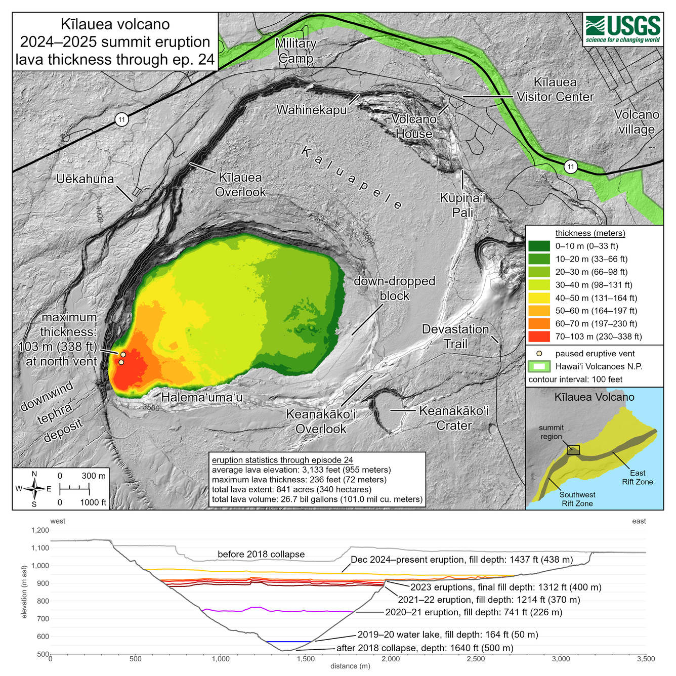
A new map shows thickness values for lava flows within Halema‘uma‘u crater from the Kīlauea summit eruption that began on December 23, 2024. And UAS work at the summit provides views into the north vent.
Media
Sources/Usage: Public Domain. View Media Details
Media
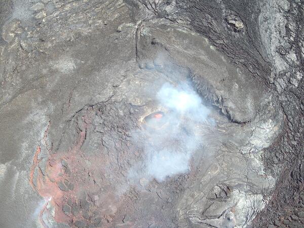
This near-vertical view into the north vent within Halema‘uma‘u crater was captured during a USGS Hawaiian Volcano Observatory UAS (uncrewed aircraft systems) flight on June 26, 2025. The aircraft was about 150 m (500 ft) above the vent, with north oriented to the upper left in this view. The opening in the vent was estimated to measure 5–10 m (16–33 ft) across, with a small pool of lava deep within. Every few minutes, weak lava spattering was observed in this pool. These UAS flights were conducted with the permission of Hawai‘i Volcanoes National Park, owing to the Hawaiian Volcano Observatory's mission to monitor active volcanoes in Hawaii, assess their hazards, issue warnings, and advance scientific understanding to reduce the impacts of eruptions. Unauthorized launching, landing, or operating of a UAS from or on lands and waters administered by the National Park Service is prohibited under 36 CFR Closures & Public Use. USGS photo by M. Zoeller.
Sources/Usage: Public Domain. View Media Details
Media
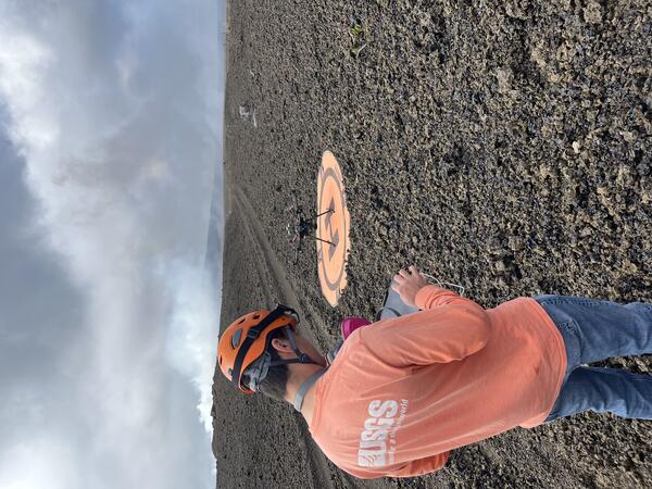
On June 26, the USGS Hawaiian Volcano Observatory conducted a UAS (uncrewed aircraft systems) mission to monitor the ongoing Kīlauea summit eruption and map its tephra deposits. Here, a geologist prepares for a flight from former Crater Rim Drive within the closed portion of Hawai‘i Volcanoes National Park. The road is now buried under about a foot of tephra in this area, but the deposit is even thicker directly downwind of the eruptive vents; the approximately 80-foot (25-meter) Pu‘u in the background of this photo has been built entirely during this eruption. UAS flights are conducted with the permission of the National Park and aid in hazard assessment of ongoing volcanic activity. Unauthorized launching, landing, or operating of a UAS from or on lands and waters administered by the National Park Service is prohibited under 36 CFR Closures & Public Use. USGS photo by P. Dotray.
Sources/Usage: Public Domain. View Media Details