



Backscattered electron image of olivine grains erupted at the summit of Kīlauea. Numbers in grains are forsterite (Fo) contents that measure the ratio of Magnesium (Mg) and Iron (Fe). Fo=100*(Mg/(Mg+Fe)). Panel A shows a typical olivine that has one composition (Fo83).
Multimedia
Images
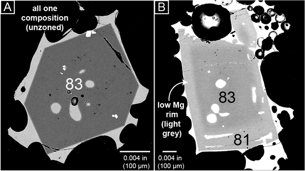
Olivine grains erupted at the summit of Kīlauea
Backscattered electron image of olivine grains erupted at the summit of Kīlauea. Numbers in grains are forsterite (Fo) contents that measure the ratio of Magnesium (Mg) and Iron (Fe). Fo=100*(Mg/(Mg+Fe)). Panel A shows a typical olivine that has one composition (Fo83).
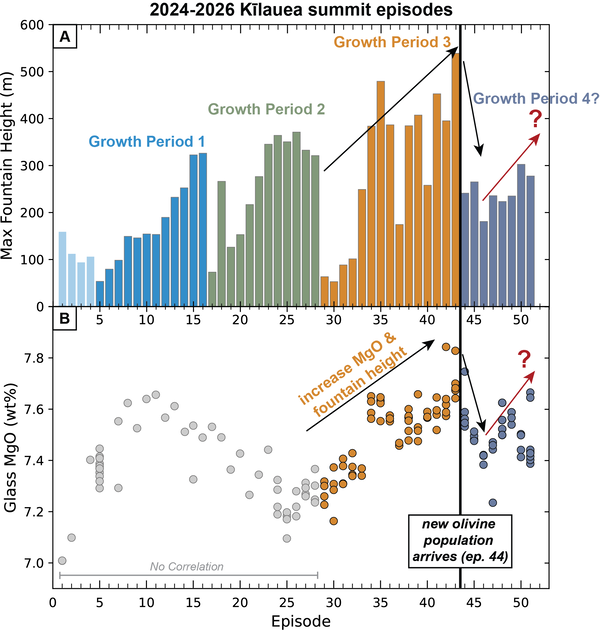
Kīlauea summit lava fountain heights and chemistry over time
Kīlauea summit lava fountain heights and chemistry over timeA) Maximum lava fountain heights during episodes 1-51 of the episodic eruption at the summit of Kīlauea in meters with three cycles of fountain height growth. B) Magnesium oxide (MgO) concentrations in the glass of tephra samples from episodes 1-51.
Kīlauea summit lava fountain heights and chemistry over time
Kīlauea summit lava fountain heights and chemistry over timeA) Maximum lava fountain heights during episodes 1-51 of the episodic eruption at the summit of Kīlauea in meters with three cycles of fountain height growth. B) Magnesium oxide (MgO) concentrations in the glass of tephra samples from episodes 1-51.
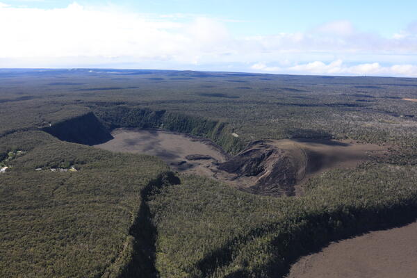
July 29, 2026—Kīlauea Iki and East Rift Zone
During the USGS Hawaiian Volcano Observatory overflight on July 29, geologists had clear views to the east of Kīlauea summit—a somewhat rare occurrence, as this area is often cloaked in misty rain. Here, Kīlauea Iki is seen in the foreground, with the East Rift Zone stretching across the background.
During the USGS Hawaiian Volcano Observatory overflight on July 29, geologists had clear views to the east of Kīlauea summit—a somewhat rare occurrence, as this area is often cloaked in misty rain. Here, Kīlauea Iki is seen in the foreground, with the East Rift Zone stretching across the background.
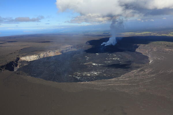
July 29, 2026—Overview of Halema‘uma‘u
On July 29, clear skies provided USGS Hawaiian Volcano Observatory geologists with excellent views of Halema‘uma‘u during a morning helicopter overflight after Kīlauea summit eruption episode 52 ended overnight. In fact, the only cloud casting shadows over the crater was the residual gas plume from the eruptive vents, which was rising vertically due to calm winds.
On July 29, clear skies provided USGS Hawaiian Volcano Observatory geologists with excellent views of Halema‘uma‘u during a morning helicopter overflight after Kīlauea summit eruption episode 52 ended overnight. In fact, the only cloud casting shadows over the crater was the residual gas plume from the eruptive vents, which was rising vertically due to calm winds.
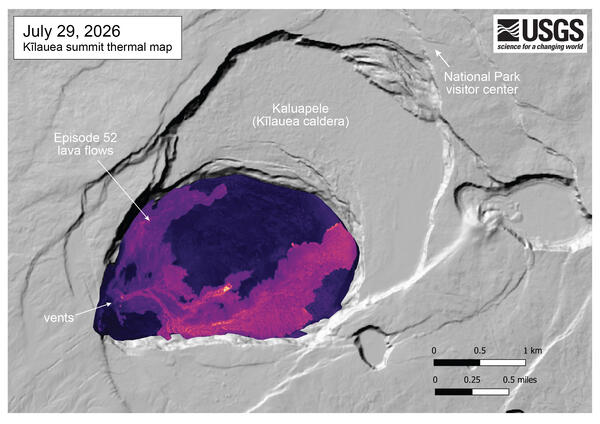
July 29, 2026 — Thermal map of Kīlauea summit
This thermal map shows the summit of Kīlauea hours after the end of episode 52 lava fountaining on July 29, 2026. The lava flow produced by this fountain mainly flowed along the southern perimeter of the crater floor, and was stalled by the time of the overflight. However, several small breakouts were still active in several areas.
This thermal map shows the summit of Kīlauea hours after the end of episode 52 lava fountaining on July 29, 2026. The lava flow produced by this fountain mainly flowed along the southern perimeter of the crater floor, and was stalled by the time of the overflight. However, several small breakouts were still active in several areas.
July 28, 2026 — Kīlauea summit eruption episode 52 at night
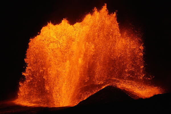
July 28, 2026 — Kīlauea summit eruption episode 52 at nightOnly the north vent erupted a lava fountain during episode 52 at the summit of Kīlauea. The south vent did not erupt any lava during precursory activity or the eruptive episode, but it did emit flames at the end of the episode. The north vent lava fountain reached a peak height of approximately 500 feet (150 meters) around 9:00 p.m. HST on July 28, 2026.
July 28, 2026 — Kīlauea summit eruption episode 52 at night
July 28, 2026 — Kīlauea summit eruption episode 52 at nightOnly the north vent erupted a lava fountain during episode 52 at the summit of Kīlauea. The south vent did not erupt any lava during precursory activity or the eruptive episode, but it did emit flames at the end of the episode. The north vent lava fountain reached a peak height of approximately 500 feet (150 meters) around 9:00 p.m. HST on July 28, 2026.
Videos
July 15, 2026 — Timelapse video of Kīlauea episode 51 of lava fountaining from the V3cam
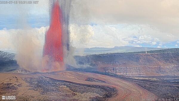
July 15, 2026 — Timelapse video of Kīlauea episode 51 of lava fountaining from the V3camEpisode 51 of lava fountaining in Halemaʻumaʻu at the summit of Kīlauea took place for about 8 hours on July 15, 2026. This timelapse video of the episode was taken by the V3cam, located on the southern rim of the crater in Hawaiʻi Volcanoes National Park. The camera is a pan-tilt-zoom model so the perspective changes several times during the timelapse video.
July 15, 2026 — Timelapse video of Kīlauea episode 51 of lava fountaining from the V3cam
July 15, 2026 — Timelapse video of Kīlauea episode 51 of lava fountaining from the V3camEpisode 51 of lava fountaining in Halemaʻumaʻu at the summit of Kīlauea took place for about 8 hours on July 15, 2026. This timelapse video of the episode was taken by the V3cam, located on the southern rim of the crater in Hawaiʻi Volcanoes National Park. The camera is a pan-tilt-zoom model so the perspective changes several times during the timelapse video.
July 15, 2026 — Timelapse video of Kīlauea episode 51 of lava fountaining from the K2cam
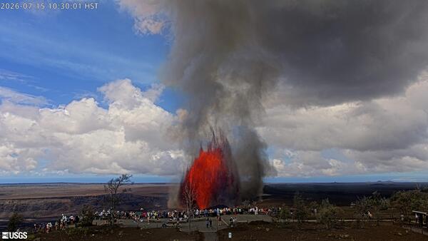
July 15, 2026 — Timelapse video of Kīlauea episode 51 of lava fountaining from the K2camEpisode 51 of lava fountaining in Halemaʻumaʻu at the summit of Kīlauea took place for about 8 hours on July 15, 2026. This timelapse video of the episode was taken by the K2cam, located near Uēkahuna bluff in Hawaiʻi Volcanoes National Park, and shows visitors viewing the eruption. USGS webcam video.
July 15, 2026 — Timelapse video of Kīlauea episode 51 of lava fountaining from the K2cam
July 15, 2026 — Timelapse video of Kīlauea episode 51 of lava fountaining from the K2camEpisode 51 of lava fountaining in Halemaʻumaʻu at the summit of Kīlauea took place for about 8 hours on July 15, 2026. This timelapse video of the episode was taken by the K2cam, located near Uēkahuna bluff in Hawaiʻi Volcanoes National Park, and shows visitors viewing the eruption. USGS webcam video.
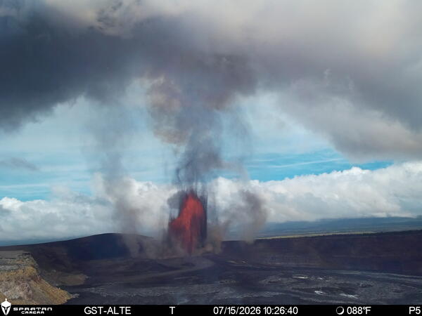
July 15, 2026 — Timelapse of Kīlauea episode 51 of lava fountaining from the S4cam
July 15, 2026 — Timelapse of Kīlauea episode 51 of lava fountaining from the S4camEpisode 51 of lava fountaining in Halemaʻumaʻu at the summit of Kīlauea took place for about 8 hours on July 15, 2026. This timelapse video of the episode was taken by the S4cam, located on the south rim of the summit caldera in Hawaiʻi Volcanoes National Park. USGS webcam video.
July 15, 2026 — Timelapse of Kīlauea episode 51 of lava fountaining from the S4cam
July 15, 2026 — Timelapse of Kīlauea episode 51 of lava fountaining from the S4camEpisode 51 of lava fountaining in Halemaʻumaʻu at the summit of Kīlauea took place for about 8 hours on July 15, 2026. This timelapse video of the episode was taken by the S4cam, located on the south rim of the summit caldera in Hawaiʻi Volcanoes National Park. USGS webcam video.
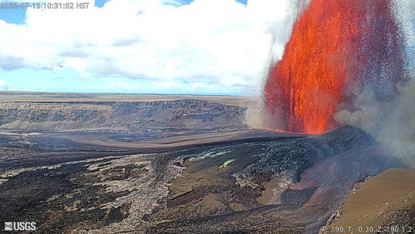
July 15, 2026 — Timelapse video of Kīlauea episode 51 of lava fountaining from the V1cam
July 15, 2026 — Timelapse video of Kīlauea episode 51 of lava fountaining from the V1camEpisode 51 of lava fountaining in Halemaʻumaʻu at the summit of Kīlauea took place for about 8 hours on July 15, 2026. This photograph of the episode was taken by the V1cam, located on the northwest rim of the crater in Hawaiʻi Volcanoes National Park. The camera is a pan-tilt-zoom model so the perspective changes several times during the timelapse video.
July 15, 2026 — Timelapse video of Kīlauea episode 51 of lava fountaining from the V1cam
July 15, 2026 — Timelapse video of Kīlauea episode 51 of lava fountaining from the V1camEpisode 51 of lava fountaining in Halemaʻumaʻu at the summit of Kīlauea took place for about 8 hours on July 15, 2026. This photograph of the episode was taken by the V1cam, located on the northwest rim of the crater in Hawaiʻi Volcanoes National Park. The camera is a pan-tilt-zoom model so the perspective changes several times during the timelapse video.
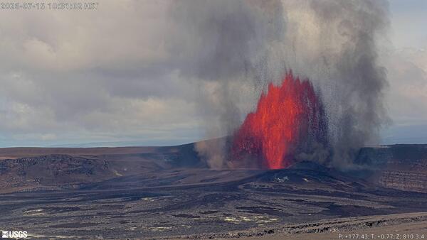
July 15, 2026 — Timelapse video Kīlauea episode 51 of lava fountaining from the V2cam
July 15, 2026 — Timelapse video Kīlauea episode 51 of lava fountaining from the V2camEpisode 51 of lava fountaining in Halemaʻumaʻu at the summit of Kīlauea took place for about 8 hours on July 15, 2026. This timelapse video of the episode was taken by the V2cam, located on the easter rim of the crater in Hawaiʻi Volcanoes National Park. The camera is a pan-tilt-zoom model so the perspective changes several times during the timelapse video.
July 15, 2026 — Timelapse video Kīlauea episode 51 of lava fountaining from the V2cam
July 15, 2026 — Timelapse video Kīlauea episode 51 of lava fountaining from the V2camEpisode 51 of lava fountaining in Halemaʻumaʻu at the summit of Kīlauea took place for about 8 hours on July 15, 2026. This timelapse video of the episode was taken by the V2cam, located on the easter rim of the crater in Hawaiʻi Volcanoes National Park. The camera is a pan-tilt-zoom model so the perspective changes several times during the timelapse video.
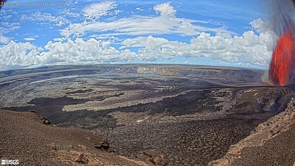
July 15, 2026 — Timelapse video Kīlauea episode 51 of lava fountaining from the KWcam
July 15, 2026 — Timelapse video Kīlauea episode 51 of lava fountaining from the KWcamEpisode 51 of lava fountaining in Halemaʻumaʻu at the summit of Kīlauea took place for about 8 hours on July 15, 2026. This timelapse video of the episode was taken by the KWcam, located on the northwest rim of the caldera in Hawaiʻi Volcanoes National Park. USGS webcam video.
July 15, 2026 — Timelapse video Kīlauea episode 51 of lava fountaining from the KWcam
July 15, 2026 — Timelapse video Kīlauea episode 51 of lava fountaining from the KWcamEpisode 51 of lava fountaining in Halemaʻumaʻu at the summit of Kīlauea took place for about 8 hours on July 15, 2026. This timelapse video of the episode was taken by the KWcam, located on the northwest rim of the caldera in Hawaiʻi Volcanoes National Park. USGS webcam video.
Audio
Volcano Minute — What can chemistry tell us about lava fountain heights?
Volcano Minute — What can chemistry tell us about lava fountain heights?The Volcano Minute is a brief audio update about eruptions, earthquakes, or ongoing volcano science in Hawaii, brought to you by scientists and affiliates of the U.S. Geological Survey Hawaiian Volcano Observatory.
Volcano Minute — What can chemistry tell us about lava fountain heights?
Volcano Minute — What can chemistry tell us about lava fountain heights?The Volcano Minute is a brief audio update about eruptions, earthquakes, or ongoing volcano science in Hawaii, brought to you by scientists and affiliates of the U.S. Geological Survey Hawaiian Volcano Observatory.
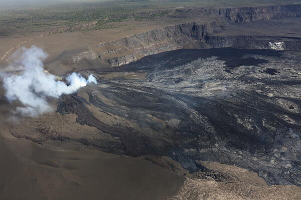
Volcano Minute — Will lava flow out of the caldera?
Volcano Minute — Will lava flow out of the caldera?The Volcano Minute is a brief audio update about eruptions, earthquakes, or ongoing volcano science in Hawaii, brought to you by scientists and affiliates of the U.S. Geological Survey Hawaiian Volcano Observatory.
Volcano Minute — Will lava flow out of the caldera?
Volcano Minute — Will lava flow out of the caldera?The Volcano Minute is a brief audio update about eruptions, earthquakes, or ongoing volcano science in Hawaii, brought to you by scientists and affiliates of the U.S. Geological Survey Hawaiian Volcano Observatory.
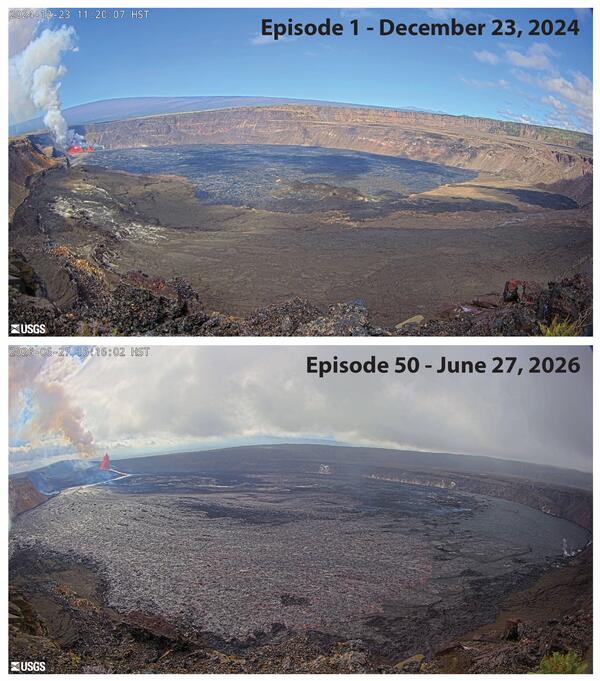
Volcano Minute — Fifty lava fountains: Hawaii Five-O
Volcano Minute — Fifty lava fountains: Hawaii Five-OThe Volcano Minute is a brief audio update about eruptions, earthquakes, or ongoing volcano science in Hawaii, brought to you by scientists and affiliates of the U.S. Geological Survey Hawaiian Volcano Observatory.
Volcano Minute — Fifty lava fountains: Hawaii Five-O
Volcano Minute — Fifty lava fountains: Hawaii Five-OThe Volcano Minute is a brief audio update about eruptions, earthquakes, or ongoing volcano science in Hawaii, brought to you by scientists and affiliates of the U.S. Geological Survey Hawaiian Volcano Observatory.
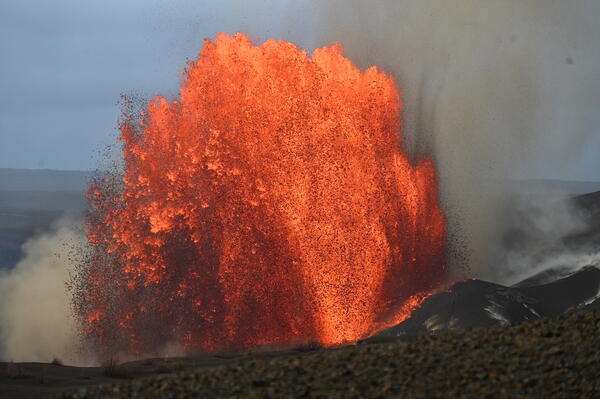
Volcano Minute — Episodes and Eruptions
The Volcano Minute is a brief audio update about eruptions, earthquakes, or ongoing volcano science in Hawaii, brought to you by scientists and affiliates of the U.S. Geological Survey Hawaiian Volcano Observatory.
The Volcano Minute is a brief audio update about eruptions, earthquakes, or ongoing volcano science in Hawaii, brought to you by scientists and affiliates of the U.S. Geological Survey Hawaiian Volcano Observatory.
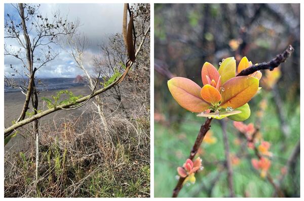
Volcano Minute — What happened to the leaves around Kīlauea summit?
Volcano Minute — What happened to the leaves around Kīlauea summit?The Volcano Minute is a brief audio update about eruptions, earthquakes, or ongoing volcano science in Hawaii, brought to you by scientists and affiliates of the U.S. Geological Survey Hawaiian Volcano Observatory.
Volcano Minute — What happened to the leaves around Kīlauea summit?
Volcano Minute — What happened to the leaves around Kīlauea summit?The Volcano Minute is a brief audio update about eruptions, earthquakes, or ongoing volcano science in Hawaii, brought to you by scientists and affiliates of the U.S. Geological Survey Hawaiian Volcano Observatory.
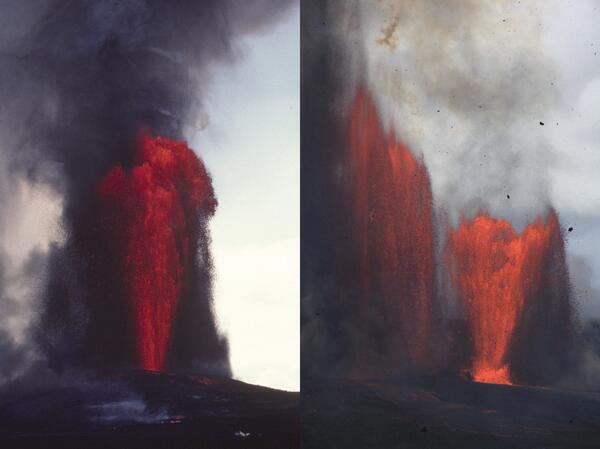
Volcano Minute — Kīlauea's Halemaʻumaʻu eruption reaches a historic milestone
Volcano Minute — Kīlauea's Halemaʻumaʻu eruption reaches a historic milestoneThe Volcano Minute is a brief audio update about eruptions, earthquakes, or ongoing volcano science in Hawaii, brought to you by scientists and affiliates of the U.S. Geological Survey Hawaiian Volcano Observatory.
Volcano Minute — Kīlauea's Halemaʻumaʻu eruption reaches a historic milestone
Volcano Minute — Kīlauea's Halemaʻumaʻu eruption reaches a historic milestoneThe Volcano Minute is a brief audio update about eruptions, earthquakes, or ongoing volcano science in Hawaii, brought to you by scientists and affiliates of the U.S. Geological Survey Hawaiian Volcano Observatory.
Webcams
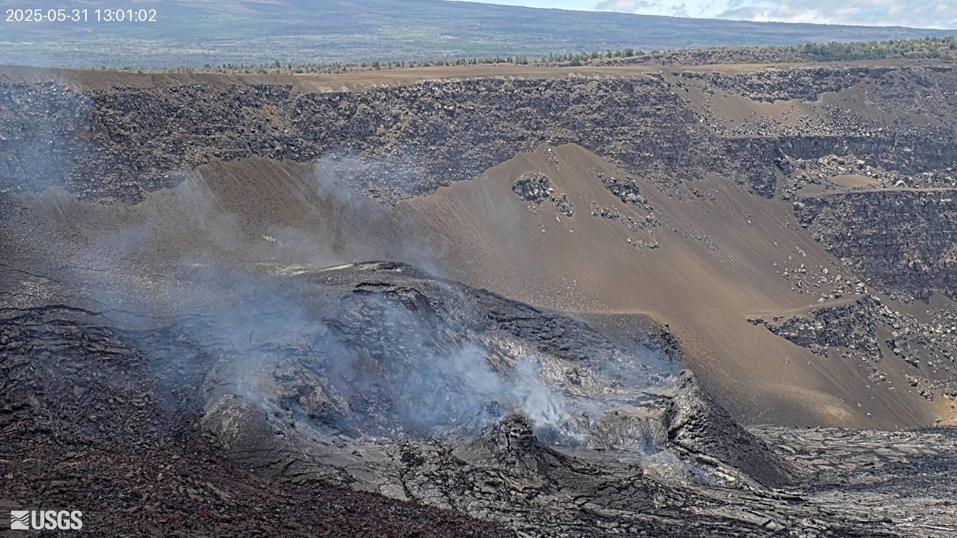
[V3cam] Kīlauea volcano, Hawaii (south Halemaʻumaʻu crater)
[V3cam] Kīlauea volcano, Hawaii (south Halemaʻumaʻu crater)Last 24 Hours - Live view of Halemaʻumaʻu crater within Kaluapele (Kīlauea caldera), from the south rim of the crater [V3cam]. This camera is a pan-tilt-zoom model and the view may change depending on activity.
Disclaimer
[V3cam] Kīlauea volcano, Hawaii (south Halemaʻumaʻu crater)
[V3cam] Kīlauea volcano, Hawaii (south Halemaʻumaʻu crater)Last 24 Hours - Live view of Halemaʻumaʻu crater within Kaluapele (Kīlauea caldera), from the south rim of the crater [V3cam]. This camera is a pan-tilt-zoom model and the view may change depending on activity.
Disclaimer
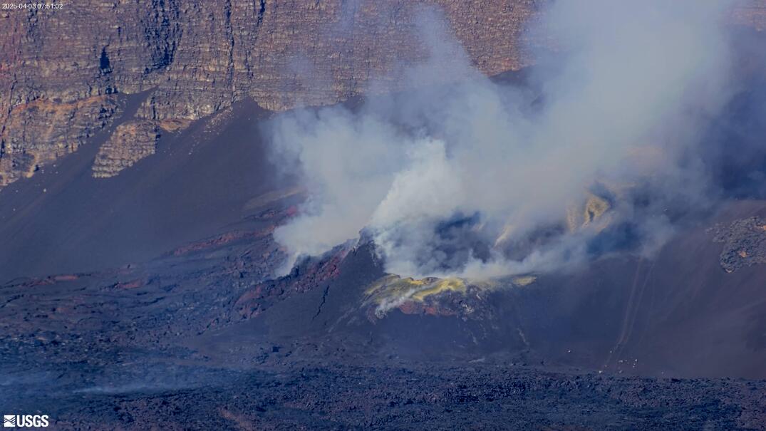
[V2cam] Kīlauea volcano, Hawaii (east Halemaʻumaʻu crater)
[V2cam] Kīlauea volcano, Hawaii (east Halemaʻumaʻu crater)Live view of Kaluapele (Kīlauea caldera) and Halemaʻumaʻu crater, from the northeast rim of the caldera [V2cam]. This camera is a pan-tilt-zoom model and the view may change depending on activity.
Disclaimer
[V2cam] Kīlauea volcano, Hawaii (east Halemaʻumaʻu crater)
[V2cam] Kīlauea volcano, Hawaii (east Halemaʻumaʻu crater)Live view of Kaluapele (Kīlauea caldera) and Halemaʻumaʻu crater, from the northeast rim of the caldera [V2cam]. This camera is a pan-tilt-zoom model and the view may change depending on activity.
Disclaimer
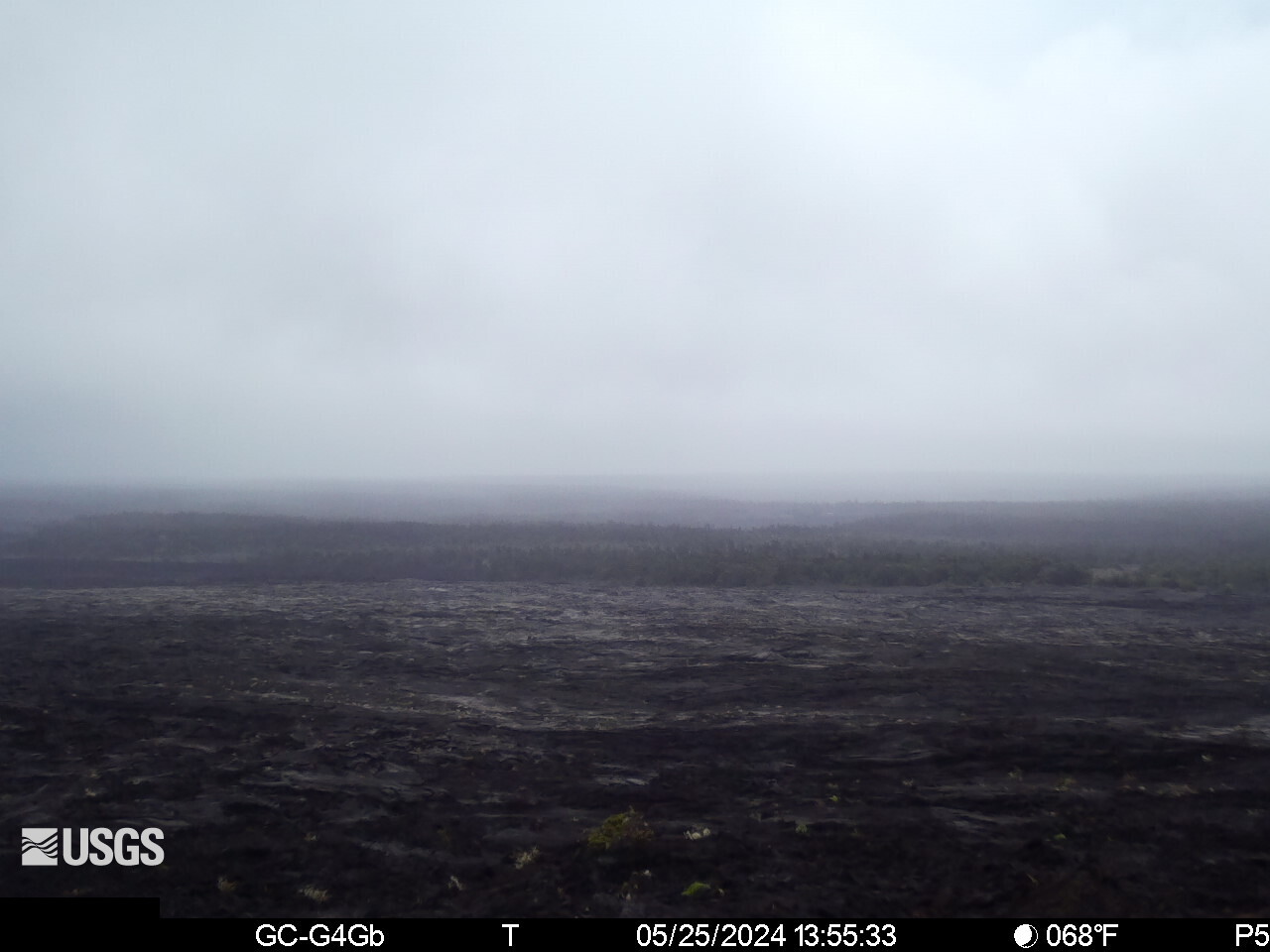
[KOcam] Live Image of upper East Rift Zone from Maunaulu
[KOcam] Live Image of upper East Rift Zone from MaunauluThis image is from a temporary research camera positioned near Maunaulu, looking northwest toward the upper East Rift Zone of Kīlauea.
Disclaimer
[KOcam] Live Image of upper East Rift Zone from Maunaulu
[KOcam] Live Image of upper East Rift Zone from MaunauluThis image is from a temporary research camera positioned near Maunaulu, looking northwest toward the upper East Rift Zone of Kīlauea.
Disclaimer
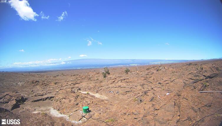
[MITDcam] Kīlauea upper Southwest Rift Zone
[MITDcam] Live view of Kīlauea's upper Southwest Rift Zone, looking northwest from a seismic station in the Kaʻū Desert.
[MITDcam] Live view of Kīlauea's upper Southwest Rift Zone, looking northwest from a seismic station in the Kaʻū Desert.
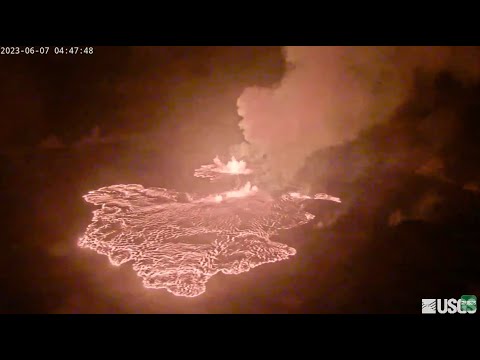
Kīlauea Volcano Live Stream - Halemaʻumaʻu crater
Live view of the eruption in Halemaʻumaʻu, from the northwest rim of the caldera, looking east [V1cam] on the USGS YouTube Channel.
Live view of the eruption in Halemaʻumaʻu, from the northwest rim of the caldera, looking east [V1cam] on the USGS YouTube Channel.
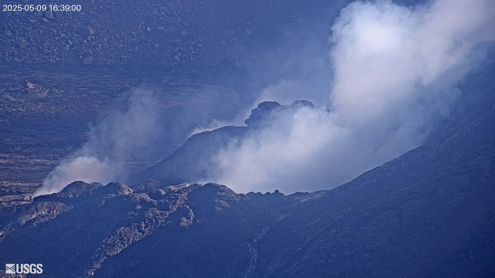
[V1cam] Kīlauea volcano, Hawaii (west Halemaʻumaʻu crater)
[V1cam] Kīlauea volcano, Hawaii (west Halemaʻumaʻu crater)Live view of Halemaʻumaʻu crater within Kaluapele (Kīlauea caldera), from the northwest rim of the crater [V1cam]. This camera is a pan-tilt-zoom model and the view may change depending on activity.
Disclaimer
[V1cam] Kīlauea volcano, Hawaii (west Halemaʻumaʻu crater)
[V1cam] Kīlauea volcano, Hawaii (west Halemaʻumaʻu crater)Live view of Halemaʻumaʻu crater within Kaluapele (Kīlauea caldera), from the northwest rim of the crater [V1cam]. This camera is a pan-tilt-zoom model and the view may change depending on activity.
Disclaimer