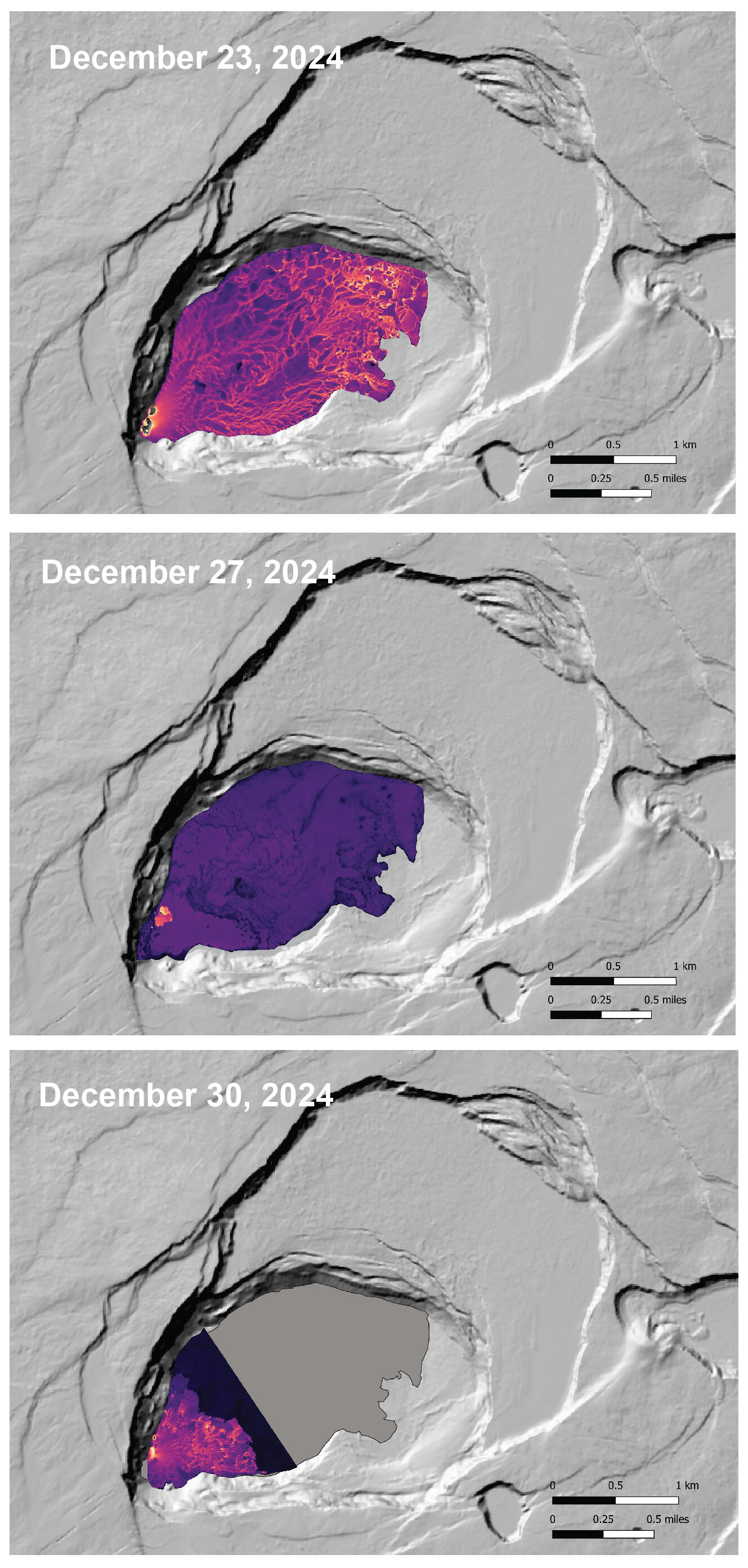
This thermal map shows eruptive activity on December 30, 2024, within Halemaʻumaʻu crater at the summit of Kīlauea. Lava fountaining and flows were active in the southwest portion of the caldera. Cooler colors (purple, black) show lower temperatures while hotter colors (orange, yellow) show higher temperatures.
December 30, 2024 — Kīlauea summit thermal map compilation
Related
This thermal map shows eruptive activity on December 30, 2024, within Halemaʻumaʻu crater at the summit of Kīlauea. Lava fountaining and flows were active in the southwest portion of the caldera. Cooler colors (purple, black) show lower temperatures while hotter colors (orange, yellow) show higher temperatures.
This map shows deformation at Kīlauea volcano associated with the ongoing eruption that started on December 23, 2024. The image covers the timespan from December 17–29, 2024, using data acquired by the European Space Agency's Sentinel-1A satellite. Colored fringes denote areas of ground deformation, with more fringes indicating more deformation. Each