
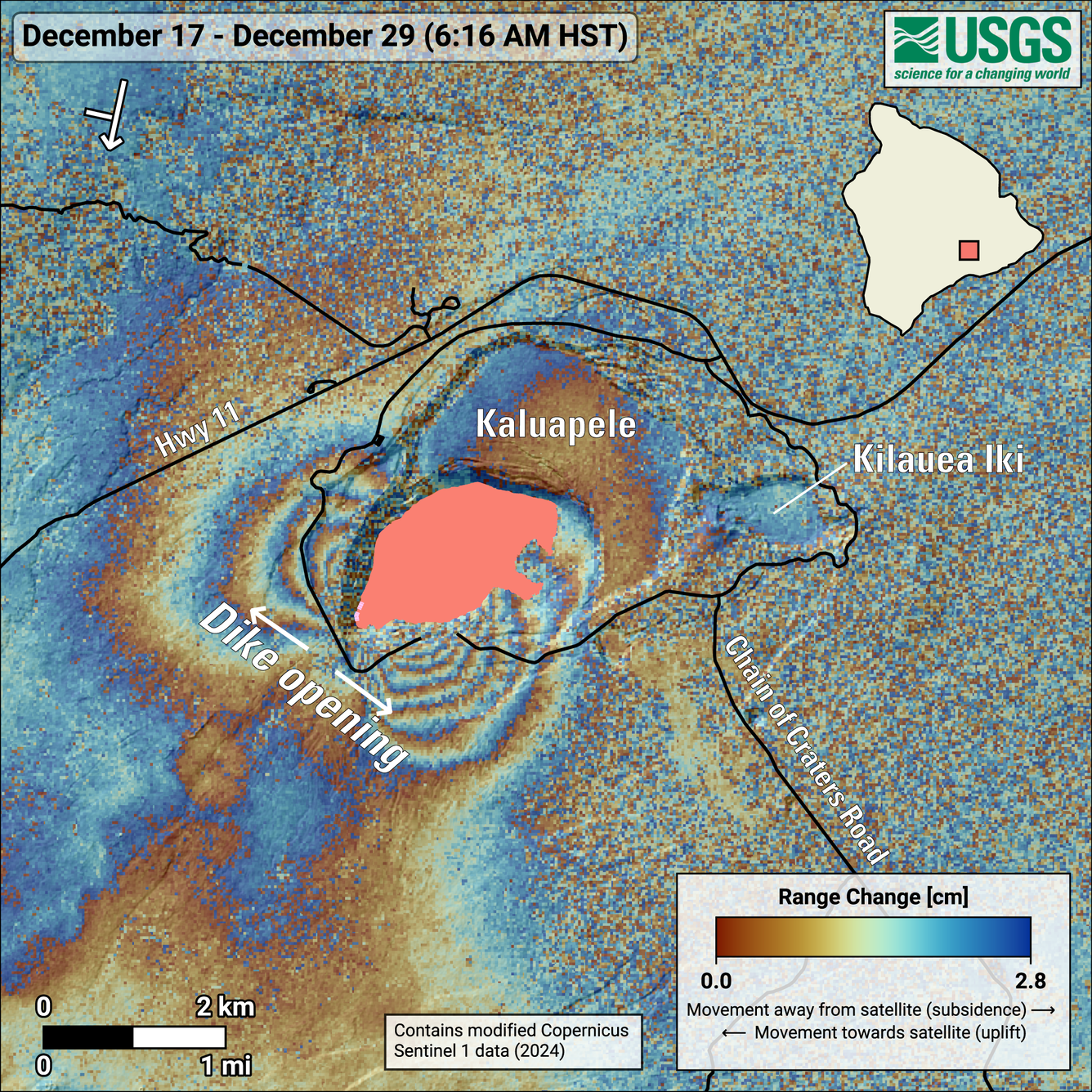
December 29, 2024—InSAR image of Kīlauea deformation associated with ongoing eruption
Detailed Description
This map shows deformation at Kīlauea volcano associated with the ongoing eruption that started on December 23, 2024. The image covers the timespan from December 17–29, 2024, using data acquired by the European Space Agency's Sentinel-1A satellite. Colored fringes denote areas of ground deformation, with more fringes indicating more deformation. Each color cycle represents 2.8 centimeters (1.1 inches) of range change. The symbol in the upper left indicates the satellite's orbit direction (arrow) and look direction (bar). The two lobes of deformation mark the two sides of the fissures that opened between the Halemaʻumaʻu magma chamber at a depth of approximately 1.5 kilometers (1 mile) and the ground surface. The current lava fountaining location is near the southwestern corner of the active lava flow field (pink area). For information about interpreting interferograms, see this "Volcano Watch" article: It’s all about perspective: How to interpret an interferogram.
Sources/Usage
Public Domain.