
December 30, 2024 — Kīlauea summit thermal map compilation
Detailed Description
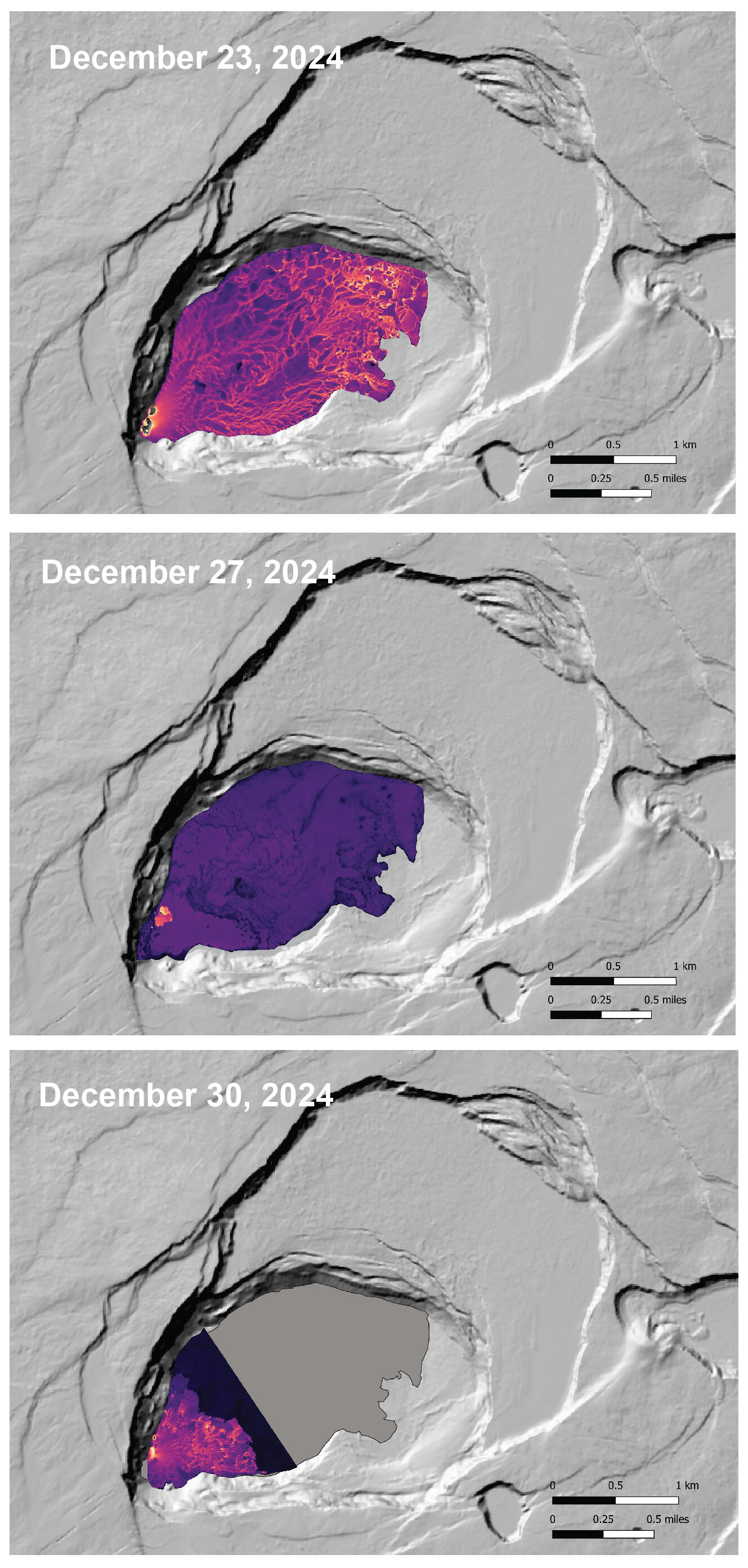
This compilation shows thermal maps of Kīlauea summit eruption from December 23-30, 2024. Initially high eruption vigor resulted in lava flows covering much of the southwest portion of the caldera with active lava flows on December 23, 2024. On December 27, 2024, eruptive activity had greatly decreased and active lava was restricted to the vent area in the very southwest part of the caldera. Eruptive vigor increased and on December 30, 2024, lava flows were active in the southwest part of the caldera. Cooler colors (purple, black) show lower temperatures while hotter colors (orange, yellow) show higher temperatures. USGS map by M. Patrick.
Sources/Usage
Public Domain.