
National Ground-Water Monitoring Network (NGWMN) Conditions, September 30, 2022
Detailed Description
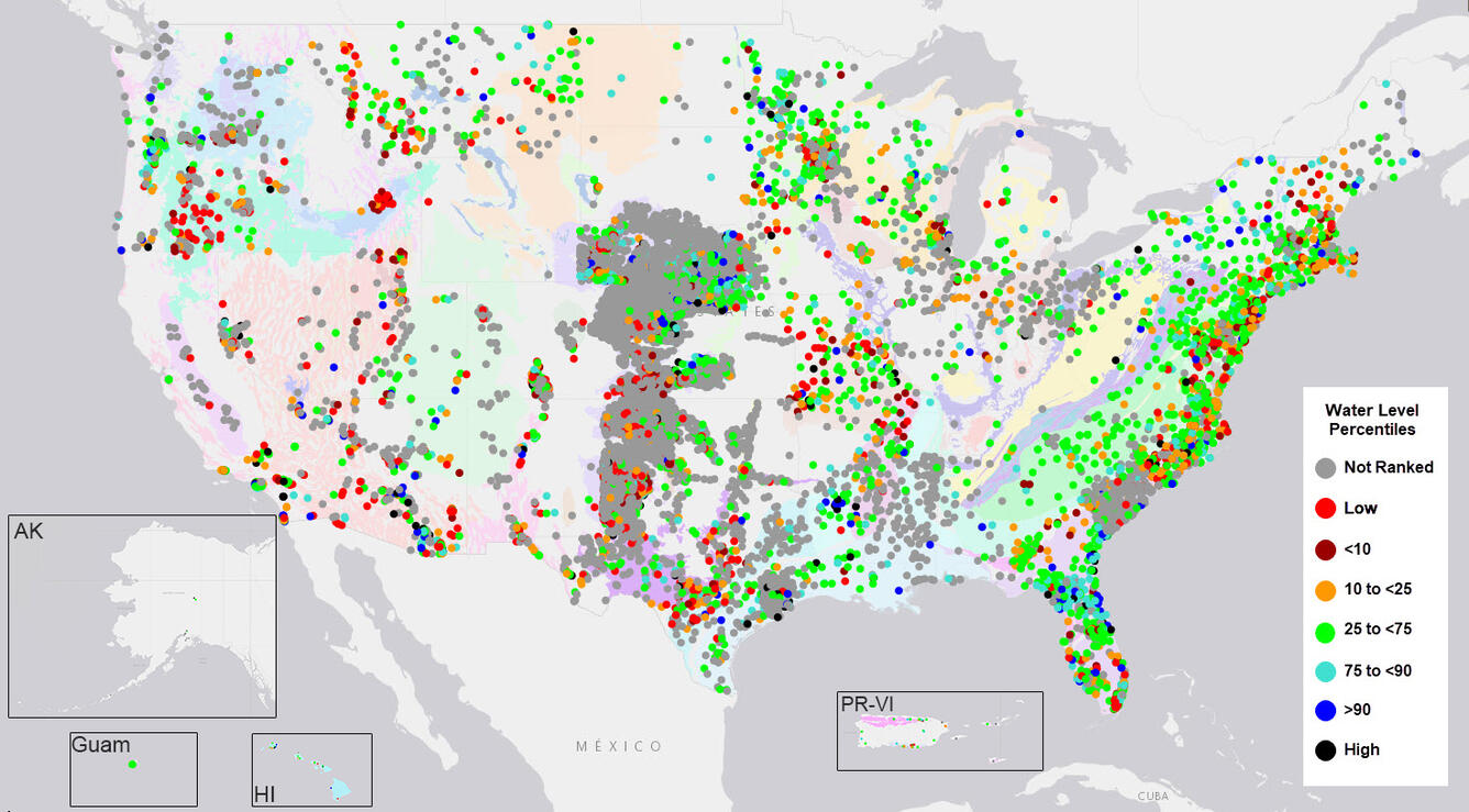
The National Ground-Water Monitoring Network (NGWMN) is a compilation of selected groundwater monitoring wells from Federal, State, and local groundwater monitoring networks across the nation. This map displays groundwater-level conditions in the NGWMN on September 30, 2022, relative to data for each well from the same month for every year data are available. As of October 3, 2022, this online database includes groundwater-level data from 17,853 sites. Users can explore the NGWMN map and data, access web services, or learn more about the network. An explanation of how the statistics are calculated is also available. In this figure, the network is displayed over a map of the Principal Aquifers of the United States. Inset maps are not to scale.
Sources/Usage
Public Domain.