
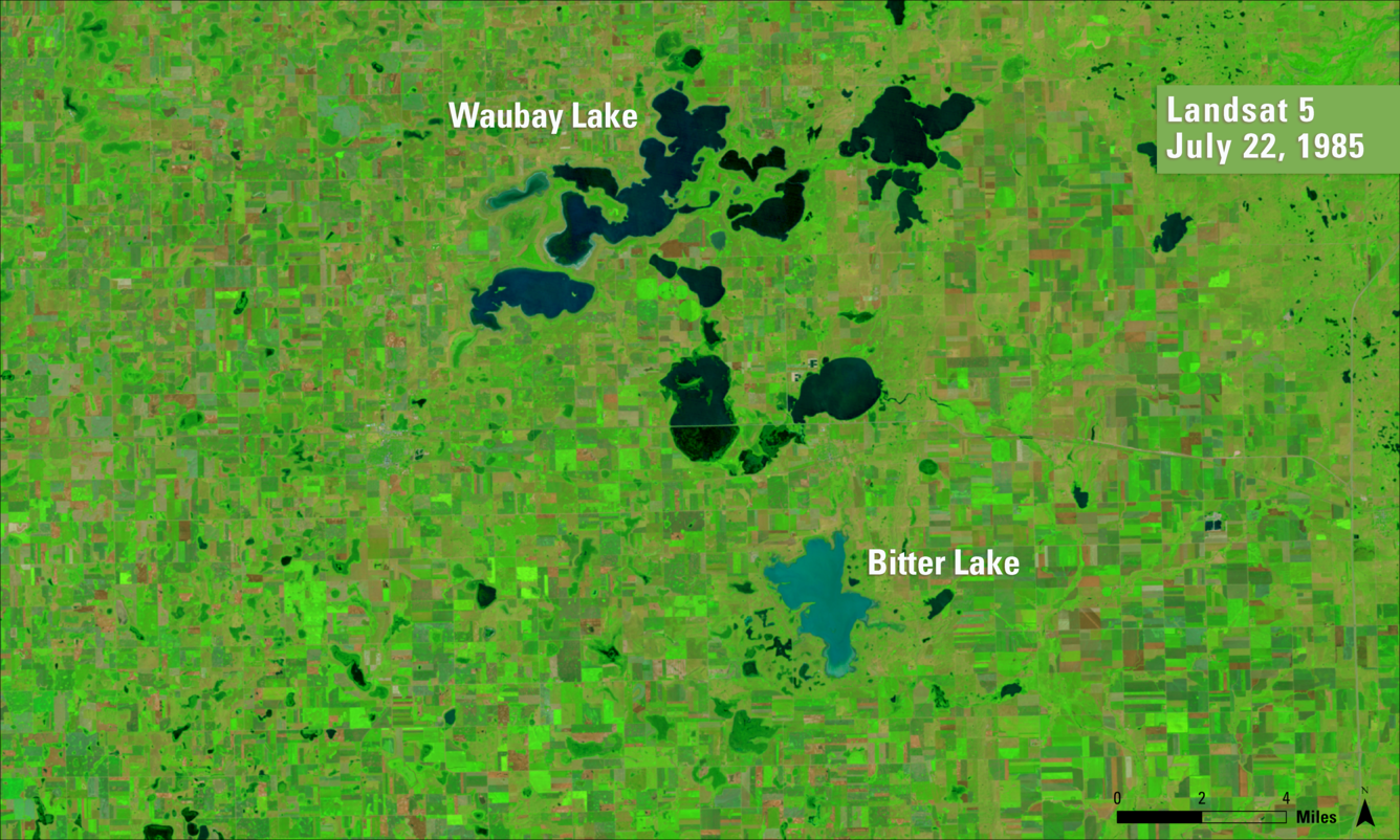
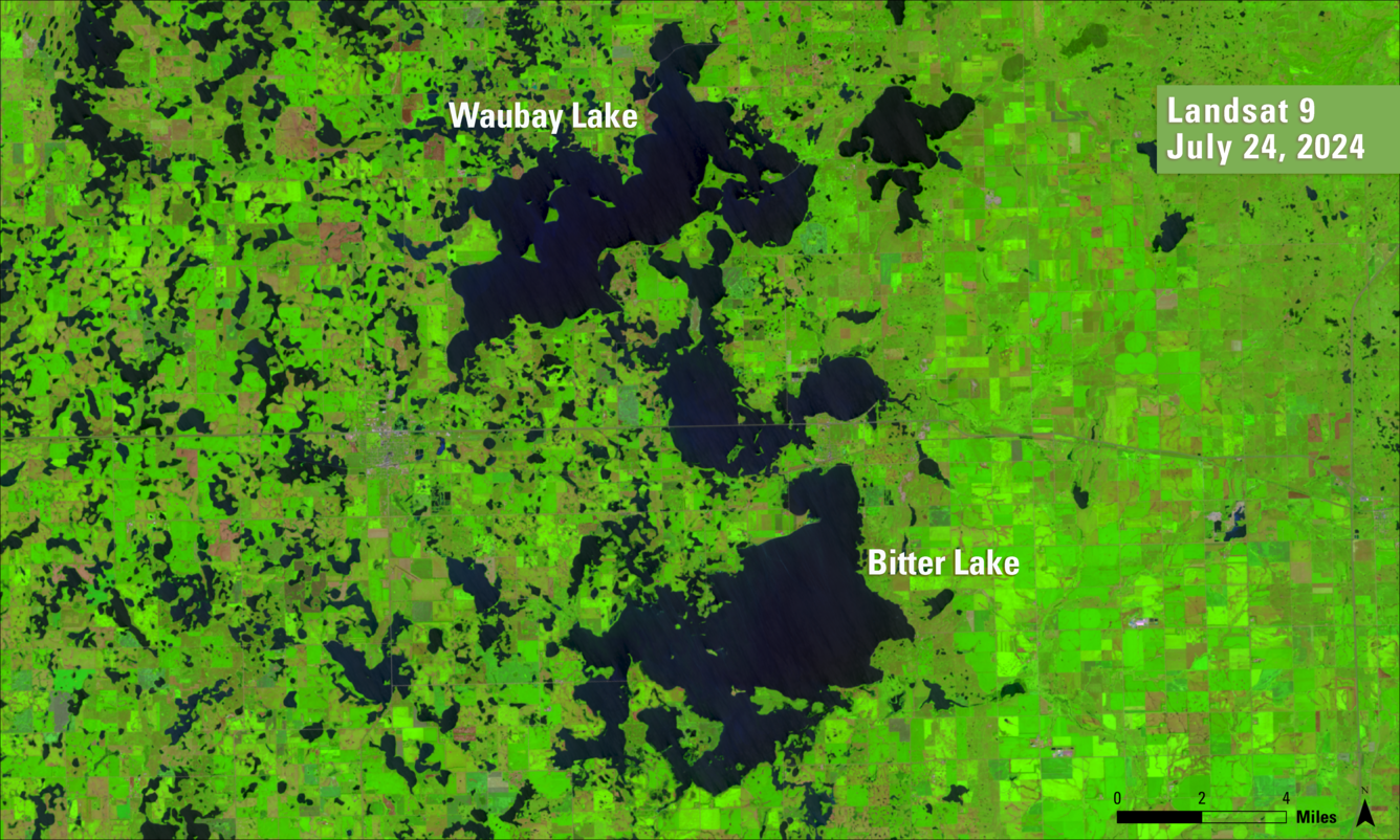
A slider of before and after images of Day County, South Dakota
Detailed Description
These false color Landsat images reveal the change in water levels for Waubay Lake and Bitter Lake in Day County, South Dakota, from July 22, 1985, to July 24, 2024. Shades can vary between satellite sensors, but blue-black represents open water, green represents vegetation and brown tones represent barer ground.
Sources/Usage
Public Domain.