
Las Vegas: 53 Years of Change
Detailed Description
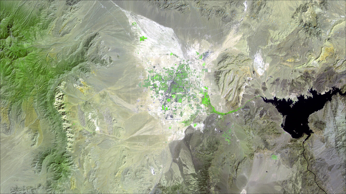
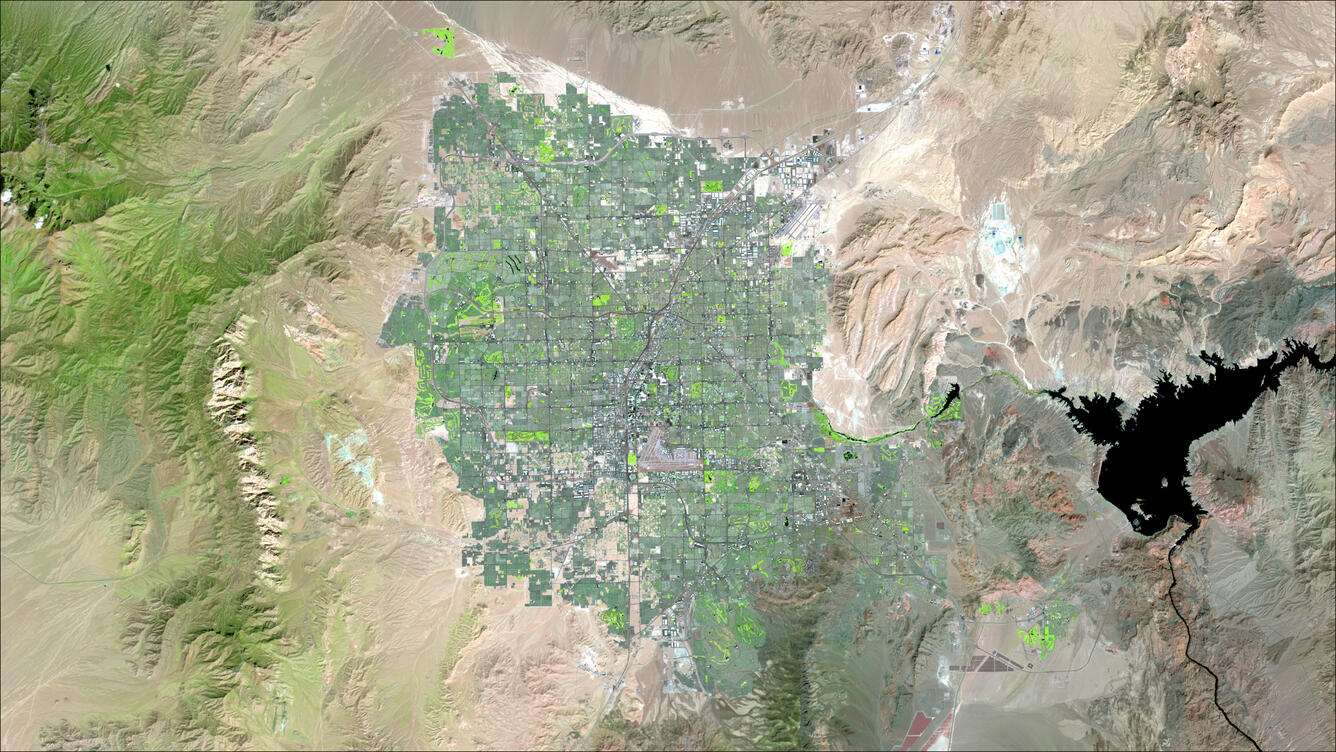
Compare Landsat images of the Las Vegas area acquired on September 13, 1972, and September 16, 2025. Over more than five decades, the metropolitan area expanded dramatically across the Las Vegas Valley while Lake Mead's shoreline changed in response to fluctuating water levels. Together, the images illustrate the value of Landsat's continuous record for observing long-term changes in urban growth, water resources, and the surrounding landscape.
Learn more about Landsat.
Sources/Usage
Public Domain.