
2018 MATRIX program
Detailed Description
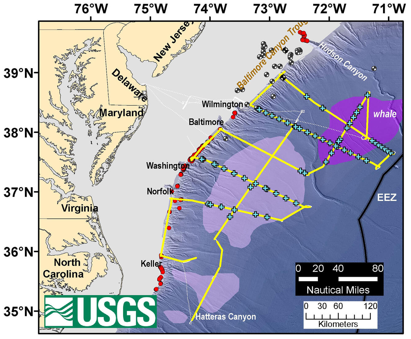
The 2018 MATRIX program collected multichannel seismic lines (yellow) through areas identified by BOEM as likely gas-hydrate accumulations (purple) and through some of the methane seeps (red circles) previously discovered on the upper-continental slope. The locations of sonobuoy deployments are marked by orange crosses. Dotted black line is the track of the R/V Hugh R. Sharp when seismic data were not being acquired. Light blue seismic line is the track of data collected in 2014 by the USGS Extended Continental Shelf project, and white seismic lines were acquired in 2014 by the National Science Foundation-sponsored Eastern North American Margin project.
Sources/Usage
Public Domain.