
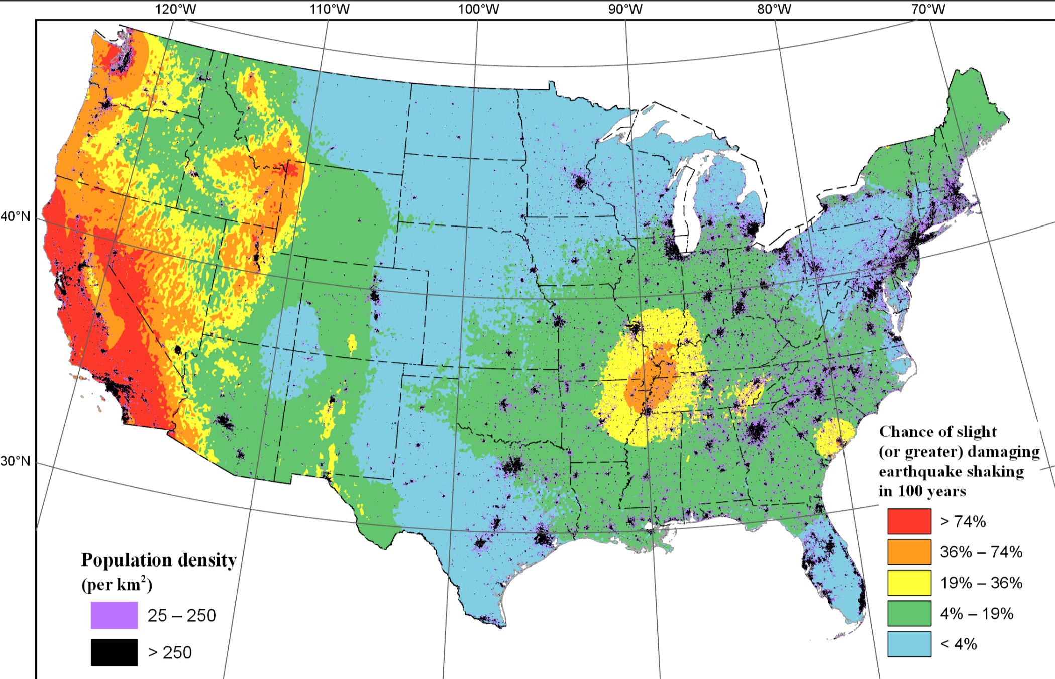
2018 NSHM - Chance of Shaking Image

Detailed Description
Map showing the chance of damaging earthquake shaking in 100 years from the 2018 NSHM. The shaking is equivalent to Modified Mercalli Intensity VI and is based on the average 1-second horizontal spectral response acceleration. Ground motions are computed for topographic-based VS30 values (Wald and Allen, 2007). Population density (from LandScan with 1 km x 1 km resolution [Dobson et al., 2000]) is superimposed on the map.
Sources/Usage
Public Domain.