
2024 Pedersen Glacier Lagoon Landslide Location Map
By Landslide Hazards Program
August 2024 (approx.)

Detailed Description
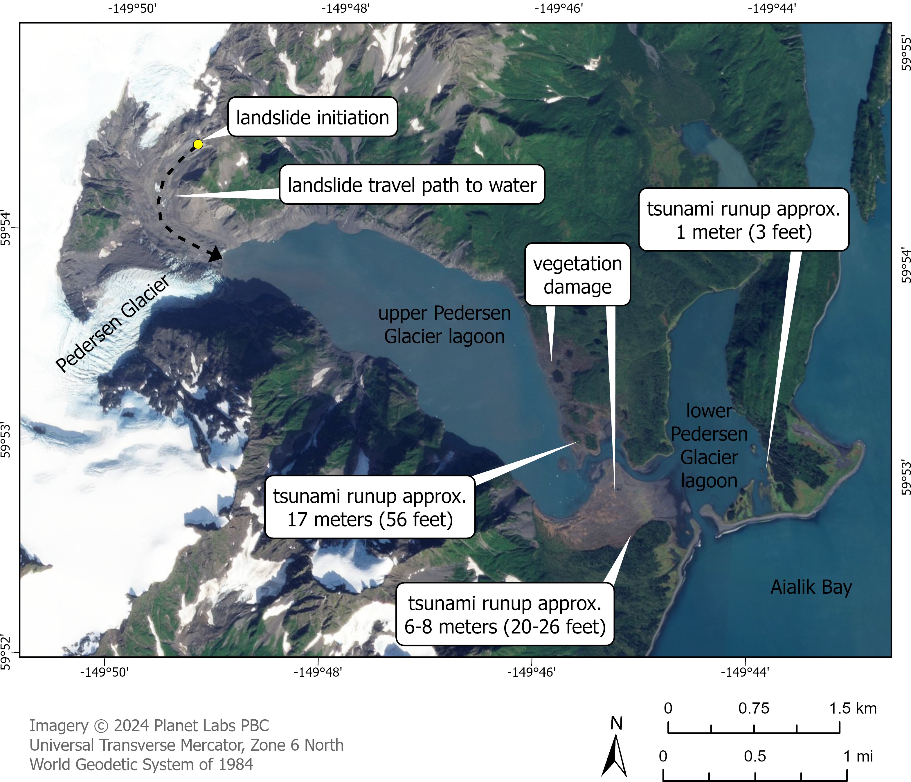
Map of upper and lower Pedersen Glacier lagoon showing the location of landslide initiation (yellow circle), approximate travel path to water (black dotted line with arrow), and preliminary estimates of tsunami runup height on land above the tide level at the time of the event.
Sources/Usage
Public Domain.
Made by Lauren Schaefer (USGS)
Related

2024 Pedersen Glacier Lagoon Landslide-Generated Tsunami
A 4.6-million-cubic-meter (equivalent to over 184 Olympic-sized swimming pools) landslide produced a tsunami in Pedersen Glacier lagoon, southwest of Seward, Alaska on Wednesday, August 7th, 2024, at approximately 04:55 AKDT / 12:55 UTC. Surveying indicated that the landslide generated tsunami runup of at least 17 meters (approx. 56 ft) in the upper Pedersen Glacier lagoon*, reducing to about one...
Related
2024 Pedersen Glacier Lagoon Landslide-Generated Tsunami
A 4.6-million-cubic-meter (equivalent to over 184 Olympic-sized swimming pools) landslide produced a tsunami in Pedersen Glacier lagoon, southwest of Seward, Alaska on Wednesday, August 7th, 2024, at approximately 04:55 AKDT / 12:55 UTC. Surveying indicated that the landslide generated tsunami runup of at least 17 meters (approx. 56 ft) in the upper Pedersen Glacier lagoon*, reducing to about one...