
2025 M7.0 Hubbard Glacier Earthquake-Triggered Landslides and Snow Avalanches Satellite Imagery GIF
Detailed Description
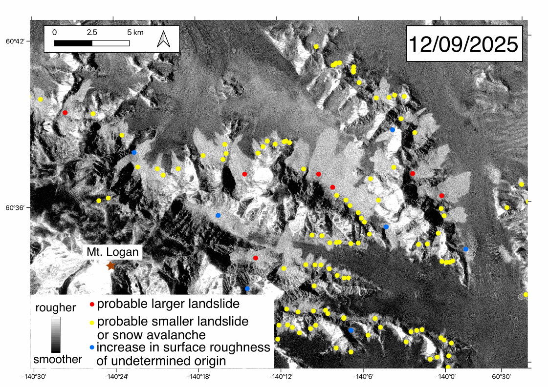
Animation of Sentinel-1 radar backscatter satellite imagery from November 28th and December 9th, 2025, showing the changes in surface roughness after the M7.0 Hubbard Glacier Earthquake. The lighter regions have rougher surface areas. The colored points correspond to preliminary mapping of potential mass movements. The points are located at the highest elevation of the patch of roughness change that likely corresponds to the location of deposits.
Sources/Usage
Public Domain.
Related

2025 M7.0 Hubbard Glacier Earthquake-Triggered Landslides and Snow Avalanches
A M7.0 oblique-slip earthquake initiated about 10 km below the Hubbard Glacier in the St. Elias Mountains about 88 km north of Yakutat, Alaska, at approximately 11:40am AKST (1:40pm YST) on December 6, 2025. The U.S. Geological Survey (USGS) Ground Failure product estimated that landslides triggered by this earthquake would likely be significant in number and/or spatial extent. This was confirmed...
Related
2025 M7.0 Hubbard Glacier Earthquake-Triggered Landslides and Snow Avalanches
A M7.0 oblique-slip earthquake initiated about 10 km below the Hubbard Glacier in the St. Elias Mountains about 88 km north of Yakutat, Alaska, at approximately 11:40am AKST (1:40pm YST) on December 6, 2025. The U.S. Geological Survey (USGS) Ground Failure product estimated that landslides triggered by this earthquake would likely be significant in number and/or spatial extent. This was confirmed...