
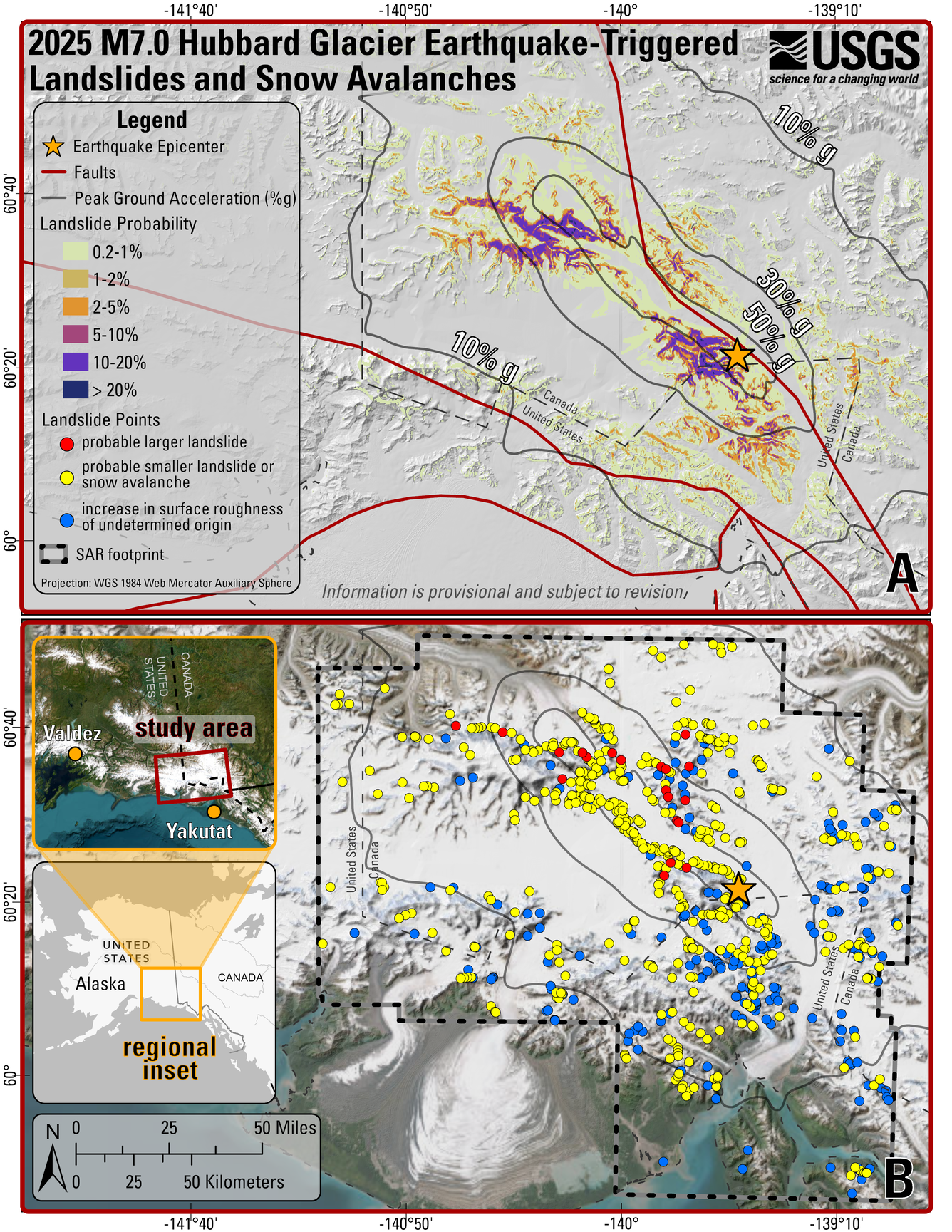
2025 M7.0 Hubbard Glacier Earthquake-Triggered Landslides and Snow Avalanches Overview Map
Detailed Description
Overview maps at the same scale showing the epicenter of the M7.0 Hubbard Glacier Earthquake and modeled peak ground acceleration contours. A) shows the probability of landslides triggered by the earthquake and mapped faults, and B) shows the locations of landslides mapped using synthetic aperture radar (SAR) change detection.
Sources/Usage
Public Domain.
Related

2025 M7.0 Hubbard Glacier Earthquake-Triggered Landslides and Snow Avalanches
A M7.0 oblique-slip earthquake initiated about 10 km below the Hubbard Glacier in the St. Elias Mountains about 88 km north of Yakutat, Alaska, at approximately 11:40am AKST (1:40pm YST) on December 6, 2025. The U.S. Geological Survey (USGS) Ground Failure product estimated that landslides triggered by this earthquake would likely be significant in number and/or spatial extent. This was confirmed...
Related
2025 M7.0 Hubbard Glacier Earthquake-Triggered Landslides and Snow Avalanches
A M7.0 oblique-slip earthquake initiated about 10 km below the Hubbard Glacier in the St. Elias Mountains about 88 km north of Yakutat, Alaska, at approximately 11:40am AKST (1:40pm YST) on December 6, 2025. The U.S. Geological Survey (USGS) Ground Failure product estimated that landslides triggered by this earthquake would likely be significant in number and/or spatial extent. This was confirmed...