



2026 Southwest Colorado Storm-Triggered Landslide Hazard Estimate Map
By Landslide Hazards Program
November 2026 (approx.)


Detailed Description
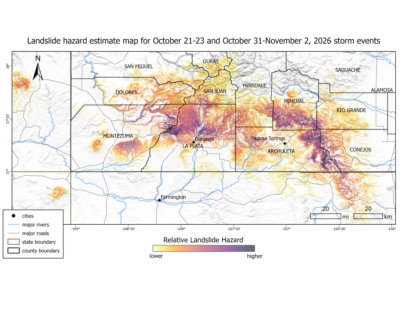
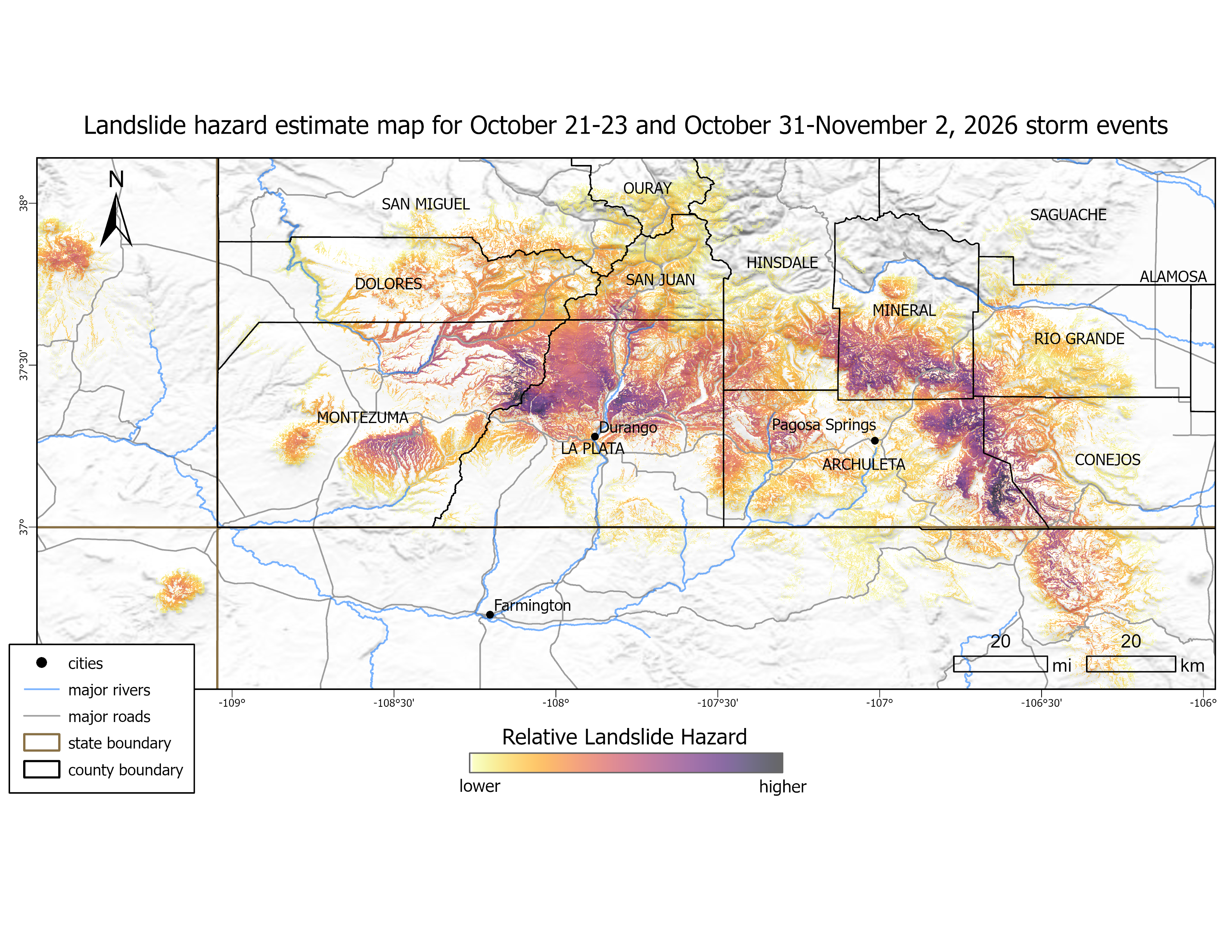
Landslide hazard estimate map for October 21-23 and October 31-November 2, 2026 storm events. Relative hazard is calculated by multiplying the USGS National Landslide Susceptibility Model by the NOAA Multi-Radar/Multi-Sensor System (MRMS) precipitation data for recent storms. Landslide hazard was calculated separately for each storm event (October 21-23 and October 31-November 2), and the maximum hazard value was used.
Sources/Usage
Public Domain.
Related
2026 Southwest Colorado Storm-Triggered Landslides
Back-to-back rain events from approximately October 21-23 and October 31-November 2, 2026, caused severe flooding in the “Four Corners” region – the intersection of Arizona, Colorado, New Mexico, and Utah. In Southwest Colorado, the storms resulted in widespread flooding throughout Montezuma, La Plata, Archuleta, Rio Grande, and Conejos counties, and the Ute Mountain and Southern Ute Reservations...
Related
2026 Southwest Colorado Storm-Triggered Landslides
Back-to-back rain events from approximately October 21-23 and October 31-November 2, 2026, caused severe flooding in the “Four Corners” region – the intersection of Arizona, Colorado, New Mexico, and Utah. In Southwest Colorado, the storms resulted in widespread flooding throughout Montezuma, La Plata, Archuleta, Rio Grande, and Conejos counties, and the Ute Mountain and Southern Ute Reservations...