
2026 Venezuela Earthquake Sequence - Landslide Hazards
Detailed Description
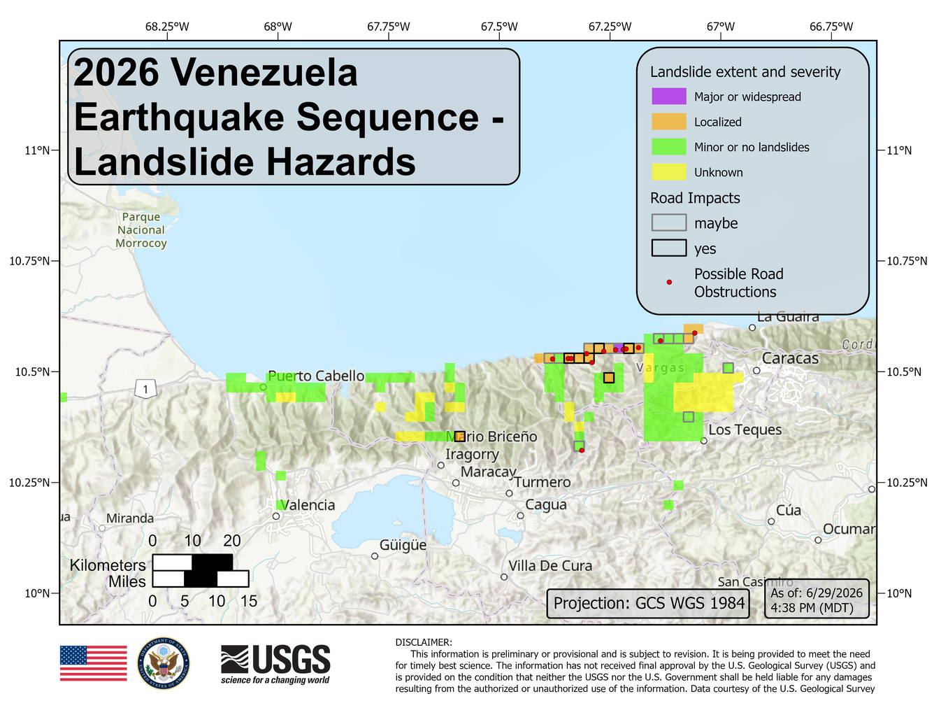
USGS Imagery assessment of landslide extent and severity (as of 06/29/26, 3:17 PM MDT). Verification remains ongoing. Color is based on USGS’s remote assessment. Landslide impact is classified as “Unknown” (yellow), “Minor or none” (green), “Localized” (orange), or “Major or Widespread” (purple). Areas where the road is impacted by landslides are outlined in gray (“maybe” impacted) and black (“yes” impacted). Possible road obstruction locations are represented by a red point. Each box is a 2.5 km x 2.5 km grid cell. Grid cells without a color indicated have not yet been assessed.
Sources/Usage
Public Domain.
Related
2026 Venezuela Sequence Earthquake-triggered Landslide Hazards
On Wednesday, June 25th, 2026, a pair of Magnitude 7.2 and Magnitude 7.5 earthquakes occurred in northern Venezuela, west of Caracas. The U.S. Geological Survey (USGS) Ground Failure product estimated that landslides triggered by this earthquake would likely be significant in number and/or spatial extent. This landslide event page serves to communicate timely science information to our partners...