
3DEP Demonstration Elevation Viewer
Detailed Description
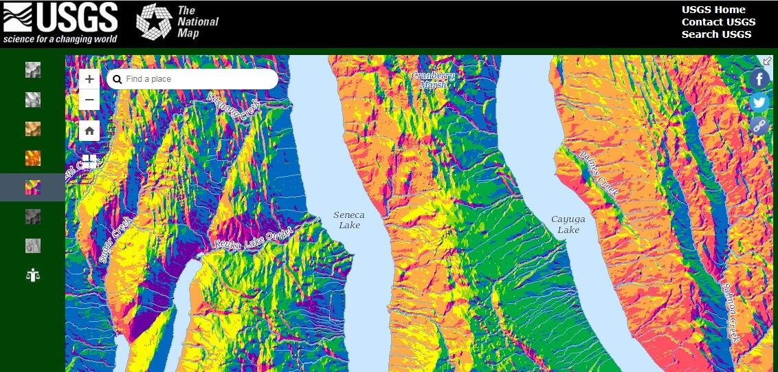
An application enabling the dynamic display of US Digital Elevation Models (DEMs) that are published by USGS on The National Map. The application is a dynamic display of different renderings of the data including contours, multiple hillshade maps, slope, and aspect. In many areas the coverage is available from multiple dates and resolutions, and the app displays the detailed information when queried.
Sources/Usage
Public Domain.