
3DNTM Development Tracks
Detailed Description
3DNTM Development Tracks
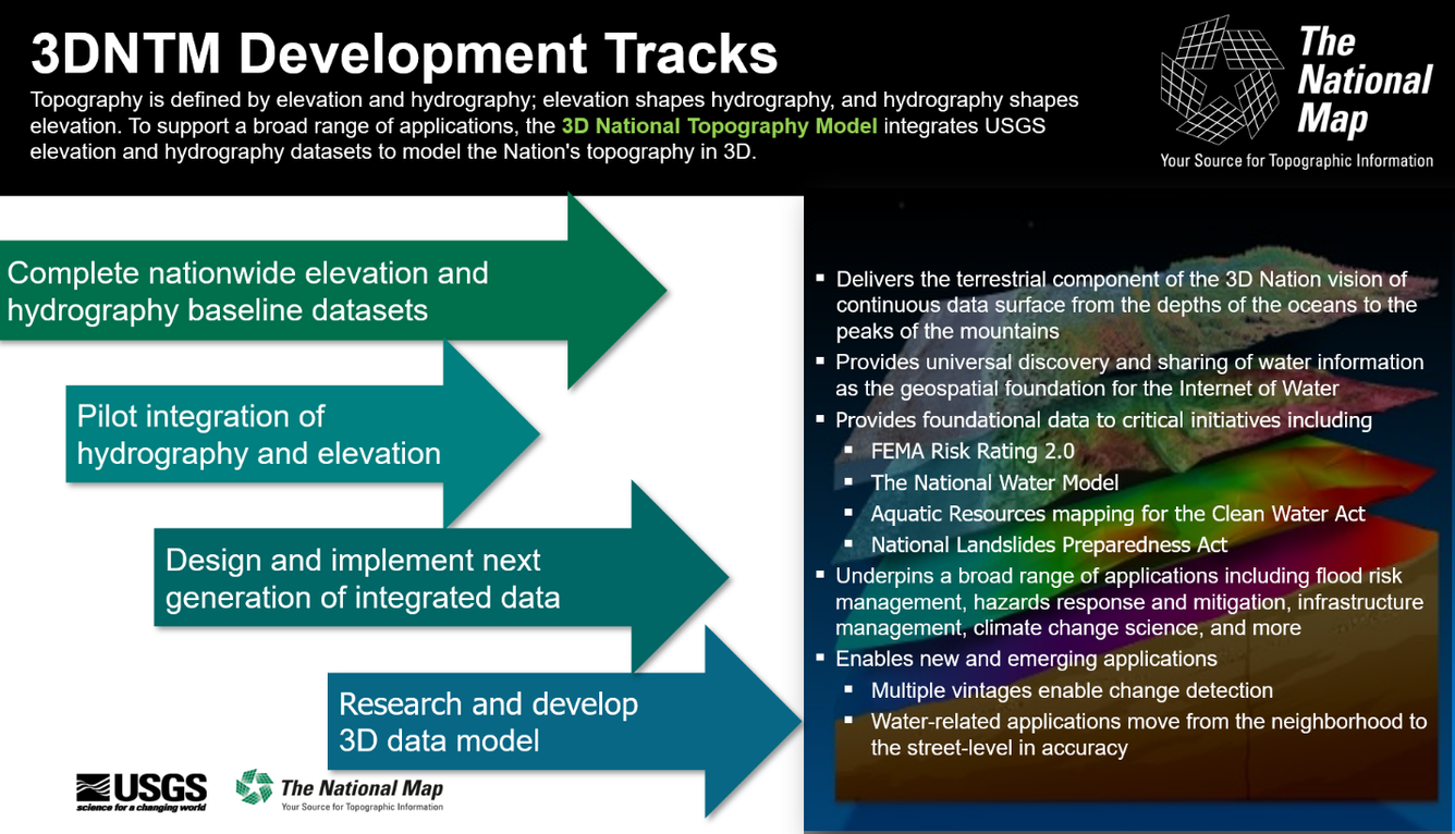
Topography is defined by elevation and hydrography; elevation shapes hydrography, and hydrography shapes elevation. To support a braod range of applications, the 3D National Topography Model integrates USGS elevation and hydrography datasets to model the Nation's topography in 3D.
Track 1: Complete nationwide elevation and hydrography baseline datasets
- Delivers the terrestrial component of the 3D Nation vision of continuous data surface from the depths of the oceans to the peaks of the mountains
Track 2: Pilot integration of hydrography and elevation
- Provides universal discovery and sharing of water information as the geospatial foundation for the Internet of Water
- Provides foundational data to critical initiatives including
- FEMA Risk Rating 2.0
- The National Water Model
- Aquatic Resources mapping for the Clean Water Act
- National Landslides Prepardness Act
Track 3: Design and implement next generation of integrated data
- Underpins a broad range of applications including flood risk management, hazards response and mitigation, infrastructure management, climate change science, and more.
Track 4: Research and develop 3D data model
- Enables new and emerging applications
- Multiple vintages enable change detection
- Water-related applications move from the neighborhood to the street-level in accuracy