
A photo of Bear Valley Road.
By Geology and Ecology of National Parks
June 1990 (approx.)

Detailed Description
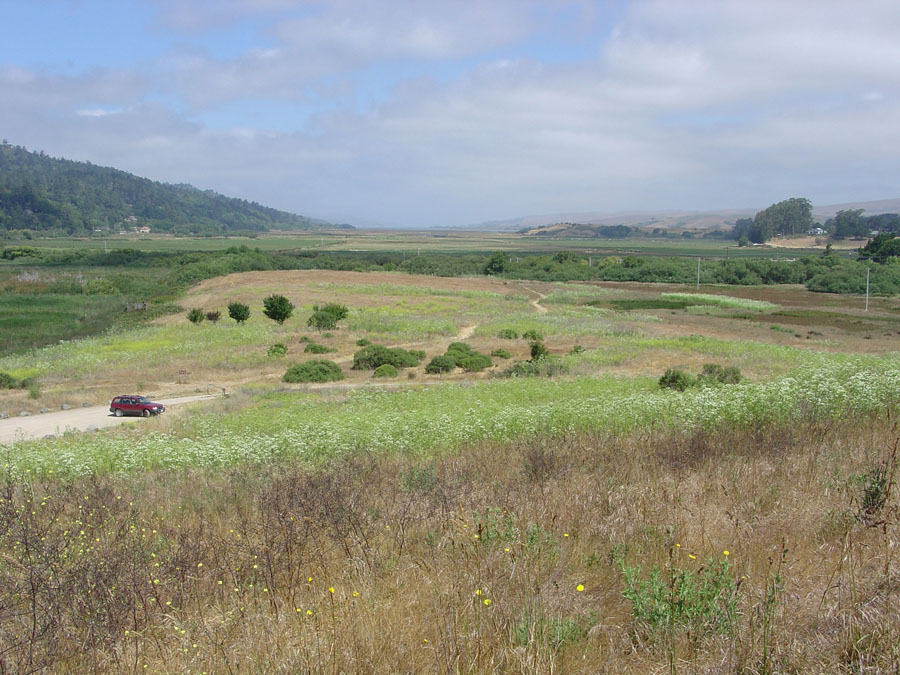
This view is looking north from the top of a shutter ridge located along Bear Valley Road about 1.5 miles (2.4 km) north of the Bear Valley Visitor Center. Inverness Ridge is on the left (west). The wetlands of southern Tomales Bay are near the center of the image, and Point Reyes Station is on an elevated terrace to the right (east). A scarp along the main trace of the San Andreas Fault is visible as a vegetation change along a break in slope located just above the parked vehicle on the left.
Sources/Usage
A photo of Bear Valley Road.