
A USGS Land Cover Trends project sample block of Montana land
Detailed Description
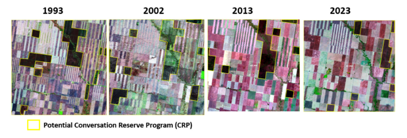
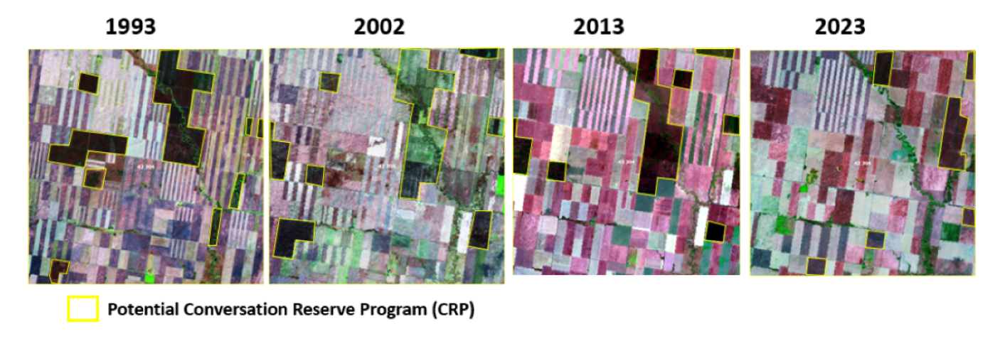
This is a “sample block” derived from Landsat satellite imagery for the past Land Cover Trends project. Land Cover Trends used 10km by 10km sample blocks located randomly across the lower 48 states to estimate land cover over time. This sample block is found within a cropland study area in northern Montana. The pattern of alternating stripes is common in a large field of Montana wheat with fallow areas. Four select years are shown: 1993, 2002, 2013, and 2023. Areas outlined in yellow highlight grassland, not cropland, that is possibly related to Conservation Reserve Program enrollment.
Sources/Usage
Public Domain.