
A Volcanologist's Toolkit: How Scientists Track Hawaiian Volcanoes

Detailed Description
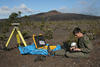
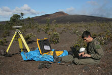
HVO scientist Mike Poland downloads data from a GPS station north of Pu‘u ‘Ō‘ō (background) on Kīlauea's east rift zone during a June 2007 eruption. These deformation data are used to locate and track the movement of subsurface magma. USGS photo.