
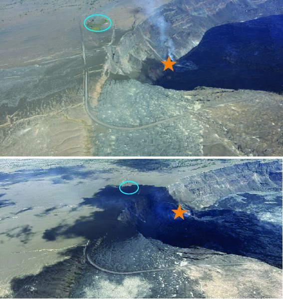
Aerial images comparing the tephra deposit southwest of Halemaʻumaʻu
Detailed Description
Aerial images comparing the tephra deposit southwest of Halemaʻumaʻu crater (left) from the ongoing eruption at Kīlauea summit. The top image, taken on December 27, 2024, during episode 3, shows a thin layer of tephra (brown) has already accumulated on the left side of the image. The bottom image from June 10, 2025, was taken the day before episode 25 high fountaining started, and a continuous tephra blanket is covering a wide section to the southwest of the caldera rim, and continuing out of view. The orange star marks the location of the north and south vents. The blue circle in the upper photo highlights a kīpuka of green trees, and in the lower photo shows the same location where the kīpuka has been covered by a thick layer of tephra. USGS photos.
Sources/Usage
Public Domain.