
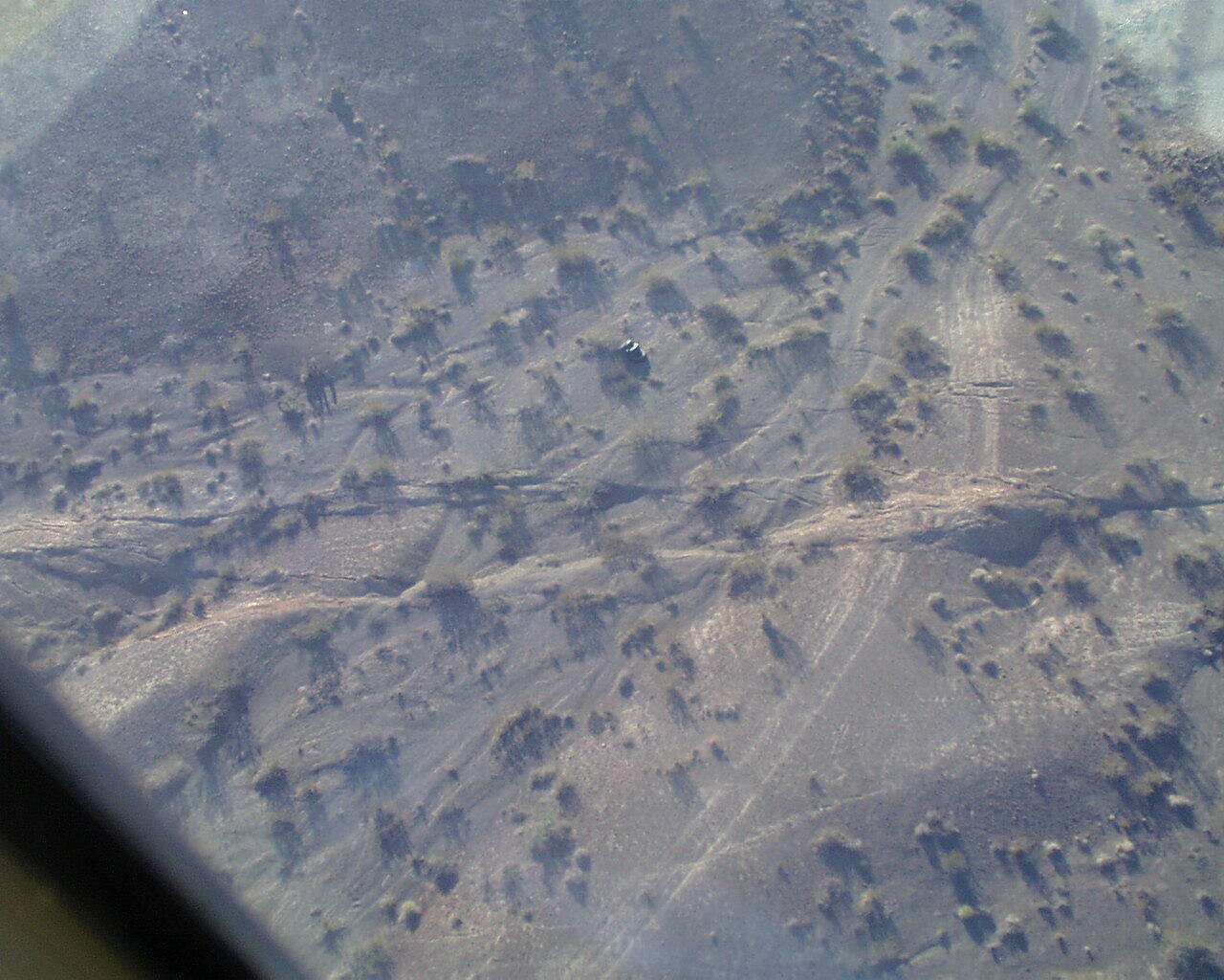
Aerial Photo of the Surface Rupture
Detailed Description
View downward onto site with maximum observed lateral displacement along the Lavic Lake fault. Here a vehicle track and dry creek bed are laterally offset by approx. 370-480 centimeters. The orientation of fractures here is nearly North-South. Compression locally across the fault pushed up a 'mole track' where the fault breaks the dirt road at the right side of the photo.
Sources/Usage
Public Domain.