
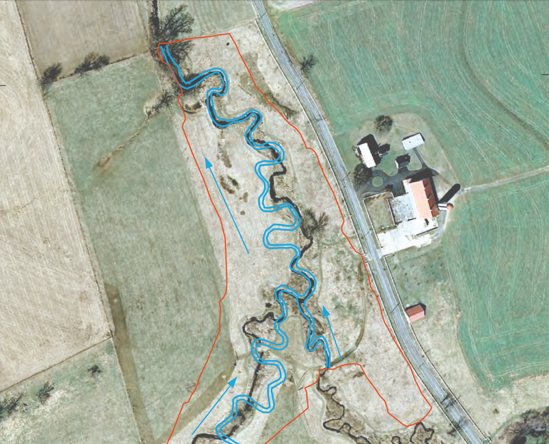
Aerial photograph of Big Spring Run, Lancaster County, Pennsylvania

Detailed Description
Aerial photograph in the prerestoration period at Big Spring Run, Lancaster County, Pennsylvania. Parallel blue lines represent the final stream channel placement (postrestoration) and red boundary line represents sediment removal site excavation limit (Michael Rahnis, Franklin and Marshall College, written commun., November 16, 2008). This is a detail cut out of Figure 2 in
Langland, M.J., Duris, J.W., Zimmerman, T.M., and Chaplin, J.J., 2020, Effects of legacy sediment removal and effects on nutrients and sediment in Big Spring Run, Lancaster County, Pennsylvania, 2009–15: U.S. Geological Survey Scientific Investigations Report 2020-5031, 28 p., https://doi.org/10.3133/sir20205031.
Sources/Usage
Public Domain.
Effects of Legacy Sediment Removal on Nutrients and Sediment in Big Spring Run, Lancaster County, Pennsylvania, 2009–15
Langland, M.J., Duris, J.W., Zimmerman, T.M., and Chaplin, J.J., 2020, Effects of legacy sediment removal and effects on nutrients and sediment in Big Spring Run, Lancaster County, Pennsylvania, 2009–15: U.S. Geological Survey Scientific Investigations Report 2020-5031, 28 p., https://doi.org/10.3133/sir20205031.