



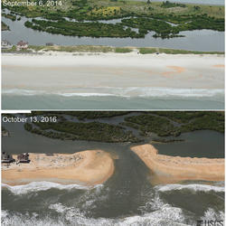
Aerial photograph of Hurricane Sandy storm damage at Mantoloking, New Jersey coastline.


Sources/Usage
Public Domain.
Related
Inundation Regime
This informational webpage provides an overview to community planners and emergency managers regarding the coastal hazards associated with inundation, a regime within the storm impact scale. This page describes the conditions that lead to the inundation regime and the risks it poses to the beach and adjacent communities. Inundation is the fourth of four storm-impact regimes and is the most severe...

Let’s Get Technical: Beach Complex
This webpage expands on the concept of the beach complex introduced on the storm-impact regime homepage. It clarifies the morphological (beach shape) markers used to assess the impact of elevated water levels and relates them to the swash, collision, overwash, and inundation regimes. It also introduces additional terms used by professionals to describe these same features (such as dune toe and...
Related
Inundation Regime
This informational webpage provides an overview to community planners and emergency managers regarding the coastal hazards associated with inundation, a regime within the storm impact scale. This page describes the conditions that lead to the inundation regime and the risks it poses to the beach and adjacent communities. Inundation is the fourth of four storm-impact regimes and is the most severe...
Let’s Get Technical: Beach Complex
This webpage expands on the concept of the beach complex introduced on the storm-impact regime homepage. It clarifies the morphological (beach shape) markers used to assess the impact of elevated water levels and relates them to the swash, collision, overwash, and inundation regimes. It also introduces additional terms used by professionals to describe these same features (such as dune toe and...