
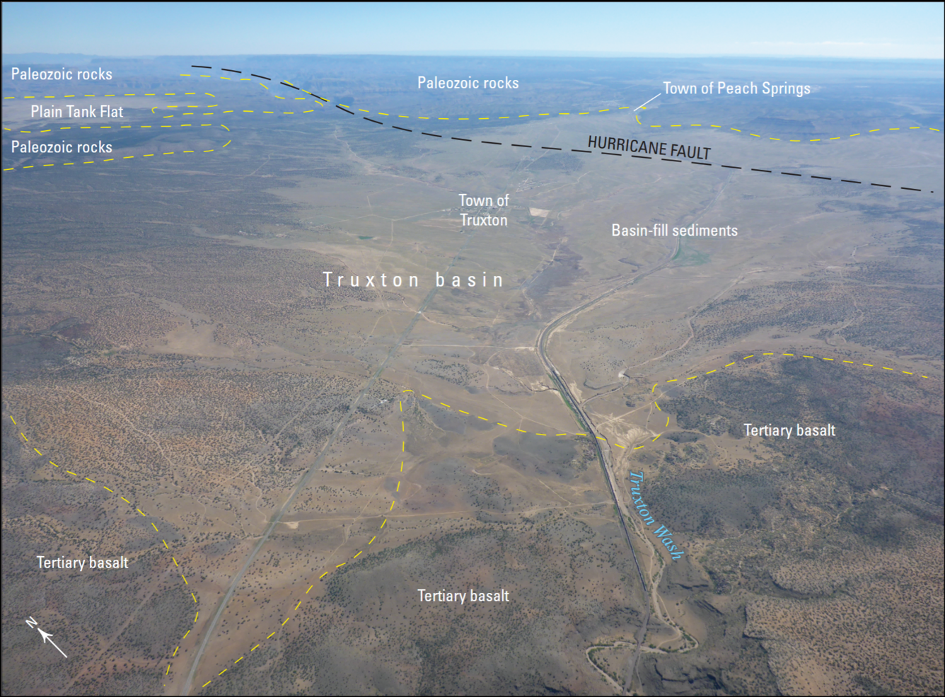
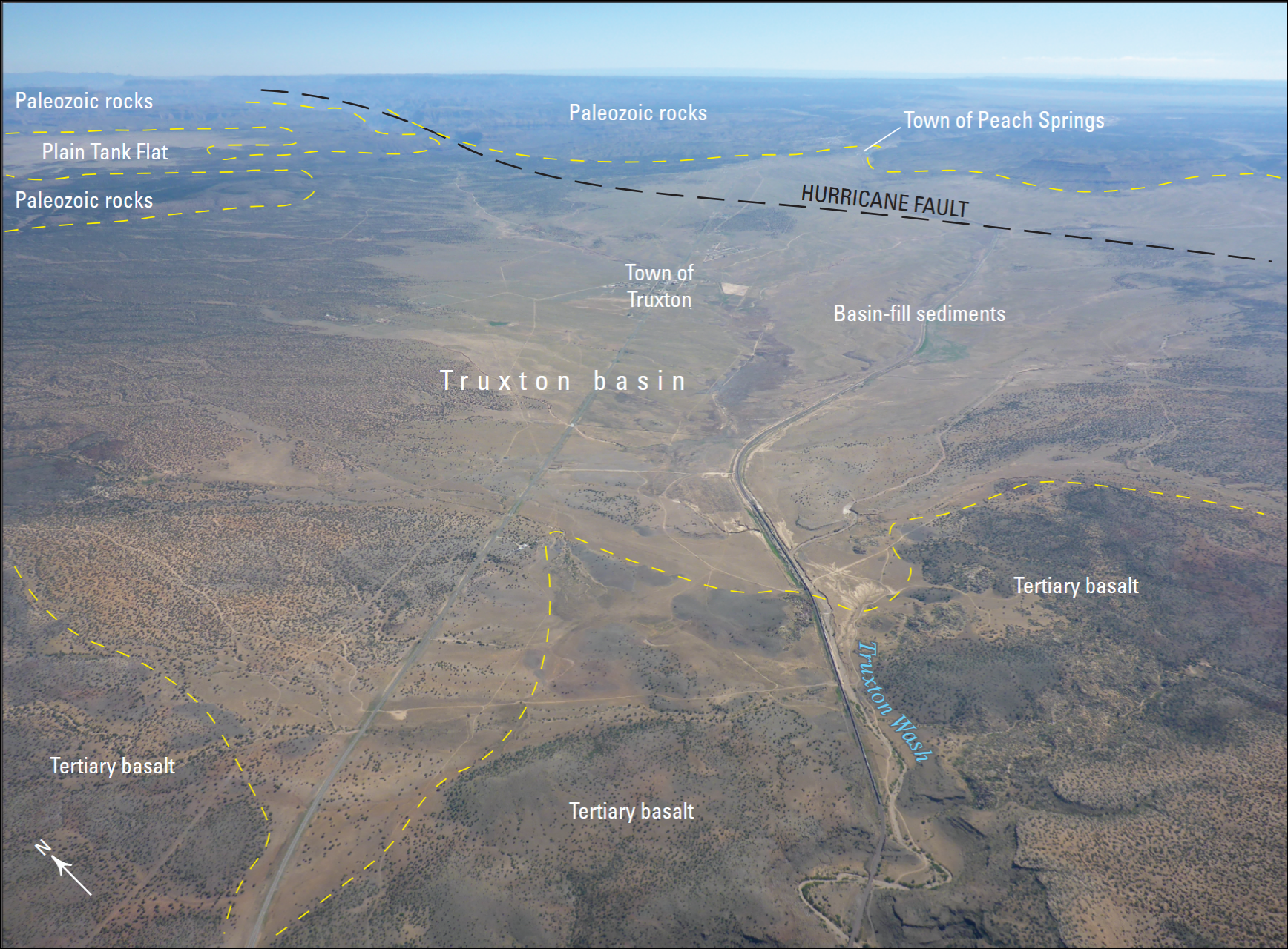
Aerial photograph of the Truxton Basin, northwestern Arizona, showing boundaries and geologic features
By Rocky Mountain Region
July 2015 (approx.)
Detailed Description
Aerial photograph of the Truxton basin, Arizona (view to northeast). Yellow dashed lines are approximate boundaries between labeled geologic features and units. From figure 2 in chapter B of Mason 2020
Sources/Usage
Public Domain.
USGS image--public domain