
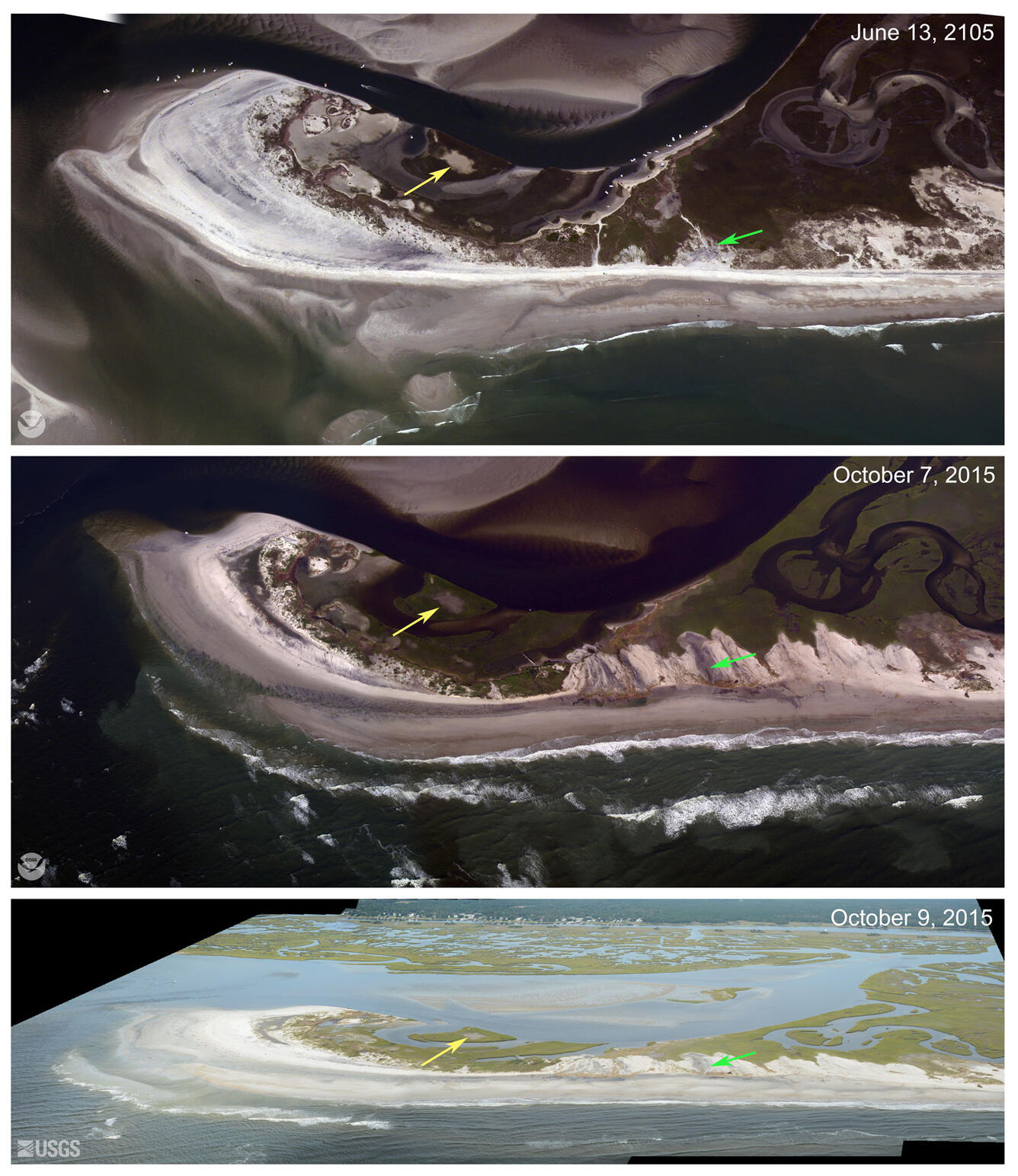
Aerial photographs of Topsail, North Carolina
By St. Petersburg Coastal and Marine Science Center
2015 (approx.)
Detailed Description
Near vertical (top, middle) and low angle oblique (bottom) aerial photographs of Topsail, North Carolina. View looking northwest along the North Carolina shore. Elevated storm-induced water levels overtopped the low dunes here causing the dune to overwash. Sand was transported landward, burying the marsh (green arrow). The yellow arrows in each image point to the same feature. Near vertical images courtesy of National Oceanic and Atmospheric Administration.
Sources/Usage
Public domain