
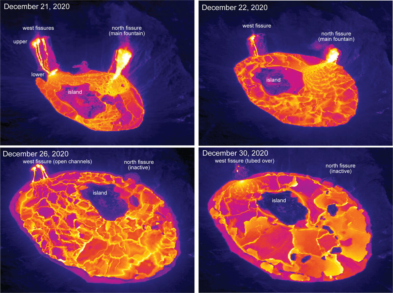
Aerial thermal images of Kīlauea Volcano’s summit compare the changes
Detailed Description
These aerial thermal images of Kīlauea Volcano’s summit compare the changes within Halema‘uma‘u crater over the course of this summit eruption. The first image (upper left) was taken on December 21, the morning after the eruption started, with the north and west fissure vents feeding the lava lake and the middle fissure inactive. The depth of the lava lake was approximately 88 m (289 ft). By the next morning, December 22, (upper right) the lava lake depth increased to about 134 m (440 ft) and had drowned the inactive middle fissure. In the December 26 image (lower left), the north fissure is inactive and only the west fissure vents are feeding lava into the lava lake, which was at a depth of about 176 m (577 ft) that morning. During today’s overflight (lower right), the lava lake was approximately 182 m (597 ft) deep, and lava flowing into the lake was crusted over. Note the change in position over time of the island within the lava lake. USGS thermal images taken by M. Patrick.
Sources/Usage
Public Domain.