
Ambae Island, Ambae eruption sequence, and Ambae evacuations
By Hawaiian Volcano Observatory
2018 (approx.)
Detailed Description
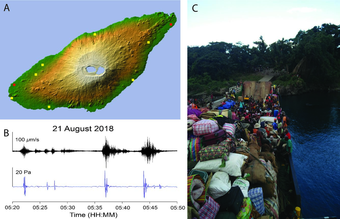
Ambae Island is in the northern Vanuatu archipelago (Figure A, courtesy of NASA) and hosts a nested caldera at its summit. A temporary seismic-acoustic array was deployed beginning July 2018 (yellow squares). Local airports are marked by the red squares. An example record of an eruption sequence is shown in Figure B, courtesy of Iseul Park, GNS Science. The seismic (black) and acoustic (blue) records compare the data from several eruptions on August 21, 2018 (VUT Time Zone). The eruptions forced the full evacuation of Ambae (Figure C) to neighboring islands of Maewo and Esperitu Santo. This photo is courtesy of Graham Leonard, GNS Science, taken on August 18, 2018.
Sources/Usage
Public Domain.