
Annual NLCD animation of the Smith River Complex Fire land change between 2023 and 2024
The Annual National Land Cover Database (NLCD) product uses AI in the process of characterizing land cover and land change data.
Detailed Description
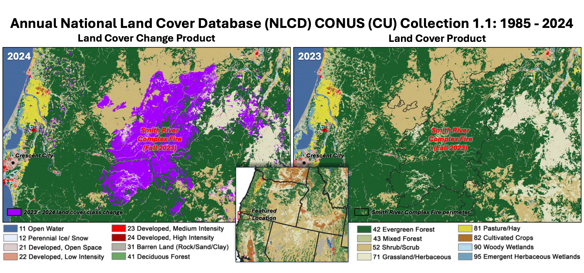
This Annual National Land Cover Database (NLCD) animation shows how the Smith River Complex Fire, which occurred in the fall of 2023 at the California-Oregon border, left a devastating mark on the landscape. The wildland fire burned nearly 95,000 acres, seen here causing an abrupt transition from evergreen forest to the grassland/herbaceous land cover classification. If the area follows a common wildfire disturbance and regrowth cycle observed in forest systems, it will eventually fill in with shrub/scrub and then return to forest again. The Annual NLCD Land Cover Change product is shown on the left, with the changed area in purple, and the Land Cover product for 2023 flips to 2024 on the right. Annual NLCD, based on Landsat data, is produced at the USGS Earth Resources Observation and Science (EROS) Center.
Sources/Usage
Public Domain.