
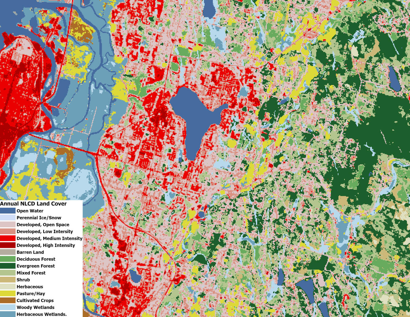
An Annual NLCD Land Cover map centered are around Lake Stevens, WA
Altered Content -
All Annual NLCD products are derived using deep learning.
Detailed Description
An Annual NLCD Land Cover map of centered around Lake Stevens, WA depicting 16 land cover classes.
Sources/Usage
Public Domain.
Related

Annual NLCD Land Cover Classification
The primary NLCD land cover product represents the predominant thematic land cover class within the mapping year with respect to broad categories of artificial or natural surface cover.

USGS EROS Archive – Land Cover – Annual NLCD Collection 1.2 Land Cover
The primary NLCD Land Cover product represents the predominant state of the surface within the mapping year with respect to broad categories of natural and anthropogenic surface cover types. The National Land Cover Database (NLCD) project announces (June 30, 2026) the release of Annual NLCD Conterminous U.S. (CU), Collection 1.2. With this release, Collection 1.2 adds 2025 to the temporal extent...
Related
Annual NLCD Land Cover Classification
The primary NLCD land cover product represents the predominant thematic land cover class within the mapping year with respect to broad categories of artificial or natural surface cover.
USGS EROS Archive – Land Cover – Annual NLCD Collection 1.2 Land Cover
The primary NLCD Land Cover product represents the predominant state of the surface within the mapping year with respect to broad categories of natural and anthropogenic surface cover types. The National Land Cover Database (NLCD) project announces (June 30, 2026) the release of Annual NLCD Conterminous U.S. (CU), Collection 1.2. With this release, Collection 1.2 adds 2025 to the temporal extent...