
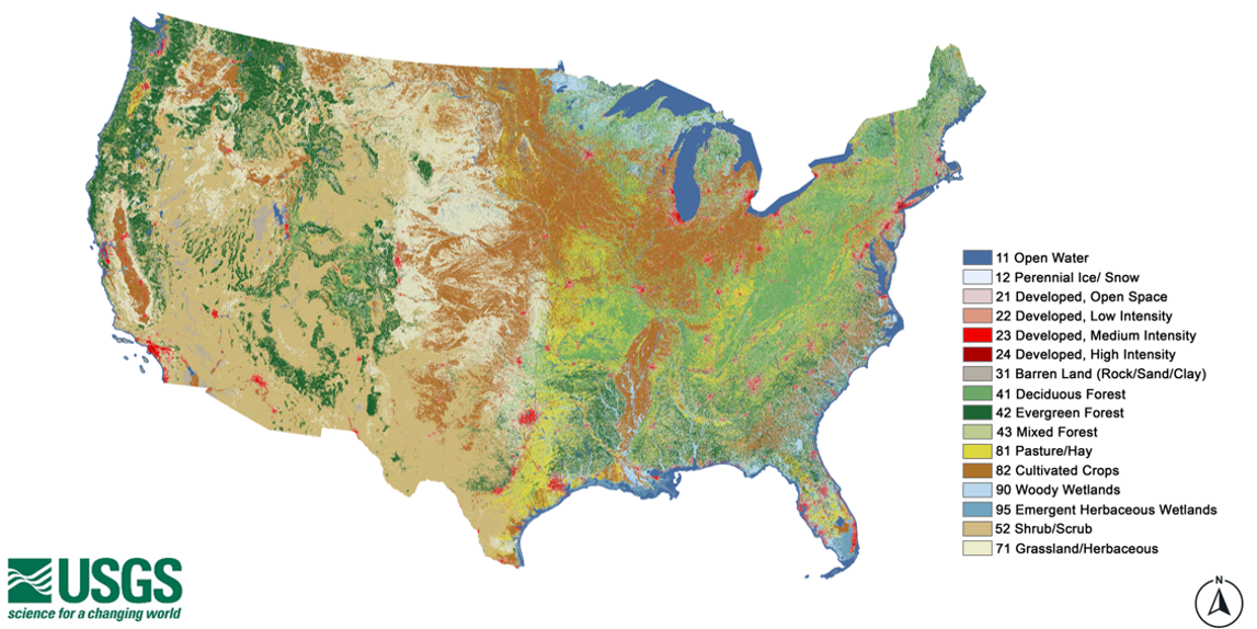
Annual NLCD map of the United States with legend
Altered Content -
The Annual National Land Cover Database (NLCD) uses AI/ML to process satellite data into a land cover product.
Detailed Description
Annual National Land Cover Database (NLCD) map of the United States with classifications for types of land cover. Produced by the USGS Earth Resources Observation and Science (EROS) Center.
Sources/Usage
Public Domain.
Related

Annual National Land Cover Database
Land cover is foundational information for land managers, scientists, and the general public. Many types of scientific studies have applied annual land cover information including projecting future land use, documenting forest fragmentation or conservation practices, modeling wildfire hazards, tracking water quality and quantity, and understanding change in wildlife habitat and ecosystem...
Related
Annual National Land Cover Database
Land cover is foundational information for land managers, scientists, and the general public. Many types of scientific studies have applied annual land cover information including projecting future land use, documenting forest fragmentation or conservation practices, modeling wildfire hazards, tracking water quality and quantity, and understanding change in wildlife habitat and ecosystem...