
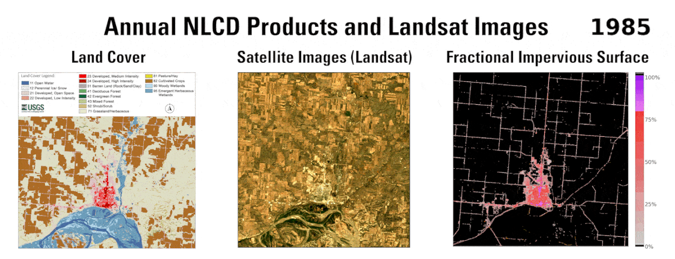
Annual NLCD Products and Landsat Images for the Williston, ND, area
Annual NLCD processing uses AI.
Detailed Description
These three animations, including Land Cover (left), Landsat (center) and Fractional Impervious Surface (right), show the changes on the ground in the Williston, North Dakota, area over time between 1984 and 2024.
Annual Land Cover allows you to see what kind of land cover changes are happening and when the change occurred. Agricultural land is brown, grassland is tan, pasture is yellow, and developed land is pink and red. Blue is the Missouri River and its floodplain to the south and the Little Muddy River running into the Missouri River on the east side of Williston. Over time, you can see agricultural land and grassland being replaced by developed land (Fitzgerald et al., 2020; Preston et al., 2016; Torgerson, 2017).
Landsat offers a true color look at the changes going on across the landscape.
The Fractional Impervious Surface shows the increase in developed land cover (pink and red) with an expanding road network, more buildings and oil well pads.
Sources/Usage
Public Domain.