
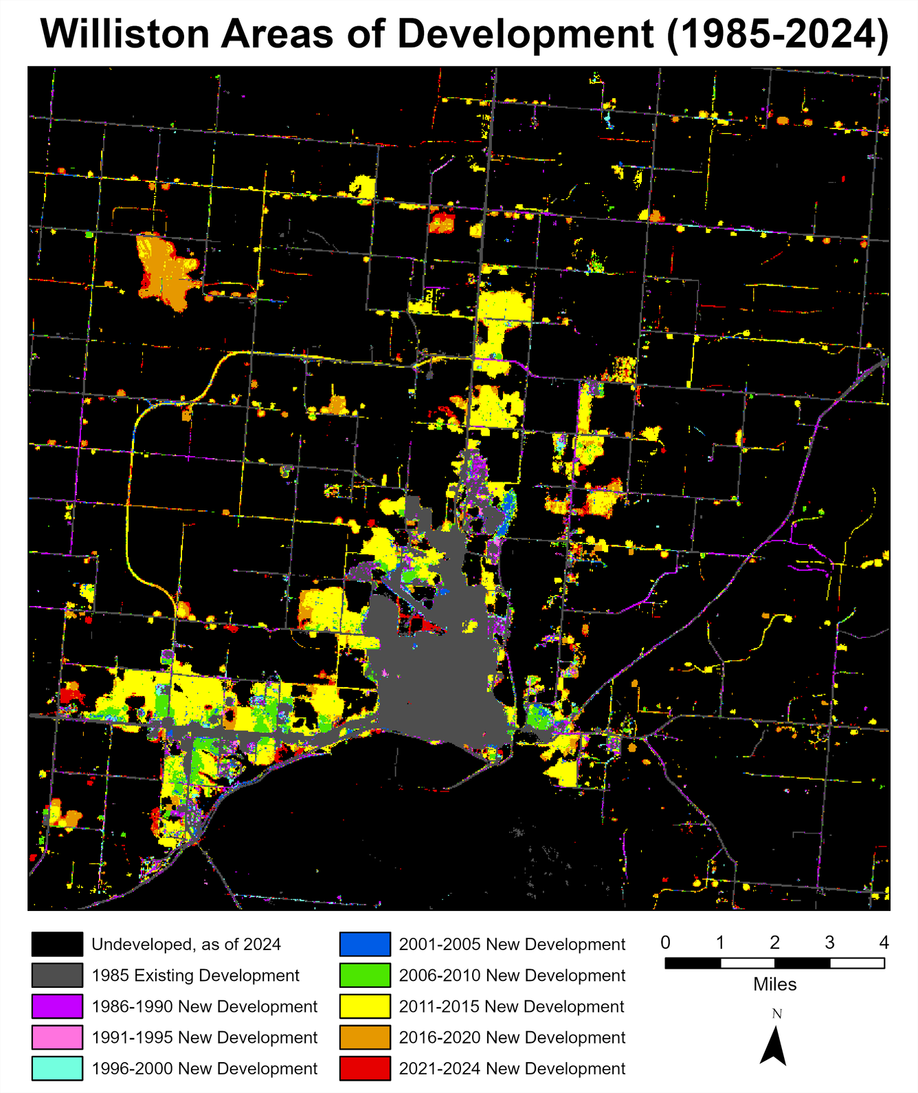
Annual NLCD view of development in the Williston, ND, area from 1985 to 2024
AI is used in the Annual NLCD production process.
Detailed Description
In this Annual National Land Cover Database (NLCD) image of Williston, North Dakota, the various colors represent the range of years that particular areas were developed. The gray area in the lower center of the image is the area of the city that developed prior to 1985. Throughout the 1980s and 1990s, roads were built, and small parcels were developed on the periphery of town. Starting in 2000, there was an increase in the rate of development as Williston expanded east and west along the river. The Eagle Ridge Golf Course, northeast of town, expanded in 2005. By 2010, development began expanding north. In 2011, a boomtown atmosphere existed in Williston (Polzin, 2017). Another highway was built on the west side in 2014 to better connect the industrial centers west of town with the north end of town. In 2018, the airport moved to a location northwest of town. Map produced at USGS Earth Resources Observation and Science (EROS) Center.
Sources/Usage
Public Domain.