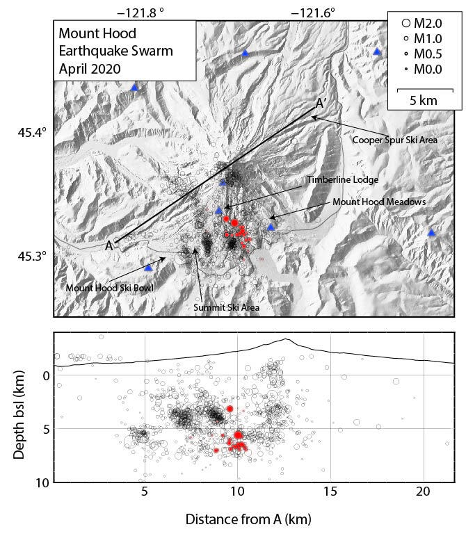
April 2020 Earthquake Swarm at Mount Hood, Oregon.

Detailed Description
"Top: Map view of Mount Hood, Oregon, showing the April 2020 earthquake swarm (filled red circles) relative to other earthquake that have occurred from 2010 to present. The filled blue triangles are volcano monitoring stations.
Bottom: Cross-sectional view (along A to A' pictured on map view) showing April 2020 earthquake swarm depths (filled red circles). Circles are sized with respect to earthquake magnitude. Note that in the cross-section, the earthquakes above the surface (on the left) are called "airquakes" and typically reflect large errors in depth and/or a poor velocity model. Data are from the Pacific Northwest Seismic Network."
Sources/Usage
Public Domain.

