
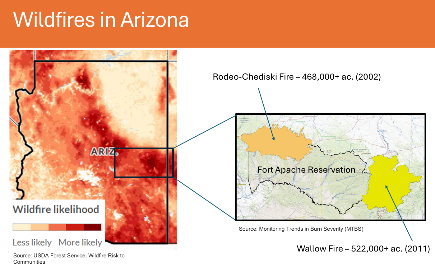
Arizona's and Fort Apache Reservation wildfire ignition likelihood

Detailed Description
Arizona wildfire ignition likelihood (left) and location callout for the Fort Apache Reservation (right). Outlines of Arizona's largest historical wildfires are included. Wildfire likelihood mapping is sourced from the USDA Wildfire Risk to Communities program. Historical fire outlines come from the Monitoring Trends in Burn Severity (MTBS) program. Figures from a presentation by Aaron Russell, USGS Southwest Biological Science Center.
Sources/Usage
Public Domain.