
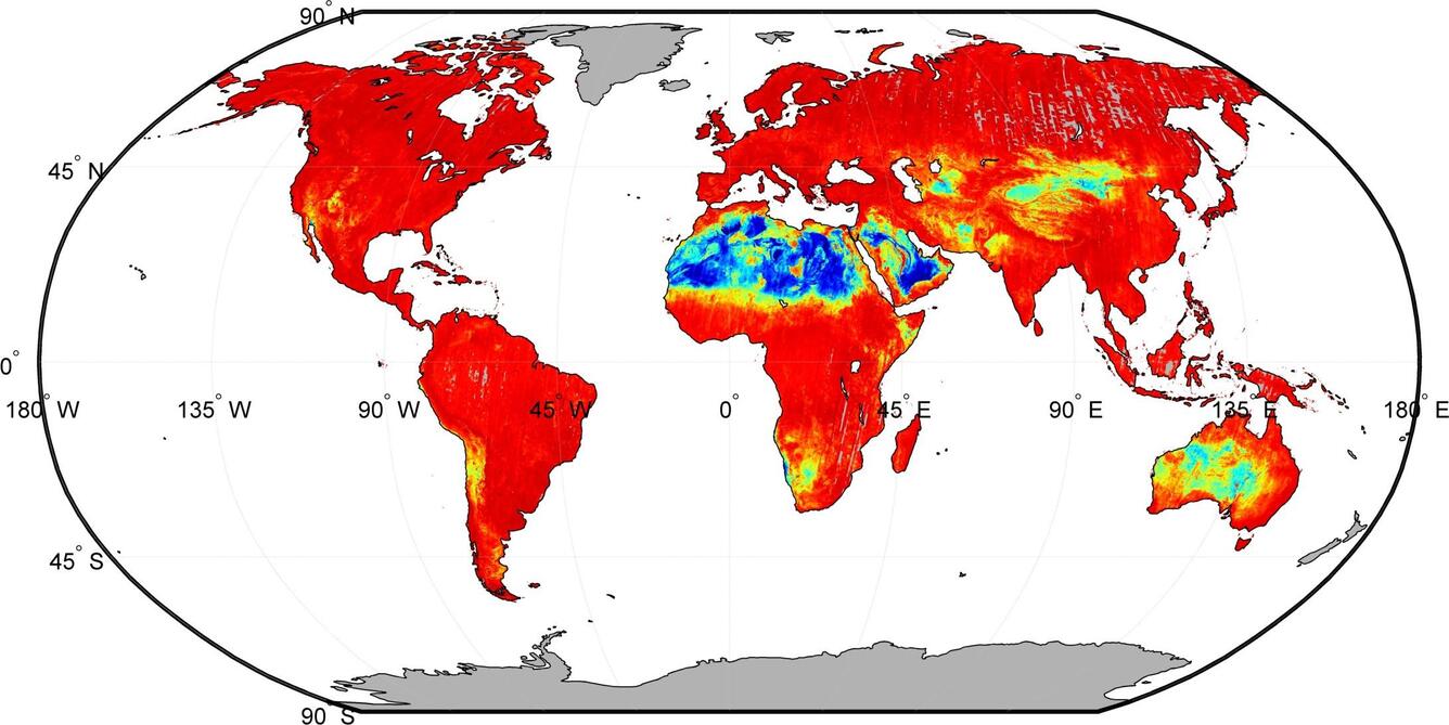
ASTER Global Emissivity Database (GED) map
By Earth Resources Observation and Science (EROS) Center
2014 (approx.)
Detailed Description
The ASTER Global Emissivity Database (GED) was released in 2014 using the archive of ASTER scenes from 2000 to 2008. Here, lower emissivities are shown in blue and green in arid and semiarid regions, and higher emissivities are shown in orange and reds in areas of dense vegetation, water or ice/snow surfaces. ASTER (Advanced Spaceborne Thermal Emission and Reflection Radiometer) is an instrument resulting from a U.S. and Japanese partnership that is aboard NASA's Terra satellite. The USGS Earth Resources Observation and Science (EROS) Center houses NASA's LP DAAC, which archives and distributes ASTER data. Image courtesy of NASA.
Sources/Usage
Public Domain.