
Attachment D: FY16 NRCS 3DEP High Priority Areas for Data Acquisition
Detailed Description
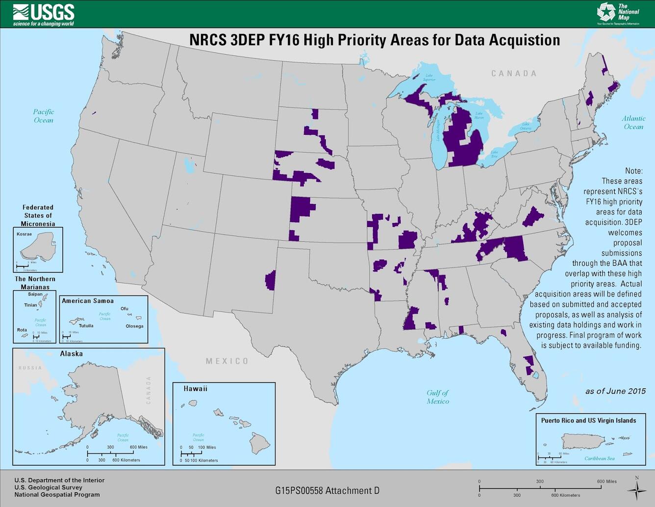
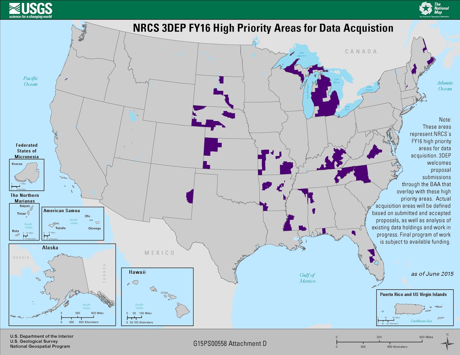
Map Title: NRCS 3DEP FY16 High Priority Areas for Data Acquisition
These areas represent NRCS's FY16 high priority areas for data acquisition. 3DEP welcomes proposal submissions through the BAA that overlap with these high priority areas. Actual acquisition areas will be defined based on submitted and accepted proposals, as well as analysis of existing data holdings and work in progress. Final program of work is subject to available funding.
Legend:
Purple - NRCS 3DEP FY16 High Priority Areas for Data Acquisition
Sources/Usage
Public Domain.
Broad Agency Announcements (BAAs)
The USGS issues a Broad Agency Announcement (BAA) that provides detailed information on how to partner with the USGS and other Federal agencies to acquire high-quality 3D data. Past BAA information may be found on the general BAA webpage.