
Attachment E: FY18/19 Status of 3DEP Quality Data

Detailed Description
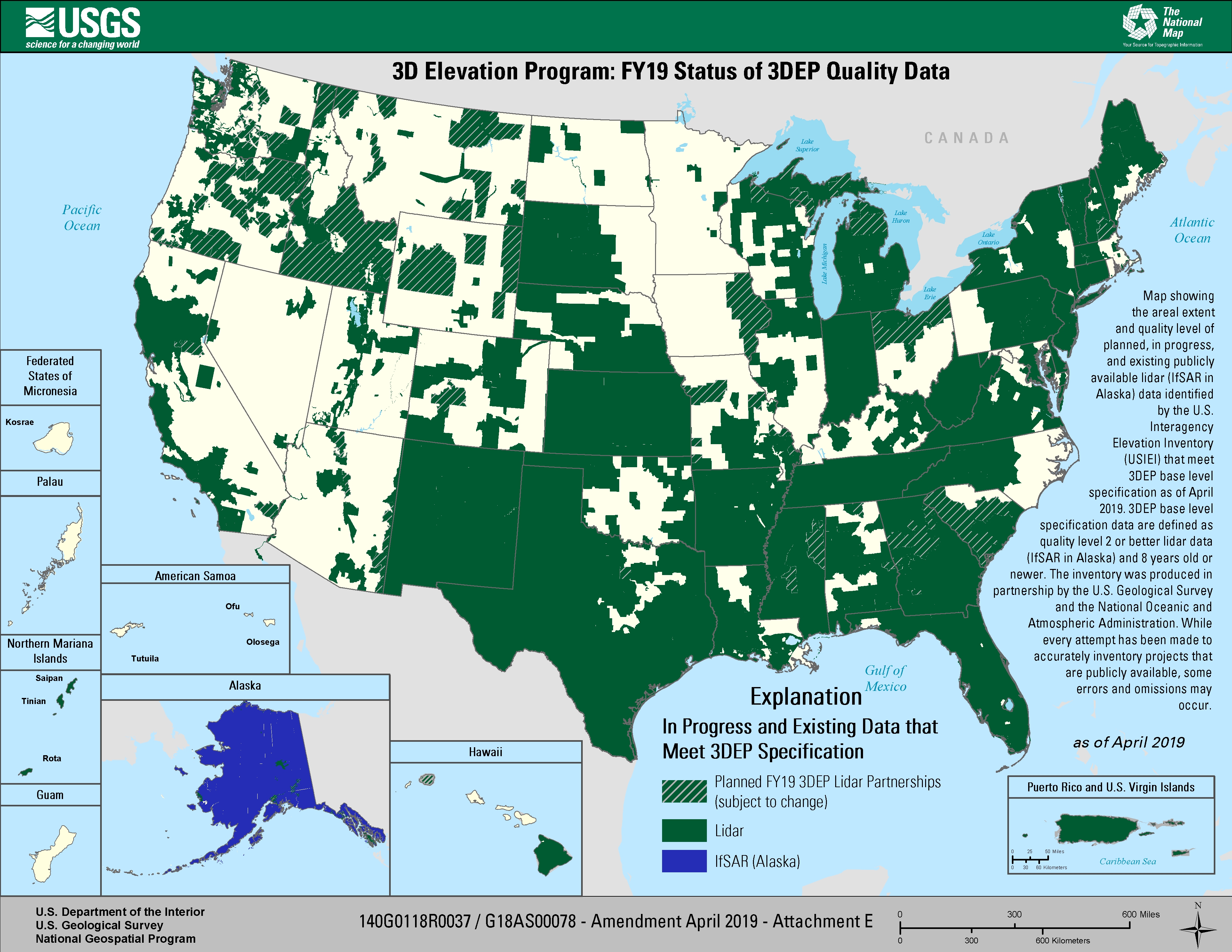
Title: 3D Elevation Program: FY19 Status of 3DEP Quality Data
Map showing the areal extent and quality level of planned, in progress, and existing publicly available lidar (IfSAR in Alaska) data identified by the U.S. Interagency Elevation Inventory (USIEI) that meet 3DEP base level specification planned to be under award by April 2019.
3DEP base level specification data are defined as quality level 2 or better lidar data (IfSAR in Alaska) and 8 years old or newer. The inventory was produced in partnership by the U.S. Geological Survey and the National Oceanic and Atmospheric Administration. While every attempt has been made to accurately inventory projects that are publicly available, some errors and omissions may occur.
Legend
In-Progress and Existing Data that Meet 3DEP Specification
Dark Green/ Stripe = Planned FY19 3DEP Lidar Partnerships (subject to change)
Dark Green = Lidar
Dark Blue = IfSAR (Alaska Only)
Sources/Usage
Public Domain.