
August 8, 2022—Kīlauea summit eruption reference map

Detailed Description
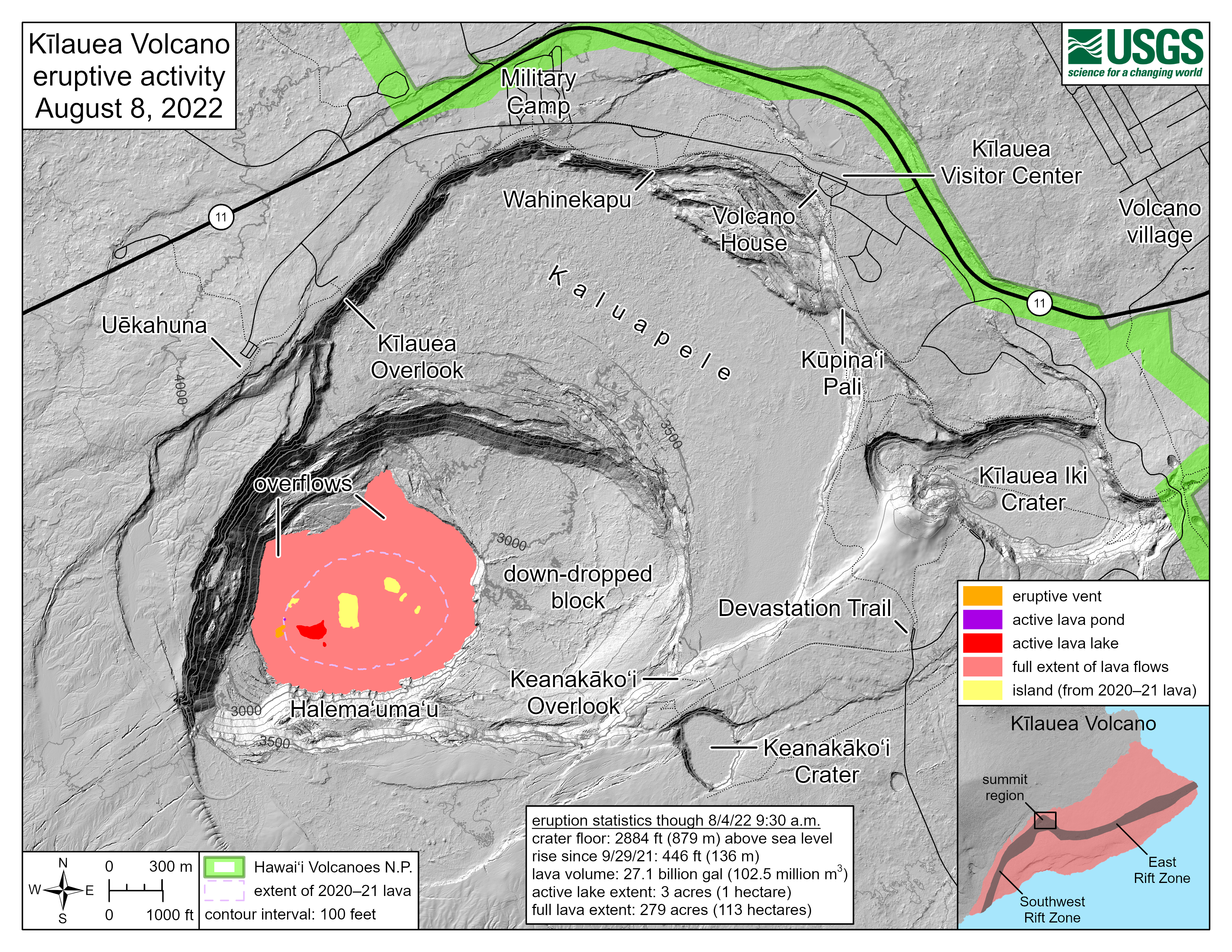
This reference map depicts the ongoing Kīlauea summit eruption on August 8, 2022. One eruptive vent (orange) is active within Halema‘uma‘u, on the western side of the crater floor. An adjacent pond (purple) is feeding lava to a larger lake (red) via a crusted-over tube. The eruption statistics provided here are current as of the last HVO overflight on August 4, 2022. This map provides a volume-averaged elevation for the crater floor—2,884 feet (879 meters) above sea level—and its rise since September 29, 2021—446 feet (136 meters). Lava is presently visible from three public visitor overlooks in Hawai‘i Volcanoes National Park: Keanakāko‘i Overlook and Kūpina‘i Pali (Waldron Ledge) can see the eruptive vent and lava lake, while Kīlauea Overlook can occasionally see lava ooze-outs in the southeast part of the crater. Visit the park eruption page for more info: https://www.nps.gov/havo/learn/nature/september-2021-eruption.htm.
Sources/Usage
Public Domain.