
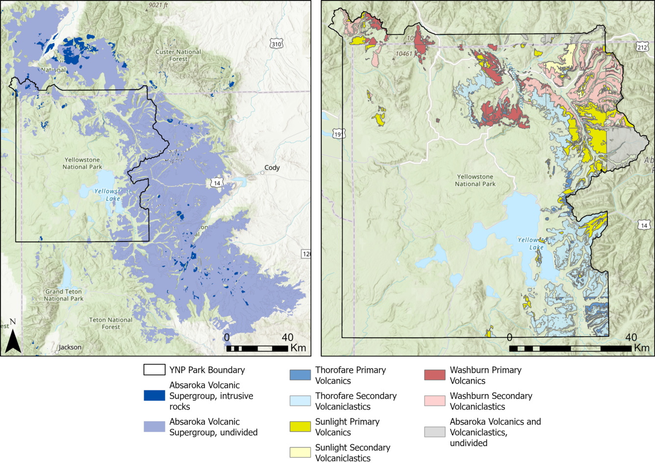
Volcanic deposits associated with the Absaroka volcanic province along the eastern and northern boundaries of Yellowstone National Park
Detailed Description
Volcanic deposits associated with the Absaroka volcanic province along the eastern and northern boundaries of Yellowstone National Park. The left panel shows the spread of the Absaroka Volcanic Supergroup (AVS) throughout Wyoming and Montana. The intrusive rocks (dark blue) typically coincide with the main eruptive centers of the volcanic chain, and the rest of the material (light blue) is a mix of lavas, tuffs, and volcaniclastic units. The right panel shows the different extents of the primary volcanics, like lava and ash flows, and secondary volcaniclastics, made up of debris derived from the primary units, of the three groups of the AVS (the Washburn, Sunlight, and Thorofare groups) within Yellowstone National Park (YNP). This figure demonstrates how the products of the different groups interact and overlap. Geologic mapping interpretations have been made at an appropriate scale for this map within YNP, but mapping is too coarse outside of YNP to identify the differences between the primary volcanics and secondary volcaniclastics. Figure by Natali Kraugh, Montana State University.
Sources/Usage
Public Domain.