
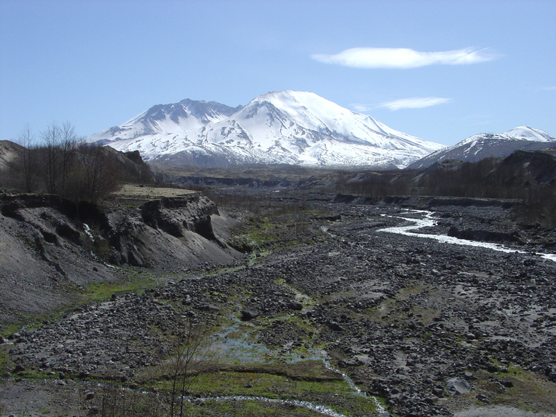
Badlands along Toutle River

Detailed Description
This view is looking upstream along the Toutle River (North Fork) toward the northwest flank of Mount St. Helens. Note the elevated stream terraces on either side of the river. These elevated floodplain surfaces (terraces) show that the river is rapidly cutting down into the deposits generated by the May, 1980 eruptions of the volcano.
Sources/Usage
Public Domain.