
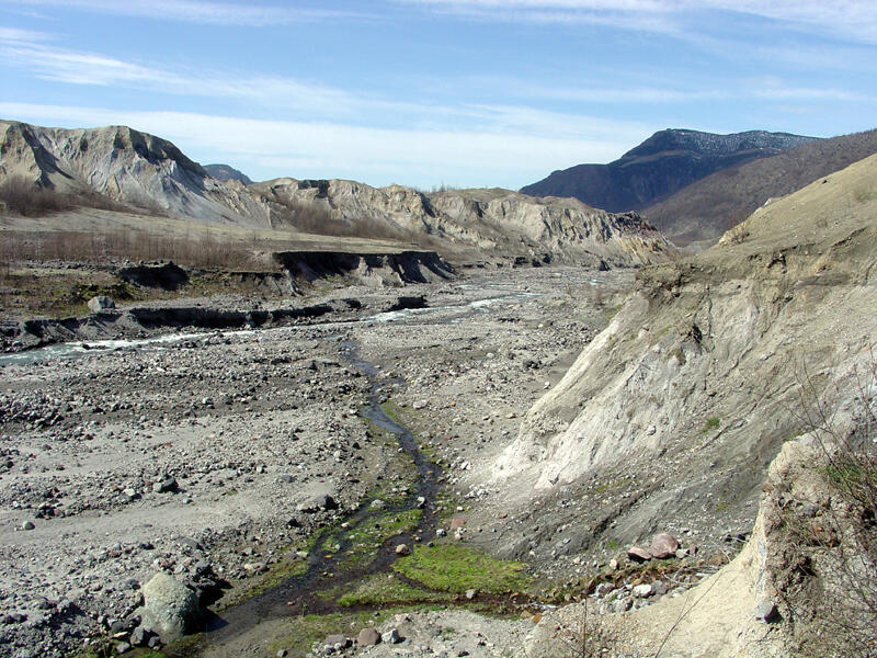
Badlands along Toutle River
Detailed Description
This view looking downstream along the Toutle River (North Fork) also shows elevated terraces formed by stream erosion of the volcanic debris field formed by the 1980 eruptions of Mount St. Helens. Note the truncated alluvial fans on the left side of the image.
Sources/Usage
Public Domain.