
Berm at Jim Foot Key, Florida (2019)

Detailed Description
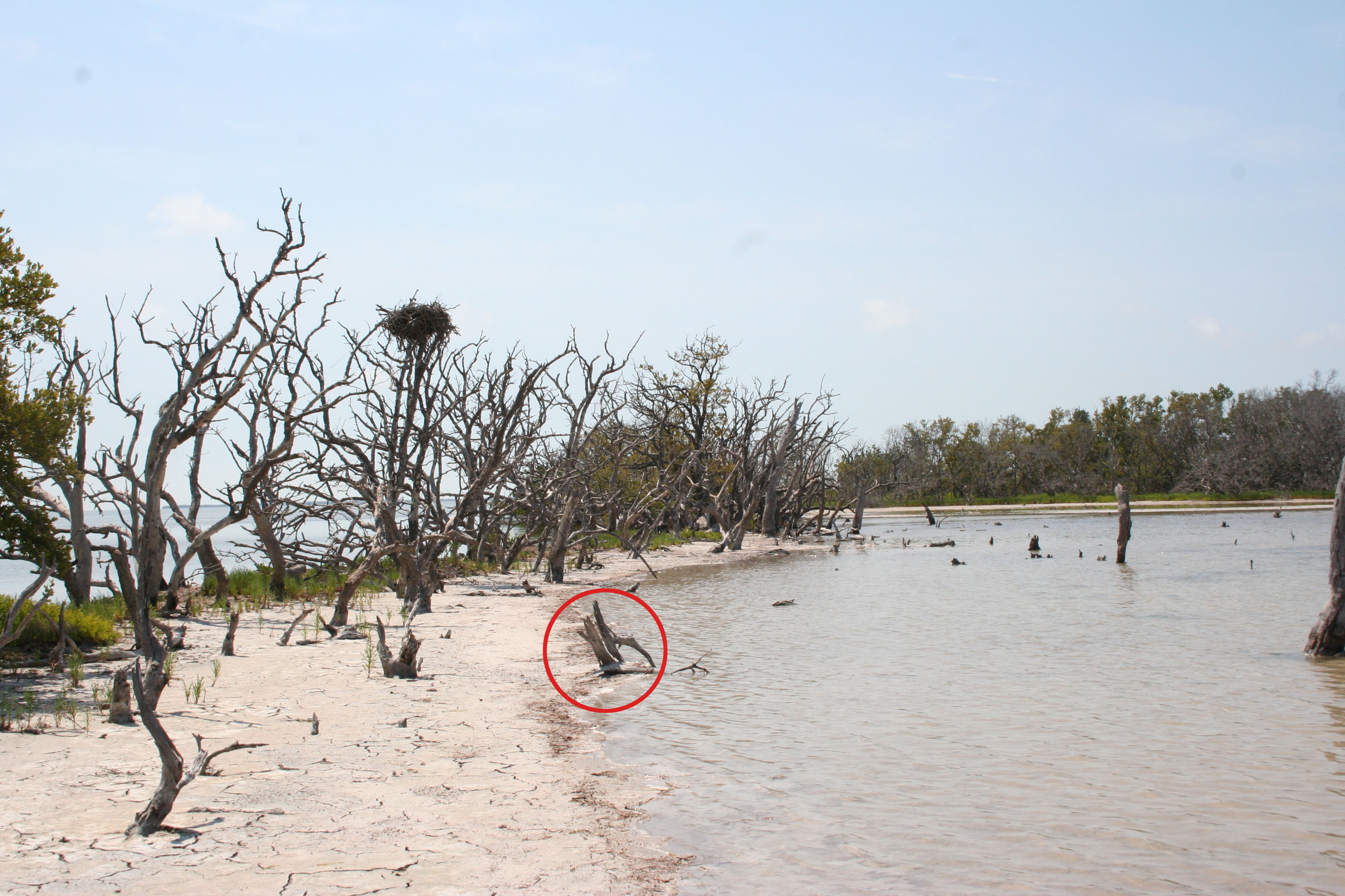
In Photo: Berm of Jim Foot Key about 1.5 years after Hurricane Irma. The red circle indicates the same position as shown in the April 2014 photo. The mature mangrove trees have not recovered from the storm.
Scientists from the Florence Bascom Geoscience Center first sampled four islands in Florida Bay, Everglades National Park, in April 2014 to collect cores to study sea level rise and storm history in the region. In September 2017, Hurricane Irma (a category 4 storm at landfall in the Florida Keys) passed just to the west of our field sites. The western-most of the four islands (Jim Foot Key) was closest to the eye of the storm and the most impacted.
Islands such as Jim Foot Key serve as examples of what might happen to the main-land coast of Florida with changes in sea level and climate. Observations through summer 2018 have been published but the research team continues to monitor Jim Foot Key to see if the protective berm will recover or if the eastern part of the island will be inundated by rising sea level.
Sources/Usage
Public Domain.