
Broad scope map of Kīlauea's ERZ flow field

Detailed Description
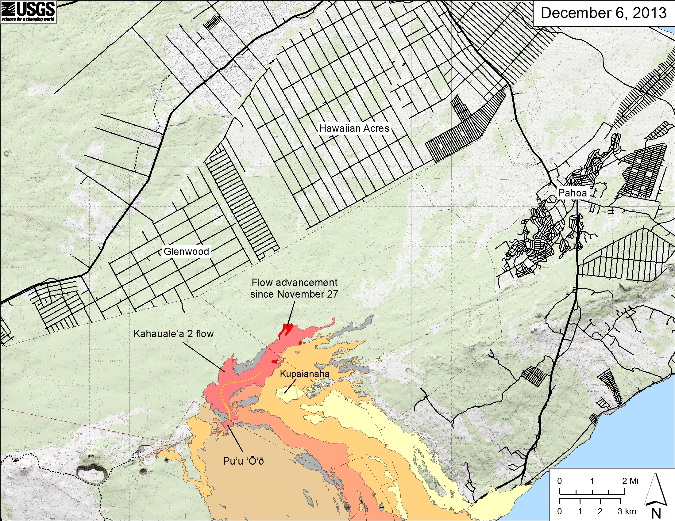
Map showing the Kahauale‘a 2 flow in relation to the eastern part of the Big Island as of December 6, 2013. The tip of the Kahauale‘a 2 flow that reached 7.3 km (4.5 miles) from Pu‘u ‘Ō‘ō several weeks ago is no longer active. Flows remain active, however, about 5 km (3 miles) northeast of Pu‘u ‘Ō‘ō where they continue to spread into the forest. The area of the Kahauale‘a 2 flow as of November 27 is shown in pink, while widening of the flow as of December 6 is shown in red. Older lava flows are distinguished by color: episodes 1-48b flows (1983-1986) are shown in gray; episodes 48c-49 flows (1986-1992) are pale yellow; episodes 50-55 flows (1992-2007) are tan; episodes 58-60 flows (2007-2011) are pale orange, and episode 61 flows (2011-2013) are reddish orange. The active lava tube is shown with a yellow line.
Sources/Usage
Public Domain.